This article needs additional citations for verification .(March 2020) |
Edel Land National Park Western Australia | |
---|---|
Nearest town or city | Denham |
Coordinates | 26°09′05″S113°09′18″E / 26.15139°S 113.15500°E |
Elevation | 200 m (656 ft) |
Managing authorities | Department of Biodiversity, Conservation and Attractions |
Website | Edel Land National Park |
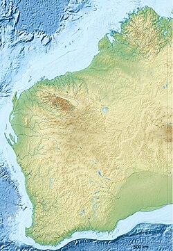
Edel Land National Park is a proposed national park located in the Gascoyne Region of Western Australia, located 670 kilometres (420 mi) north of the state's capital Perth. [1]
The national park is also a part of the Shark Bay World Heritage Site and lies south of Steep Point, which was named in 1697 by Willem de Vlamingh calling it ‘Steyle Hock’ when he was anchored adjacent to the cliffs at the southern side of Dirk Hartog Island. [1] [2] [3]
The park is located on the traditional country of the Malgana people. [4] Edel Land was an important place for Indigenous Australians. [4] Tools were created using stone from a natural quarry at Crayfish Bay. [4] Food was available in the form of fish, as well as the flora located in the park. [4] Fresh water was sourced from Willyah Mia, on the eastern shore of the peninsula. [4]
The earliest European exploration of the region was by the Dutch explorer Dirk Hartog in 1616. [4] Hartog landed on the nearby island, now named Dirk Hartog Island. [2] Hartog was the first European to land on the western coastline of Australia. [1]
Dirk Hartog was a 17th-century Dutch sailor and explorer. Dirk Hartog's expedition was the second European group to land in Australia and the first to leave behind an artefact to record his visit, the Hartog Plate. His name is sometimes alternatively spelled Dirck Hartog or Dierick Hartochszch. Ernest Giles referred to him as Theodoric Hartog. The Western Australian island Dirk Hartog Island is named after Hartog.
Dirk Hartog Island is an island off the Gascoyne coast of Western Australia, within the Shark Bay World Heritage Area. It is about 80 kilometres long and between 3 and 15 kilometres wide and is Western Australia's largest and most western island. It covers an area of 620 square kilometres and is approximately 850 kilometres north of Perth.
The human history of Western Australia commenced between 40,000 and 60,000 years ago with the arrival of Aboriginal Australians on the northwest coast. The first inhabitants expanded across the east and south of the continent.
Shark Bay is a World Heritage Site in the Gascoyne region of Western Australia. The 23,000-square-kilometre (8,900 sq mi) area is located approximately 800 kilometres (500 mi) north of Perth, on the westernmost point of the Australian continent. UNESCO's official listing of Shark Bay as a World Heritage Site reads:
The Gascoyne region is one of the nine administrative regions of Western Australia. It is located in the northwest of Western Australia, and consists of the local government areas of Carnarvon, Exmouth, Shark Bay and Upper Gascoyne. The Gascoyne has about 600 km (370 mi) of Indian Ocean coastline; extends inland about 500 km (310 mi); and has an area of 135,073.8 km2 (52,152.3 sq mi), including islands.
Gould's mouse, also known as the Shark Bay mouse and djoongari in the Pintupi and Luritja languages, is a species of rodent in the murid family. Once ranging throughout Australia from Western Australia to New South Wales, its range has since been reduced to five islands off the coast of Western Australia.
The Shark Bay Marine Park is protected marine park located within the UNESCO World Heritage–listed Shark Bay, in the Gascoyne region of Western Australia. The 748,725-hectare (1,850,140-acre) marine park is situated over 800 km (500 mi) north of Perth and 400 kilometres (250 mi) north of Geraldton.
Denham is the administrative town for the Shire of Shark Bay, Western Australia. At the 2016 census, Denham had a population of 754. Located on the western coast of the Peron Peninsula 831 kilometres (516 mi) north of Perth, Denham is the westernmost publicly accessible town in Australia, and is named in honour of Captain Henry Mangles Denham of the Royal Navy, who charted Shark Bay in 1858. Today, Denham survives as the gateway for the tourists who come to see the dolphins at Monkey Mia, which is located 23 kilometres (14 mi) northeast of the town. The town also has an attractive beach and a jetty popular with those interested in fishing and boating.
Steep Point is the westernmost point of mainland Australia. It is located within the Gascoyne region of Western Australia, 670 kilometres (420 mi) north of the state's capital Perth, in the proposed Edel Land National Park. It is also a part of the Shark Bay World Heritage Site. The point was named Steyle Hock by Willem de Vlamingh in 1697.
Hartog Plate or Dirk Hartog's Plate is either of two pewter plates, although primarily the first, which were left on Dirk Hartog Island during a period of European exploration of the western coast of Australia prior to European settlement there. The first plate, left in 1616 by Dutch explorer Dirk Hartog, is the oldest-known artifact of European exploration in Australia still in existence. A replacement, copying the text of the original plus some new text, was left in 1697 – the original dish returned to the Netherlands, where it is on display in the Rijksmuseum. Further additions at the site, in 1801 and 1818, led to the location being named Cape Inscription.
The Western barred bandicoot, also known as the Shark Bay bandicoot or the Marl, is a small species of bandicoot; now extinct across most of its former range, the western barred bandicoot only survives on offshore islands and in fenced sanctuaries on the mainland.
The rufous hare-wallaby, also known as the mala, is a small macropod found in Australia. It was formerly widely distributed across the western half of the continent, but naturally occurring populations are now confined to Bernier Island and Dorre Island Islands off Western Australia.
The Shire of Shark Bay is a local government area of Western Australia in the Gascoyne region. It has an area of 25,423 km2 and a population of about 950. It is made up of two peninsulas and Shark Bay, located at the westernmost point of Australia. There is one town in the Shire of Shark Bay, Denham, which is the administrative centre for the Shire. There are also a number of small communities; they are Useless Loop, Monkey Mia, Nanga and Hamelin Pool. The Overlander and The Billabong are roadhouses.
Yalgoo is an interim Australian bioregion located in Western Australia. It has an area of 5,087,577 hectares. The bioregion, together with the Avon Wheatbelt and Geraldton Sandplains bioregions, is part of the larger Southwest Australia savanna ecoregion as classified by the World Wildlife Fund.
Faure Island is a 58 km2 island pastoral lease and nature reserve, east of the Francois Peron National Park on the Peron Peninsula, in Shark Bay, Western Australia. It lies in line with the Monkey Mia resort to the west, and the Wooramel River on the eastern shore of Shark Bay. It is surrounded by the Shark Bay Marine Park and Shark Bay World Heritage Site and, as the Faure Island Sanctuary, is owned and managed by the Australian Wildlife Conservancy (AWC).
The greater stick-nest rat, also known as the house-building rat and wopilkara is a species of rodent in the family Muridae. They are about the size of a small rabbit and construct large nests of interwoven sticks. Once widespread across southern Australia, the population was reduced after European colonisation to a remnant outpost on South Australia's Franklin Islands. The species has since been reintroduced to a series of protected and monitored areas, with varying levels of success.
Dorre Island is one of three islands that make up the Bernier and Dorre Island Nature Reserve in the Shark Bay World Heritage area in Western Australia. The island was named after Peter Dorre, the pilot of a Dutch vessel, the Eendracht, in 1616.
Rosemary Island is an island in the Dampier Archipelago in the Pilbara region of Western Australia. With Enderby Island it forms Class A Nature Reserve 36915, part of a proposed national park.
The Malgana are an Aboriginal Australian people of Western Australia.
French Western Australia was a French territorial claim in modern-day Western Australia. It was made at Dirk Hartog Island by an expedition under French explorer Louis Aleno de St Aloüarn in 1772.