
Francois Peron National Park is a national park on the Peron Peninsula in Western Australia, 726 kilometres (451 mi) north of Perth, and located within the boundary of the Shark Bay World Heritage area. The nearest towns to the park are Denham, which is found on the southern edge of the park and Carnarvon which is found about 80 kilometres (50 mi) to the north.
Moore River National Park is a national park in the Wheatbelt region of Western Australia, 95 km north of Perth. The Moore River runs through the park on its way to the Indian Ocean where the township of Guilderton is situated.
Sir James Mitchell National Park is a national park in the South West region of Western Australia, 284 km south of Perth.

Walyunga National Park is a national park in Western Australia, 35 km northeast of Perth along the Great Northern Highway.

The Shoalwater Islands Marine Park is a protected marine park located in Western Australia and stretches from the northern point of the Garden Island Causeway to the southern point of Becher Point. The 6,540-hectare (16,200-acre) marine park is located offshore from the suburban locality of Shoalwater.
Whicher National Park is a National Park in the Whicher Range of the South West region of Western Australia. The park is home to the protected Petrophile shrub and the source of the Margaret River.
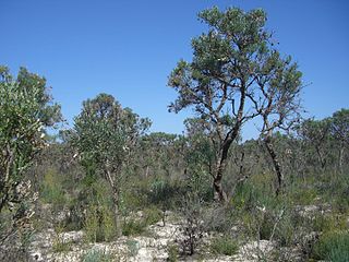
Greater Kingston National Park is a national park in the South West region of Western Australia, 308 kilometres (191 mi) south of Perth. It is located in the Shires of Bridgetown–Greenbushes, Boyup Brook and Manjimup. It is located in the Jarrah Forest bioregion.
Dalgarup National Park is a national park in the South West region of Western Australia, 275 kilometres (171 mi) south of Perth. It is predominantly located in the Shire of Bridgetown–Greenbushes, except for a small part in the south-western corner of the national park, which is located in the Shire of Nannup. It is located in the Jarrah Forest and Warren bioregions.
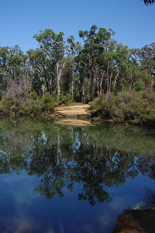
Jane National Park is a national park in the South West region of Western Australia, 357 kilometres (222 mi) south of Perth. It is located adjacent to the west of the much larger Shannon National Park, in the Shire of Manjimup. It is located in the Warren bioregion.
Easter National Park is a national park in the South West region of Western Australia, 294 kilometres (183 mi) south of Perth. It is located adjacent to the east of the much larger Hilliger and Milyeannup national parks, in the Shire of Nannup. The majority of the national park is located east of the Vasse Highway. It is located in the Jarrah Forest and Warren bioregions.
Forest Grove National Park is a national park in the South West region of Western Australia, 292 kilometres (181 mi) south of Perth. It is located in the Shire of Augusta-Margaret River. To the east of the national park lies an unnamed national park (WA46400), which connects Forest Grove to the Blackwood River National Park. It is located in the Jarrah Forest and Warren bioregions.
Greater Dordagup National Park is a national park in the South West region of Western Australia, 332 kilometres (206 mi) south of Perth. It is located in the Shire of Manjimup with the South Western Highway running through the park. To the east it borders the much larger Shannon National Park. It is located in the Warren bioregion.
Greater Hawke National Park, also referred to as Hawke National Park, is a national park in the South West region of Western Australia, 342 kilometres (213 mi) south of Perth. It is located in the Shire of Manjimup. To the south, it borders the much larger D'Entrecasteaux National Park. It is located in the Warren bioregion.
Goldfields Woodlands National Park is a national park in the Goldfields-Esperance region of Western Australia, 474 kilometres (295 mi) east of Perth and 120 km (75 mi) west of Kalgoorlie, in the Shire of Coolgardie. The park borders the Boorabbin National Park in the west and is situated along the Great Eastern Highway. It is located in the Coolgardie bioregion.
Milyeannup National Park is a national park in the South West region of Western Australia, 309 km (192 mi) south of Perth. It is located in the Shire of Nannup, bordering the Hilliger National Park. The park is located in the Jarrah Forest bioregion.
Mungada Ridge National Park is a national park in the Mid West region of Western Australia, 90 km (56 mi) north-east of Perenjori and 200 km (120 mi) south-east of Geraldton. It was declared on 17 January 2022, is located in the Shire of Perenjori, and is part of the Yalgoo bioregion.
Warlibirri National Park is a national park in the Kimberley region of Western Australia, stretching along the Margaret River east of Fitzroy Crossing. It was declared on 22 September 2021, is located in the Shires of Derby-West Kimberley and Halls Creek, and is part of the Central Kimberley and Dampierland bioregions.
Cape Range (South) National Park is a national park in the Gascoyne region of Western Australia, 90 kilometres (56 mi) south-west of Exmouth. It was declared on 4 November 2020, is located in the Shire of Exmouth, and is part of the Carnarvon xeric shrublands bioregion. The national park is south of the older and larger Cape Range National Park, which was declared in 1964.
Pimbee National Park is a national park in the Gascoyne region of Western Australia, 180 km (110 mi) south-east of Carnarvon. It was declared in August 2023, is located in the Shire of Carnarvon, and is part of the Carnarvon xeric shrublands bioregion.

