The Department of Environment and Conservation (DEC) was a department of the Government of Western Australia that was responsible for implementing the state's conservation and environment legislation and regulations. It was formed on 1 July 2006 by the amalgamation of the Department of Environment and the Department of Conservation and Land Management.
The department was managing more than 285,000km2, including more than nine per cent of WA's land area: its national parks, marine parks, conservation parks, regional parks, state forests and timber reserves, nature reserves, roadside reserves and marine nature reserves. It provided visitor and recreation facilities at a sustainable level for many of these.[4]
It also supported or worked closely with the following authorities:
The total reportable visitation to DEC-managed lands and waters during the 2012–13 financial year was 16.02 million, with visitor satisfaction levels of 88%.
4,717 people were registered volunteers with the department in 2012–13 that helped in a range of projects across the state with 564,350 hours contributed.
Department of Environment and Conservation national park rangers at Fern Pool, Karijini National Park, Pilbara in September 2012
DEC was responsible from 2007 to 2013 for protecting and conserving the state of Western Australia's environment; this included managing:
At 30 June 2013, the total area under Department of Environment and Conservation's care was 28,531,987 ha.
The department's key responsibilities also included roles in managing, regulating and assessing aspects of the use of the state's natural resources and biodiversity, including the regulation of native vegetation clearing and pollution control. The department initiated 14 environmental prosecutions during 2012–13, involving a broad range of charges including pollution, unauthorised clearing of native vegetation and illegal dumping. At 30 June 2013, eight environmental prosecutions remained before the courts. There were an additional 18 pending cases that, subject to the evidentiary standard being met, could result in prosecution or other sanction.
Air Tractor 602 water bomber, based in Albany on reloading at Esperance airport in November 2009Fire appliance truck Isuzu 750 heavy duty #100 'Esperance 3.4' at Cape Le Grand National Park prescribed burn in May 2009 (Western Australia)
DEC was also responsible for the wildlife conservation project Western Shield.
The department was also in charge of wildfire prevention and suppression on its land as well as fire prevention in unallocated Crown land.
The indicative burn target for 2012–13 in the south-west forest regions was 200,000 hectares. In 2012–13, DEC achieved 23,468 hectares in the south-west forest regions, including about 6,410 hectares that were burnt for pine plantation protection.
The combination of unsuitable weather conditions, fuels remaining dry due to summer conditions extending into autumn, and enhanced requirements in prescribed burn planning and risk management as a result of the 2011 Margaret River bushfire contributed to a significant reduction of the area able to be prescribed burnt this year.
The average area of burning achieved over the past 10 years has been about 163,019 hectares per annum.
A further 6,023,884 hectares was burnt in the Kimberley, Pilbara, Goldfields, Midwest, Wheatbelt and South Coast regions. The burns were carried out on DEC-managed lands as well as on unallocated Crown lands and unmanaged reserves within these regions.
DEC staff attended and monitored 676 bushfires throughout the state in 2012–13, which burnt about 5,477,394 hectares. The causes of these fires were:
lightning—28 per cent (above the 10-year average of about 24 per cent)
deliberately lit or arson-caused fires—37 per cent (below the 10-year average of about 43 per cent)
accidental fires—16 per cent
escapes from private burns—4 per cent
escapes from DEC burns—0 per cent
other causes—4 per cent
unknown—11 per cent.
Some of the most severe bushfires the department had to suppress, in chronological order, included:
72 homes destroyed, 32 damaged, Buckingham Bridge on Brookton Highway collapsed and closed for 3 weeks whilst a temporary bridge was constructed and opened a month after the fires
The department maintained and coordinated a range of specialist equipment and emergency response vehicles. This included pumpers, water bombers and tankers and other equipment relating to operations involving search and rescue and firefighting.
Heavy duty fire appliance Isuzu 550 (HD119 – Cape Le Grand) at Esperance depot, September 2010.
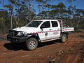
Toyota Hilux 3.0 D4D light patrol used by sector commander (ESP4) on ESP003 bushfire in Dundas Nature Reserve, December 2010.
Toyota Hilux with flame-thrower at Eyre Highway buffer prescribed burn, Cocklebiddy, October 2010.
Toyota Landcruiser (FA2 – fire allowance officer in 2nd), Swan Coastal District, October 2013.
Toyota Landcruiser Prado for operations officer, Blackwood District, Busselton, August 2011.
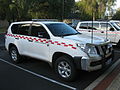
Nissan Patrol sector commander 4WD, Esperance office, January 2011.
Mitsubishi Canter tender gang truck, Esperance depot, November 2010.
D6 5EX dozer (plant P3 – Swan Coastal 53), Moore River National Park, October 2013.
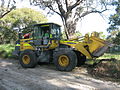
Front end loader (plant P1 – Swan Coastal 50), Swan Coastal District, October 2013.
Grader opening a fireline by taking the fuel off the edge, followed by heavy duty fire appliance (HD156) in charge of its protection and avoiding hop overs. ESP001 bushfire at Mundrabilla, October 2011.
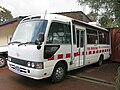
Toyota Coaster fire operations control van, Bunbury state facilities, August 2011.
Marmion Marine Park vessel V61 "LaKela", Hillary Harbour, December 2009.
American Champion Scout at Esperance Airport in November 2011. This aircraft was used for bushfire spotting or incident mapping.
↑ "Home page". Department of Water and Environmental Regulation. Retrieved 25 August 2021. The Department of Water and Environmental Regulation was established by the Government of Western Australia on 1 July 2017. It is a result of the amalgamation of the Department of Environment Regulation, Department of Water and the Office of the Environmental Protection Authority.
This page is based on this Wikipedia article Text is available under the CC BY-SA 4.0 license; additional terms may apply. Images, videos and audio are available under their respective licenses.