Walpole Wilderness Area

Last updated

Walpole Wilderness Area
Western Australia
Mtroe copy.jpg
Walpole Wilderness Area
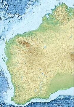
Australia Western Australia relief location map.png
Red pog.svg
Walpole Wilderness Area
Nearest town or city Walpole
Coordinates 34°59′S116°46′E / 34.983°S 116.767°E / -34.983; 116.767 Coordinates: 34°59′S116°46′E / 34.983°S 116.767°E / -34.983; 116.767
Established1957 (1957)
Area3,633.33 km2 (1,402.8 sq mi)
Managing authorities Department of Environment and Conservation
See also List of protected areas of
Western Australia

The Walpole Wilderness Area is a group of conservation reserves on the south coast of Western Australia. The area includes vast tracts of jarrah, red tingle and karri forests surrounding granite peaks, rivers, heathlands, and wetlands. Coastal features include inlets and sandy beaches, sheer cliffs and the Southern Ocean.

Contents

Geography

The planning area, together with the Shannon and D'Entrecasteaux National Parks, provide a contiguous conservation reserve system stretching from near Augusta in the west to Denmark in the east.

The Walpole Wilderness incorporates:

History

The concept of a Walpole Wilderness Area was first developed by Donna Selby and Cath Roberts on behalf of the South Coast Environment Group Inc., in 1998. [1] During the height of the old growth logging debate, the Walpole Wilderness proposal sought to realise the region's potential for nature conservation by proposing the creation of a Regional Wilderness Park which expanded and linked existing parks and reserves into a single integrated conservation reserve. [2]

The proposal extended the concept of conserving the Shannon River Basin across the Deep River and Frankland River systems.

This proposal was also unique as it sought to integrate the Walpole/Nornalup townships and farming districts into the Area. It proposed the development of a unique relationship between local residents, visitors and the surrounding natural areas. It would facilitate the development of a wide range of nature-based recreational activities and maximise opportunities for associated business development. Existing recreational and tourism infrastructure would be enhanced and expanded to capitalise on the significant growth in tourism to the Walpole region, while concurrently ensuring the long term ecological and economic sustainability of the region. [3]

The Walpole Wilderness area was adopted by the Western Australian Labor government by Premier Geoff Gallop on 22 April 2001. [4]

Values

These areas have long been recognised for their unique natural, cultural, scenic and landscape values, in particular the rich array of endemic and nationally significant flora and fauna. The planning area is important for:

Related Research Articles

Protected areas of South Australia Areas protected by legislation in South Australia

Protected areas of South Australia consists of protected areas located within South Australia and its immediate onshore waters and which are managed by South Australian Government agencies. As of March 2018, South Australia contains 359 separate protected areas declared under the National Parks and Wildlife Act 1972, the Crown Land Management Act 2009 and the Wilderness Protection Act 1992 which have a total land area of 211,387.48 km2 (81,617.16 sq mi) or 21.5% of the state's area.

Croajingolong National Park Protected area in Victoria, Australia

The Croajingolong National Park is a coastal national park located in the East Gippsland region of the Australian state of Victoria. The 88,355-hectare (218,330-acre) national park is situated approximately 450 kilometres (280 mi) east of Melbourne and 500 kilometres (310 mi) south of Sydney.

Mount Frankland National Park Protected area in Western Australia

Mount Frankland National Park is a national park in the South West region of Western Australia, 327 km (203 mi) south of Perth. The park is part of the larger Walpole Wilderness Area that was established in 2004, an international biodiversity hotspot.

Shannon National Park Protected area in Western Australia

Shannon National Park is a national park on the south coast of Western Australia, 302 km (188 mi) south of Perth and 55 km (34 mi) southeast of Manjimup. It was declared a national park in 1988. The park covers the entire Shannon River basin. It is part of the larger Walpole Wilderness Area that was established in 2004, an international biodiversity hotspot.

Walpole-Nornalup National Park Protected area in Western Australia

Walpole-Nornalup National Park is a national park in the South West region of Western Australia, 355 km (221 mi) south of Perth. It is famous for its towering karri and tingle trees. Red tingle trees are unique to the Walpole area. The park is part of the larger Walpole Wilderness Area that was established in 2004, an international biodiversity hotspot.

Mooloolah River National Park Protected area in Queensland, Australia

The Mooloolah River National Park is a nationally protected area located on the Sunshine Coast, Queensland. It covers an area of 830.9 hectares and is bordered by the Mooloolah River to the east, Claymore and Dixon Roads to the west, and the Lower Mooloolah River Environmental Reserve to the south. It is bisected by the Sunshine Motorway with the northern, 161.93 hectare component of the Park being a later addition. The Park was initially vacant crown land prior to national park designation in 1960. Surrounding land uses include livestock grazing, urban development and the campus of the University of the Sunshine Coast. It is the second largest mainland park on the coastal lowlands in South East Queensland after Noosa National Park and represents an example of low-lying coastal floodplain distinctive of the region.

Tasmanian Wilderness World Heritage Area UNESCO World Heritage Site in Tasmania

The Tasmanian Wilderness World Heritage Area, abbreviated to TWWHA, is a World Heritage Site in Tasmania, Australia. It is one of the largest conservation areas in Australia, covering 15,800 km2 (6,100 sq mi), or almost 25% of Tasmania. It is also one of the last expanses of temperate wilderness in the world, and includes the South West Wilderness.

Tarkine Region in Tasmania, Australia

The Tarkine, officially takayna / Tarkine, is an area containing the Savage River National Park in the north west Tasmania, Australia, which environmental non-government organisations (ENGOs) claim contains significant areas of wilderness. The Tarkine is noted for its beauty and natural values, containing the largest area of Gondwanan cool-temperate rainforest in Australia, as well as for its prominence in Tasmania's early mining history. The area's high concentration of Aboriginal sites has led to it being described by the Australian Heritage Council as "one of the world's great archaeological regions".

Tasmania Parks and Wildlife Service

Tasmania Parks and Wildlife Service is the government body responsible for protected areas of Tasmania on public land, such as national parks, historic sites and regional reserves. Historically it has also had responsibility for managing wildlife, including game.

Nornalup Inlet Inlet on southern coast of Western Australia

Nornalup Inlet is an estuarine body of water on the south coast of the South West of Australia, approximately 450 km (280 mi) from Perth.

The Conservation Council of Western Australia is the umbrella body for conservation groups and organisations in Western Australia. It has been the co-ordinator, publisher and guiding body for issues of woodchipping in the South West of Western Australia, the logging of old growth forests, as well as providing input into government processes involved with all aspects of environmental protection and conservation.

Warren (biogeographic region) Biogeographic region in southern Western Australia

Warren, also known as Karri Forest Region and the Jarrah-Karri forest and shrublands ecoregion, is a biogeographic region in southern Western Australia. Located in the southwest corner of Western Australia between Cape Naturaliste and Albany, it is bordered to the north and east by the Jarrah Forest region. Its defining characteristic is an extensive tall forest of Eucalyptus diversicolor (karri). This occurs on dissected, hilly ground, with a moderately wet climate. Karri is a valuable timber and much of the karri forest has been logged over, but less than a third has been cleared for agriculture. Recognised as a region under the Interim Biogeographic Regionalisation for Australia (IBRA), and as a terrestrial ecoregion by the World Wide Fund for Nature, it was first defined by Ludwig Diels in 1906.

Deep River (Western Australia) River in Western Australia

Deep River is a river located in the Great Southern region of Western Australia.

Gull Rock National Park Protected area in Western Australia

Gull Rock National Park is a small national park situated 25 km (16 mi) east of Albany in Western Australia. It was established in 2006, becoming Western Australia's 97th national park in the process. It is around 2,593 hectares in area.

The Nadgee Nature Reserve is a protected nature reserve that is located in the far south coast region of New South Wales, in eastern Australia. The 20,671-hectare (51,080-acre) reserve is situated to the immediate south of Ben Boyd National Park. Its southern border is bounded by the Black-Allan Line that marks the straight–line border between New South Wales and Victoria, where it abuts Croajingolong National Park.

Mount Roe National Park is a national park in the Great Southern Region of Western Australia. It was designated in 2004, and covers an area of 1278 km2.

Mount Frankland South National Park is a national park in Western Australia. It lies mostly in the South West Region, with the eastern portion in Great Southern Region. It was designated in 2004, and covers an area of 422.99 km2. It is part of the larger Walpole Wilderness Area that was established in the same year.

Boyndaminup National Park is a national park in Western Australia. It is located in the Shire of Manjimup in the South West region. It was designated in 2004, and covers an area of 54.43 km2.

References

  1. Walpole Wilderness and Adjacent Parks and Reserves Management Plan 2008, Department of Environment and Conservation, Management Plan No 61, 2008
  2. "Walpole Wilderness Proposal" (PDF). 1998. Retrieved 9 August 2009.
  3. Walpole Wilderness Proposal, South Coast Environment Group Inc, 2004.
  4. http://www.dec.wa.gov.au/news/premier-of-western-australia/government-unveils-maps-of-the-proposed-walpole-wilderness-area.html [ dead link ]