Related Research Articles

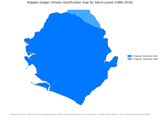
Sierra Leone is located on the west coast of Africa, between the 7th and 10th parallels north of the equator. Sierra Leone is bordered by Guinea to the north and northeast, Liberia to the south and southeast, and the Atlantic Ocean to the west.

Protected areas of Australia include Commonwealth and off-shore protected areas managed by the Australian government, as well as protected areas within each of the six states of Australia and two self-governing territories, the Australian Capital Territory and the Northern Territory, which are managed by the eight state and territory governments.
This is an index of conservation topics. It is an alphabetical index of articles relating to conservation biology and conservation of the natural environment.

A transboundary protected area (TBPA) is an ecological protected area that spans boundaries of more than one country or sub-national entity. Such areas are also known as transfrontier conservation areas (TFCAs) or peace parks.

Marine protected areas (MPA) are protected areas of seas, oceans, estuaries or in the US, the Great Lakes. These marine areas can come in many forms ranging from wildlife refuges to research facilities. MPAs restrict human activity for a conservation purpose, typically to protect natural or cultural resources. Such marine resources are protected by local, state, territorial, native, regional, national, or international authorities and differ substantially among and between nations. This variation includes different limitations on development, fishing practices, fishing seasons and catch limits, moorings and bans on removing or disrupting marine life. In some situations, MPAs also provide revenue for countries, potentially equal to the income that they would have if they were to grant companies permissions to fish.

The Loma Mountains are the highest mountain range in Sierra Leone. The highest peak is Mount Bintumani which rises to a height of 1,945 metres (6,381 ft). The area has been designated a non-hunting forest reserve since 1952. The reserve covers an area of 33,201 hectares.

Tiwai Island is a wildlife sanctuary and tourist site in Sierra Leone. Run by the non-governmental organization Environmental Foundation for Africa, Tiwai is 12 square kilometers in area and located on the Moa River in the Southern Province. It is also one of the largest inland islands in the country.

The Sierra Leone River is a river estuary on the Atlantic Ocean in Western Sierra Leone. It is formed by the Bankasoka River and Rokel River and is between 4 and 10 miles wide (6–16 km) and 25 miles (40 km) long. It holds the major ports of Queen Elizabeth II Quay and Pepel. The estuary is also important for shipping. It is the largest natural harbour in the African continent. Several islands, including Tasso Island, Tombo Island, and the historically important Bunce Island, are located in the estuary.

The Zapata Swamp is located on the Zapata Peninsula in the southern Matanzas Province of Cuba, in the municipality of Ciénaga de Zapata. It is located less than 150 kilometres (93 mi) southeast of Havana.

Western Area Peninsula National Park is a protected area in Sierra Leone. It covers an area of 183.37 km².

Kangari Hills Forest Reserve is a non-hunting forest reserve in the centre of Sierra Leone. The area became a forest reserve in 1924. Lying between 200 and 500 metres above sea level, the reserve has an area of 8,573 hectares (85.73 km²), although parts of it area have been encroached upon by farming and mining. The Reserve is one of the few places in Sierra Leone where the endangered forest elephant survives.
Farangbaia Forest Reserve is a forest reserve with a rainforest ecosystem in Sierra Leone. The Reserve covers an area of 1,260 hectares, is located approximately 10 km to the south-east of the town of Bumbuna and forms part of the catchment area for the Seli River. Since the outbreak of Sierra Leone civil war in 1991 much of the reserve has become farmland and bush forest and there a number sawmills operating there.
The Kambui Hills Forest Reserve occupies an area of 14,335 hectares in the Eastern Province of Sierra Leone. It is located 10 kilometres from the town of Kenema with terrain consisting of steep slopes that reach an altitude of between 100 and 645 metres. The area mainly contains forest habitat but there is also some savanna and wetland. Over 200 separate species of birds have been recorded in the reserve including vulnerable species the white-necked picathartes and green-tailed bristlebill and near threatened species the yellow-casqued hornbill, rufous-winged illadopsis and copper-tailed glossy-starling.

The Tingi Hills Forest Reserve is located in a mountain range in the east of Sierra Leone and occupies an area of 118.85 km2 (45.89 sq mi). It became a forest reserve in 1947 and a non-hunting forest reserve in 1973. The area reaches from an altitude of 400 to 1850 metres at the north peak of the dual peaked Sankan Biriwa massif. In the lower regions the area consists of forest interspersed with savannah then moves into shrub savannah and then mountain grassland at higher altitudes. Over 200 species of birds have been recorded in the area and the reserve is also home to western baboons and forest elephants.
The Bo Plains are located in the south of Sierra Leone by the city of Bo. The plains are mainly made up of savannah and 2,590 hectares of the area have been proposed as a game sanctuary.
Kasewe Forest Reserve is an area of hills in the Moyamba District of Sierra Leone. It is designated as a forest reserve and contains moist semi-deciduous and evergreen forests that cover an area of 1.224 km². Made up of volcanic rock the hills stand about 500m above the interior plains of the country. The nearest town is Lunsar.

Protected areas of Poland include the following categories, as defined by the Act on Protection of Nature of 16 April 2004, by the Polish Parliament:

The World Database on Protected Areas (WDPA) is the largest assembly of data on the world's terrestrial and marine protected areas, containing more than 260,000 protected areas as of August 2020, with records covering 245 countries and territories throughout the world. The WDPA is a joint venture between the United Nations Environment Programme World Conservation Monitoring Centre and the International Union for Conservation of Nature World Commission on Protected Areas.

Many parts of Scotland are protected in accordance with a number of national and international designations because of their environmental, historical or cultural value. Protected areas can be divided according to the type of resource which each seeks to protect. NatureScot has various roles in the delivery of many environmental designations in Scotland, i.e. those aimed at protecting flora and fauna, scenic qualities and geological features. Historic Environment Scotland is responsible for designations that protect sites of historic and cultural importance. Some international designations, such as World Heritage Sites, can cover both categories of site.
References
- World Database on Protected Areas: Sierra Leone, UN Environment Programme World Conservation Monitoring Centre, retrieved on 6 November 2007
- Introduction [ permanent dead link ], Sierra Leone National Commission on the Environment and Forestry, retrieved on 9 November 2007
- "Ramsar Sites Information Service", Ramsar, retrieved on 10 November 2007
- Visit Sierra Leone, retrieved on 6 November 2007
- Sheku Sei and Edward Aruna (2009). Socio-economic studies for the establishment of marine protected areas (MPAs) in the Yawri Bay. Consultancy Report, Pilot project for coastal zone management in Sierra Leone, Funded by Wetlands International and PRCM. Conservation Society Sierra Leone (CSSL)
