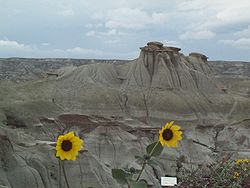
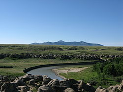
List of protected areas of Alberta

Last updated

Alberta Parks
Location and extent of parks in Alberta AB-national and provincial parks.png
Location and extent of parks in Alberta
TypeNumberArea km²
(sq mi)
Provincial Parks 762,214 km2 (855 sq mi)
Wildland Provincial Parks3117,314 km2 (6,685 sq mi)
Provincial Recreation Areas208899 km2 (347 sq mi)
Wilderness Areas 31,010 km2 (390 sq mi)
Ecological Reserves15268 km2 (103 sq mi)
Natural Areas1391,299 km2 (502 sq mi)
Heritage Rangelands2120 km2 (46 sq mi)
National Parks 563,045 km2 (24,342 sq mi)
Total47690,747 km2 (35,038 sq mi)
Dinosaur Provincial Park DinosaurProvincialParkHoodoo.jpg
Dinosaur Provincial Park
Dry Island Buffalo Jump Provincial Park Dry Island Provincial Park2.jpg
Dry Island Buffalo Jump Provincial Park
Fish Creek Provincial Park Fish-Creek-Park-Szmurlo.jpg
Fish Creek Provincial Park
Greene Valley Provincial Park Greene Valley Provincial Park.JPG
Greene Valley Provincial Park
Little Fish Lake Provincial Park Little fish lake provincial park campsite.jpg
Little Fish Lake Provincial Park
Lakeland Provincial Park Beautiful skies.jpg
Lakeland Provincial Park
Pembina River Provincial Park Entwistletwinbridges.jpg
Pembina River Provincial Park
Peter Lougheed Provincial Park U-Kananaskis-Lk-Szmurlo.jpg
Peter Lougheed Provincial Park
Pigeon Lake Provincial Park Ice fishing shacks on Pigeon Lake at Pigeon Lake Provincial Park, Alberta.jpg
Pigeon Lake Provincial Park
Spray Valley Provincial Park Spray-Valley-Szmurlo.jpg
Spray Valley Provincial Park
Williamson Provincial Park Williamston park-ab.JPG
Williamson Provincial Park
Writing-on-Stone Provincial Park MilkriverAB.JPG
Writing-on-Stone Provincial Park

This is a list of protected areas of Alberta. Protected areas are managed by the Government of Canada or the Government of Alberta. The provincial government owns 60% of Alberta's landmass [1] but most of this has not been formally protected. The total protected area throughout Alberta including federal and provincial protected areas is approximately 90,700 km2 (35,000 sq mi).

Contents

International recognition

Six of Canada's 14 UNESCO World Heritage Sites are entirely or partially located in Alberta:

Alberta also contains the following UNESCO Biosphere Reserves

Federally protected areas

Five National Parks of Canada (Banff, Elk Island, Jasper, Waterton Lakes and Wood Buffalo), managed by Parks Canada are located in the province. Several former national parks (such Buffalo National Park, Wawaskesy National Park, and Nemiskam National Park) formerly existed in Alberta, but were delisted in 1947.

There are several National Historic Sites of Canada in Alberta, but only two are operated by Parks Canada: Rocky Mountain House, which features an indoor interpretation centre and year-round in-person interpretation, and Frog Lake which has only outdoor interpretive panels to mark the site.

Alberta is also home to Suffield National Wildlife Area, a protected area within the military reserve at CFB Suffield.

Provincially protected areas

There are several different departments and agencies that deal with land use in Alberta, however Alberta's provincial parks are managed by Alberta Parks, which since 2022 is part of the Ministry of Forestry, Parks and Tourism [2] whose mandate is to protect the province's natural landscapes in Alberta, as well as the Ministry of Environment and Protected Areas. Seven categories of protection exist, provincial parks being one. These categories are:

As of 2016, the province of Alberta managed 76 provincial parks, 32 wildland provincial parks, 208 provincial recreation areas, 15 ecological reserves, 3 wilderness areas, 139 natural areas and 2 heritage rangeland. [3] Although these areas are the responsibility of the Alberta government, private companies have been contracted to handle various aspects of the operation of many parks (e.g. maintenance and campground operation).

List of wilderness areas

Wilderness areas have the strictest level of protection, no development of any kind is permitted, and travel is only permitted by foot. [4]

List of provincial parks

ParkNearest communityEstablishedCoordinateswebsite (ID)
Antelope Hill Provincial Park Hanna 2014, 4 December [5] 51°43′19″N111°56′13″W / 51.722°N 111.937°W / 51.722; -111.937 (Antelope Hill Provincial Park)
Aspen Beach Provincial Park Bentley 1932, 21 November 52°27′28″N113°58′39″W / 52.45778°N 113.97750°W / 52.45778; -113.97750 (Aspen Beach Provincial Park) 1
Beauvais Lake Provincial Park Pincher Creek 1954, 1 February 49°24′39″N114°06′33″W / 49.41083°N 114.10917°W / 49.41083; -114.10917 (Beauvais Lake Provincial Park) 6
Big Hill Springs Provincial Park Cochrane 1957, 22 November 51°15′6″N114°23′18″W / 51.25167°N 114.38833°W / 51.25167; -114.38833 (Big Hill Springs Provincial Park) 12
Big Knife Provincial Park Forestburg 1962, 2 October 52°29′25″N112°13′15″W / 52.49028°N 112.22083°W / 52.49028; -112.22083 (Big Knife Provincial Park) 11
Bow Valley Provincial Park Canmore 1959, 27 July 51°04′5″N115°02′47″W / 51.06806°N 115.04639°W / 51.06806; -115.04639 (Bow Valley Provincial Park) 293
Bragg Creek Provincial Park Bragg Creek 1960, 19 January 50°56′30″N114°35′14″W / 50.94167°N 114.58722°W / 50.94167; -114.58722 (Bragg Creek Provincial Park) 324
Brown-Lowery Provincial Park Turner Valley 1992, 29 October 50°48′58″N114°26′4″W / 50.81611°N 114.43444°W / 50.81611; -114.43444 (Brown-Lowery Provincial Park) 16
Calling Lake Provincial Park Athabasca 1971, 20 July 55°10′51″N113°14′40″W / 55.18083°N 113.24444°W / 55.18083; -113.24444 (Calling Lake Provincial Park) 248
Canmore Nordic Centre Provincial Park Canmore 1988 51°05′53″N115°23′23″W / 51.09806°N 115.38972°W / 51.09806; -115.38972 (Canmore Nordic Centre Provincial Park) 294
Carson-Pegasus Provincial Park Whitecourt 1982, 19 May 54°18′16″N115°38′30″W / 54.30444°N 115.64167°W / 54.30444; -115.64167 (Carson-Pegasus Provincial Park) 247
Castle Provincial Park Crowsnest Pass 2017, 17 February [6] 49°26′38″N114°07′01″W / 49.444°N 114.117°W / 49.444; -114.117 (Castle Provincial Park)
Chain Lakes Provincial Park Nanton 1969, 23 December 50°12′24″N114°11′47″W / 50.20667°N 114.19639°W / 50.20667; -114.19639 (Chain Lakes Provincial Park) 19
Cold Lake Provincial Park Cold Lake 1976, 18 August 54°27′38″N110°07′12″W / 54.46056°N 110.12000°W / 54.46056; -110.12000 (Cold Lake Provincial Park) 22
Crimson Lake Provincial Park Rocky Mountain House 1955, 22 November 52°27′0″N115°2′0″W / 52.45000°N 115.03333°W / 52.45000; -115.03333 (Crimson Lake Provincial Park) 27
Cross Lake Provincial Park Athabasca 1955, 22 November 54°38′17″N113°48′52″W / 54.63806°N 113.81444°W / 54.63806; -113.81444 (Cross Lake Provincial Park) 28
Crow Lake Provincial Park Fort McMurray 55°47′47″N112°10′54″W / 55.79639°N 112.18167°W / 55.79639; -112.18167 (Crow Lake Provincial Park) 574
Cypress Hills Interprovincial Park Medicine Hat 49°34′31″N110°00′23″W / 49.57528°N 110.00639°W / 49.57528; -110.00639 (Cypress Hills Interprovincial Park) 29
Dillberry Lake Provincial Park Provost 1957, 8 January 52°35′47″N110°04′51″W / 52.59639°N 110.08083°W / 52.59639; -110.08083 (Dillberry Lake Provincial Park) 38
Dinosaur Provincial Park Brooks 1955, 27 June 50°45′44″N111°31′5″W / 50.76222°N 111.51806°W / 50.76222; -111.51806 (Dinosaur Provincial Park) 246
Dry Island Buffalo Jump Provincial Park Trochu 1970, 15 December 51°56′10″N112°57′41″W / 51.93611°N 112.96139°W / 51.93611; -112.96139 (Dry Island Buffalo Jump Provincial Park) 39
Dunvegan Provincial Park Fairview 1992, 21 May 55°55′24″N118°36′2″W / 55.92333°N 118.60056°W / 55.92333; -118.60056 (Dunvegan Provincial Park) 40
Eagle Point Provincial Park Drayton Valley 2007, 29 August 53°14′40″N114°52′28″W / 53.24444°N 114.87444°W / 53.24444; -114.87444 (Eagle Point Provincial Park) 589
Fish Creek Provincial Park Calgary 1975, 10 June 50°54′11″N114°00′55″W / 50.90306°N 114.01528°W / 50.90306; -114.01528 (Fish Creek Provincial Park) 45
Garner Lake Provincial Park Vilna 1953, 14 July 54°10′59″N111°44′22″W / 54.18306°N 111.73944°W / 54.18306; -111.73944 (Garner Lake Provincial Park) 49
Glenbow Ranch Provincial Park Calgary
Cochrane
2008, 17 April 51°10′1″N114°23′34″W / 51.16694°N 114.39278°W / 51.16694; -114.39278 (Glenbow Ranch Provincial Park) 593
Gooseberry Lake Provincial Park Consort 1932, 21 November 52°07′4″N110°45′6″W / 52.11778°N 110.75167°W / 52.11778; -110.75167 (Gooseberry Lake Provincial Park) 51
Greene Valley Provincial Park Peace River 2000, 6 June 56°11′53″N117°14′30″W / 56.19806°N 117.24167°W / 56.19806; -117.24167 (Greene Valley Provincial Park) 147
Gregoire Lake Provincial Park Fort McMurray 1969, 21 October 56°28′23″N111°11′55″W / 56.47306°N 111.19861°W / 56.47306; -111.19861 (Gregoire Lake Provincial Park) 52
Hilliard's Bay Provincial Park High Prairie 1978, 24 October 55°29′57″N116°01′10″W / 55.49917°N 116.01944°W / 55.49917; -116.01944 (Hilliard's Bay Provincial Park) 3
Jarvis Bay Provincial Park Sylvan Lake 1965, 8 July 52°21′59″N114°07′56″W / 52.36639°N 114.13222°W / 52.36639; -114.13222 (Jarvis Bay Provincial Park) 61
Kinbrook Island Provincial Park Brooks 1951, 14 November 50°26′52″N111°54′40″W / 50.44778°N 111.91111°W / 50.44778; -111.91111 (Kinbrook Island Provincial Park) 65
Lakeland Provincial Park Lac La Biche 1992, 16 January 54°47′24″N111°29′17″W / 54.79000°N 111.48806°W / 54.79000; -111.48806 (Lakeland Provincial Park) 280
Lesser Slave Lake Provincial Park Slave Lake 55°25′3″N114°48′39″W / 55.41750°N 114.81083°W / 55.41750; -114.81083 (Lesser Slave Lake Provincial Park) 68
Little Bow Provincial Park Champion 1954, 20 January 50°13′10″N112°57′56″W / 50.21944°N 112.96556°W / 50.21944; -112.96556 (Little Bow Provincial Park) 69
Little Fish Lake Provincial Park Drumheller 1957, 8 April 51°22′18″N112°11′54″W / 51.37167°N 112.19833°W / 51.37167; -112.19833 (Little Fish Lake Provincial Park) 71
Lois Hole Centennial Provincial Park Edmonton
St. Albert
2005, 19 April 53°36′22″N113°40′41″W / 53.60611°N 113.67806°W / 53.60611; -113.67806 (Lois Hole Centennial Provincial Park) 437
Long Lake Provincial Park Boyle 1957, 25 March 54°25′32″N112°45′26″W / 54.42556°N 112.75722°W / 54.42556; -112.75722 (Long Lake Provincial Park) 72
Midland Provincial Park Drumheller 1979, 5 June 51°28′41″N112°47′13″W / 51.47806°N 112.78694°W / 51.47806; -112.78694 (Midland Provincial Park) 78
Miquelon Lake Provincial Park Hay Lakes 1958, 20 May 53°14′51″N112°53′15″W / 53.24750°N 112.88750°W / 53.24750; -112.88750 (Miquelon Lake Provincial Park) 81
Moonshine Lake Provincial Park Rycroft 1959, 21 April 55°55′31″N119°13′51″W / 55.92528°N 119.23083°W / 55.92528; -119.23083 (Moonshine Lake Provincial Park) 82
Moose Lake Provincial Park Bonnyville 1967, 19 April 54°15′50″N110°55′55″W / 54.26389°N 110.93194°W / 54.26389; -110.93194 (Moose Lake Provincial Park) 83
Notikewin Provincial Park Manning 1979, 20 November 57°17′19″N117°09′3″W / 57.28861°N 117.15083°W / 57.28861; -117.15083 (Notikewin Provincial Park) 87
Obed Lake Provincial Park Edson 53°33′19″N117°07′44″W / 53.55528°N 117.12889°W / 53.55528; -117.12889 (Obed Lake Provincial Park) 203
O'Brien Provincial Park Grande Prairie 1954, 29 June 55°03′49″N118°49′28″W / 55.06361°N 118.82444°W / 55.06361; -118.82444 (O'Brien Provincial Park) 88
Park Lake Provincial Park Lethbridge 1932, 21 November 49°48′14″N112°55′30″W / 49.80389°N 112.92500°W / 49.80389; -112.92500 (Park Lake Provincial Park) 143
Pembina River Provincial Park Entwistle 1953, 21 September 53°36′18″N114°59′57″W / 53.60500°N 114.99917°W / 53.60500; -114.99917 (Pembina River Provincial Park) 92
Peter Lougheed Provincial Park Kananaskis 1977, 7 October 50°41′0″N115°13′35″W / 50.68333°N 115.22639°W / 50.68333; -115.22639 (Peter Lougheed Provincial Park) 307
Pierre Grey's Lakes Provincial Park Grande Cache 53°54′23″N118°35′18″W / 53.90639°N 118.58833°W / 53.90639; -118.58833 (Pierre Grey's Lakes Provincial Park) 209
Pigeon Lake Provincial Park Wetaskiwin 1967, 26 May 53°01′35″N114°08′4″W / 53.02639°N 114.13444°W / 53.02639; -114.13444 (Pigeon Lake Provincial Park) 98
Police Outpost Provincial Park Cardston 1970, 21 April 49°00′22″N113°27′32″W / 49.00611°N 113.45889°W / 49.00611; -113.45889 (Police Outpost Provincial Park) 108
Queen Elizabeth Provincial Park Grimshaw 1956, 1 March 56°13′43″N117°41′22″W / 56.22861°N 117.68944°W / 56.22861; -117.68944 (Queen Elizabeth Provincial Park) 110
Ram Falls Provincial Park Nordegg 52°05′21″N115°50′11″W / 52.08917°N 115.83639°W / 52.08917; -115.83639 (Ram Falls Provincial Park) 213
Red Lodge Provincial Park Bowden 1951, 7 May 51°56′38″N114°16′11″W / 51.94389°N 114.26972°W / 51.94389; -114.26972 (Red Lodge Provincial Park) 114
Rochon Sands Provincial Park Stettler 1957, 8 January 52°27′51″N112°53′27″W / 52.46417°N 112.89083°W / 52.46417; -112.89083 (Rochon Sands Provincial Park) 116
Rock Lake Provincial Park Hinton 53°28′2″N118°15′10″W / 53.46722°N 118.25278°W / 53.46722; -118.25278 (Rock Lake Provincial Park) 215
Saskatoon Island Provincial Park Wembley 1932, 21 November 55°12′20″N119°05′6″W / 55.20556°N 119.08500°W / 55.20556; -119.08500 (Saskatoon Island Provincial Park) 118
Sheep River Provincial Park Turner Valley 50°38′49″N114°38′43″W / 50.64694°N 114.64528°W / 50.64694; -114.64528 (Sheep River Provincial Park) 330
Sir Winston Churchill Provincial Park Lac La Biche 1952, 29 September 54°49′45″N111°57′45″W / 54.82917°N 111.96250°W / 54.82917; -111.96250 (Sir Winston Churchill Provincial Park) 120
Spray Valley Provincial Park Kananaskis 2000, 1 December 50°50′14″N115°14′48″W / 50.83722°N 115.24667°W / 50.83722; -115.24667 (Spray Valley Provincial Park) 308
Strathcona Science Provincial Park Edmonton
Sherwood Park
1979, 12 December 53°33′39″N113°23′2″W / 53.56083°N 113.38389°W / 53.56083; -113.38389 (Strathcona Science Provincial Park) 123
Sundance Provincial Park Edson 1999, 28 April 53°38′29″N116°52′47″W / 53.64139°N 116.87972°W / 53.64139; -116.87972 (Sundance Provincial Park) 142
Sylvan Lake Provincial Park Sylvan Lake 1980, 16 January 52°20′43″N114°10′11″W / 52.34528°N 114.16972°W / 52.34528; -114.16972 (Sylvan Lake Provincial Park) 125
Thunder Lake Provincial Park Barrhead 1958, 28 January 54°07′59″N114°43′57″W / 54.13306°N 114.73250°W / 54.13306; -114.73250 (Thunder Lake Provincial Park) 137
Tillebrook Provincial Park Tilley 1965, 20 July 50°32′16″N111°48′30″W / 50.53778°N 111.80833°W / 50.53778; -111.80833 (Tillebrook Provincial Park) 138
Two Lakes Provincial Park Grande Prairie 54°22′22″N119°45′31″W / 54.37278°N 119.75861°W / 54.37278; -119.75861 (Two Lakes Provincial Park) 222
Vermilion Provincial Park Vermilion 1953, 29 May 53°21′53″N110°52′55″W / 53.36472°N 110.88194°W / 53.36472; -110.88194 (Vermilion Provincial Park) 152
Wabamun Lake Provincial Park Wabamun 53°33′58″N114°27′16″W / 53.56611°N 114.45444°W / 53.56611; -114.45444 (Wabamun Lake Provincial Park) 154
Whitney Lakes Provincial Park Elk Point 1982, 23 June 53°49′48″N110°29′48″W / 53.83000°N 110.49667°W / 53.83000; -110.49667 (Whitney Lakes Provincial Park) 158
William A. Switzer Provincial Park Hinton 1958, 22 December 53°32′34″N117°48′20″W / 53.54278°N 117.80556°W / 53.54278; -117.80556 (William A. Switzer Provincial Park) 159
Williamson Provincial Park Valleyview 1960, 7 November 55°04′52″N117°33′26″W / 55.08111°N 117.55722°W / 55.08111; -117.55722 (Williamson Provincial Park) 165
Willow Creek Provincial Park Stavely 1957, 10 December 50°06′54″N113°46′14″W / 50.11500°N 113.77056°W / 50.11500; -113.77056 (Willow Creek Provincial Park) 167
Winagami Lake Provincial Park Donnelly 1956, 13 November 55°37′45″N116°40′41″W / 55.62917°N 116.67806°W / 55.62917; -116.67806 (Winagami Lake Provincial Park) 169
Woolford Provincial Park Cardston 49°10′33″N113°11′20″W / 49.17583°N 113.18889°W / 49.17583; -113.18889 (Woolford Provincial Park) 173
Writing-on-Stone Provincial Park Coutts 1957, 8 January 49°04′49″N111°38′21″W / 49.08028°N 111.63917°W / 49.08028; -111.63917 (Writing-on-Stone Provincial Park) 177
Wyndham-Carseland Provincial Park Strathmore 1979, 2 May 50°49′47″N113°26′59″W / 50.82972°N 113.44972°W / 50.82972; -113.44972 (Wyndham-Carseland Provincial Park) 178
Young's Point Provincial Park Valleyview 1971, 3 August 55°07′3″N117°33′29″W / 55.11750°N 117.55806°W / 55.11750; -117.55806 (Young's Point Provincial Park) 180
Map all coordinates using: OpenStreetMap  
Download coordinates as: KML

Other parks

Other provincial lands

Approximately 60% of land in Alberta is public land owned by the Alberta government. [7] For administrative purposes, the province is divided into two broad land use areas: the Green Area (forested land, almost entirely provincially owned) and the White Area (other). [7] The Rocky Mountains Forest Reserve was created by the Forest Reserves Act of 1964. [8] There are also 32 provincial grazing reserves located throughout Alberta. They are administered by Alberta Sustainable Resource Development. [1]

Municipal parks

See also

Related Research Articles

<span class="mw-page-title-main">Kananaskis Country</span> Multiple use area west of Calgary, Alberta, Canada

Kananaskis Country is a multi-use area west of Calgary, Alberta, Canada in the foothills and front ranges of the Canadian Rockies. The area is named for the Kananaskis River, which was named by John Palliser in 1858 after a Cree acquaintance. Covering an area of approximately 4,000 km2 (1,500 sq mi), Kananaskis Country was formed by the Alberta Government in 1978 to provide an assortment of land uses and designations. Land uses include resource extraction activities, recreation, power generation, and residential communities. Land designations include public land and protected areas.

<span class="mw-page-title-main">Willmore Wilderness Park</span> Provincial park of Alberta, Canada

Willmore Wilderness Park, located in Alberta, Canada, is a 4,600-square-kilometre (1,800 sq mi) wilderness area adjacent to Jasper National Park. It is lesser known and less visited than Jasper National Park. There are no public roads, bridges or buildings. There are, however, several ranger cabins in the park that are available as a courtesy to visitors.

<span class="mw-page-title-main">Waterton Lakes National Park</span> National park in Alberta, Canada

Waterton Lakes National Park is a national park located in the southwest corner of Alberta, Canada. It borders Glacier National Park in Montana, United States. Waterton was the fourth Canadian national park, formed in 1895 and named after Waterton Lake, in turn after the Victorian naturalist and conservationist Charles Waterton. Its range is between the Rocky Mountains and prairies. This park contains 505 km2 (195 sq mi) of rugged mountains and wilderness.

<span class="mw-page-title-main">Rangeland</span> Biomes which can be grazed by animals or livestock (grasslands, woodlands, prairies, etc)

Rangelands are grasslands, shrublands, woodlands, wetlands, and deserts that are grazed by domestic livestock or wild animals. Types of rangelands include tallgrass and shortgrass prairies, desert grasslands and shrublands, woodlands, savannas, chaparrals, steppes, and tundras. Rangelands do not include forests lacking grazable understory vegetation, barren desert, farmland, or land covered by solid rock, concrete and/or glaciers.

The Oldman River is a river in southern Alberta, Canada. It flows roughly west to east from the Rocky Mountains, through the communities of Fort Macleod, Lethbridge, and on to Grassy Lake, where it joins the Bow River to form the South Saskatchewan River, which eventually drains into the Hudson Bay.

Height of the Rockies Provincial Park is a provincial park in the Canadian Rockies of south eastern British Columbia, Canada. It is located west of the Continental Divide, adjacent to Elk Lakes Provincial Park.

<span class="mw-page-title-main">Tourism in Alberta</span> Tourism in Alberta, Canada

Alberta has been a tourist destination since the early days of the 20th Century, with attractions including national parks, National Historic Sites of Canada, urban arts and cultural facilities, outdoor locales for skiing, hiking and camping, shopping locales such as West Edmonton Mall, outdoor festivals, professional athletic events, international sporting competitions such as the Commonwealth Games and Olympic Winter Games, as well as more eclectic attractions.

<span class="mw-page-title-main">Great Divide Trail</span> A long-distance hiking trail

The Great Divide Trail (GDT) is a wilderness hiking trail in the Canadian Rockies. The trail closely follows the Great Divide between Alberta and British Columbia, crossing the divide more than 30 times. Its southern terminus is in Waterton Lakes National Park at the Canada–US border and its northern terminus is at Kakwa Lake in Kakwa Provincial Park, north of Jasper National Park. The trail is 1,130 km (700 mi) long and ranges in elevation from 1,055 m (3,461 ft) at Old Fort Point trailhead near Jasper to 2,590 m (8,500 ft) at an unnamed pass above Michele Lakes just south of the White Goat Wilderness Area.

Chinchaga Wildland Park is a protected 800 km2 (310 sq mi) tract of land in the 5,000 km2 (1,900 sq mi) of the greater Chinchaga wilderness area in a disjunct outlier of the Foothills Natural Region of Alberta, in a remote area of northwest Alberta, Canada, about 140 kilometres (87 mi) west of Manning. It was designated as a Wildlife Park in December 1999. The greater Chinchaga area was identified in 1995 as an Environmentally Significant Area. It was designated by the Alberta Government as a protected area in 2000, under the "Special Places" program. "Elevations in the Park range from 650 m adjacent to the Chinchaga River to 915 m at the height of land atop Halverson Ridge."

Caribou Mountains Wildland Park is a large wilderness area in northern Alberta, Canada. It is located in the Caribou Mountains, immediately west of Wood Buffalo National Park in a remote backcountry area. The closest community in Alberta is Fort Vermilion.

<span class="mw-page-title-main">Ghost River Wilderness Area</span> Protected area in the Canadian Rockies

The Ghost River Wilderness Area is a provincially designated wilderness area in the Canadian Rockies of Alberta protecting the headwaters of the Ghost River. It was established in 1967 and it, as one of the three Wilderness Areas of Alberta, has the strictest form of government protection available in Canada. All development is forbidden and only travel by foot is permitted. Hunting and fishing are not allowed. The other two Wilderness Areas are White Goat Wilderness Area and Siffleur Wilderness Area and together the three areas total 249,548.80 acres (100,988.82 ha).

The Rocky Mountains Forest Reserve is a tract of land owned by the government of Canadian province of Alberta along the eastern slopes and foothills of the Albertan section of the Canadian Rockies. It is a long strip of land just east of the more famous Canadian Rocky Mountain parks, which is managed for industrial and economic goals, rather than aesthetic and conservation goals as in the parks.

<span class="mw-page-title-main">Waterton Biosphere Reserve</span> UNESCO Biosphere Reserve in Alberta, Canada

Waterton Biosphere Reserve is a UNESCO Biosphere Reserve encompassing Waterton Lakes National Park in the extreme south-west of the Province of Alberta, Canada. The reserve includes a section of the east slopes of the Rocky Mountains extending from the Continental Divide to the edge of the Canadian Great Plains to the east. The Glacier Biosphere Reserve and National Park in Montana, USA is located to the south of the area. The reserve is administered by Waterton Lakes National Park and the Waterton Biosphere Association.

<span class="mw-page-title-main">Castle Provincial Park</span> Provincial park in Alberta, Canada

Castle Provincial Park is a provincial park in southern Alberta, Canada. It is located within the Municipal District of Pincher Creek No. 9 south of the Municipality of Crowsnest Pass, northwest of Waterton Lakes National Park and west of the Town of Pincher Creek. It shares a boundary with Castle Wildland Provincial Park to the west and south.

<span class="mw-page-title-main">Bluerock Wildland Provincial Park</span> Protected area in southwestern Alberta, Canada

Bluerock Wildland Provincial Park is a wildland provincial park located in Kananaskis Improvement District, Alberta, Canada. It was established on 24 July 2001 and has an area of 12,719.59 hectares. The park was named for the Bluerock Creek that flows through and forms part of the western boundary of the park and Bluerock Mountain which is the creek's source. The park is included in the South Saskatchewan Region land use framework and administered by the South Saskatchewan Regional Plan. Sheep River Provincial Park and Bluerock Wildland Provincial Park are managed under the same Management Plan.

Bighorn Wildland Provincial Park is a proposed provincial park that would be situated near Rocky Mountain House, Alberta, Canada. It would be part of the Alberta Provincial Parks system and governed by Alberta Tourism, Parks and Recreation under Alberta Environment and Parks. After the 2019 Alberta election, the new United Conservative government announced the plan would not go ahead.

Bob Creek Wildland Provincial Park is a wildland provincial park located in the Municipal District of Ranchland, in southern Alberta, Canada. It was established on 12 May 1999, modified slightly on 24 June 2003, and is 20,777.69 hectares in area. The park is included in the South Saskatchewan Region Land Use Framework and administered by the South Saskatchewan Regional Plan. Because they are so intertwined, Bob Creek Wildland and Black Creek Heritage Rangeland are managed through the same Management Plan. The park gets its name from the Bob Creek that runs through the center of the park and drains the surrounding hills.

Kitaskino Nuwenëné Wildland Provincial Park is a wildland provincial park in Wood Buffalo, northern Alberta, Canada. Kitaskino, means “our land” in Cree and Nuwenëné means “our land” in Dene; the two languages are spoken by the First Nation communities in the area. The park as created on 8 March 2019 had an area of 161,880 hectares. It was expanded on 26 January 2022 to 314,510 hectares. The park is a successful collaboration between the Mikisew Cree First Nation, the governments of Alberta and Canada, and petroleum industry partners in the area. Teck Resources, Imperial Oil, and Cenovus Energy returned oil leases to the Athabasca oil sands which underlay the area. This enabled the land to be turned into a park. After the initial creation of the park in 2019, the Milisew First Nation worked with Burgess Canadian Resources to relinquished their oilsands leases which led to the addition of 152,000 hectares to the park.

References

  1. 1 2 Alberta Sustainable Resource Development. "Provincial Grazing Reserves". Archived from the original on 18 May 2008. Retrieved 8 May 2009.
  2. https://www.alberta.ca/forestry-parks-and-tourism.aspx [ bare URL ]
  3. "Land Reference Manual". Alberta Parks. Government of Alberta. Retrieved 6 October 2016.
  4. About Alberta's Parks - AlbertaParks.ca Archived 2009-12-27 at the Wayback Machine
  5. "O.C. 455/2014". Government of Alberta. 4 December 2014. Retrieved 8 December 2014.
  6. "O.C. 22/2017". Government of Alberta. 20 January 2017. Retrieved 21 January 2017.
  7. 1 2 Archived 12 March 2009 at the Wayback Machine
  8. Archived 13 September 2004 at the Wayback Machine