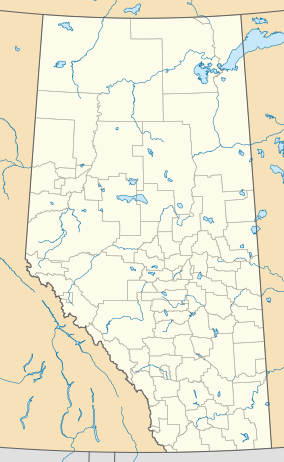
Alberta is one of the thirteen provinces and territories of Canada. It is a part of Western Canada and is one of the three prairie provinces. Alberta borders British Columbia to the west, Saskatchewan to the east, the Northwest Territories to the north, and the U.S. state of Montana to the south. It is one of the only two landlocked provinces in Canada, with Saskatchewan being the other. The eastern part of the province is occupied by the Great Plains, while the western part borders the Rocky Mountains. The province has a predominantly continental climate but experiences quick temperature changes due to air aridity. Seasonal temperature swings are less pronounced in western Alberta due to occasional Chinook winds.

Kananaskis Country is a multi-use area west of Calgary, Alberta, Canada in the foothills and front ranges of the Canadian Rockies. The area is named for the Kananaskis River, which was named by John Palliser in 1858 after a Cree acquaintance. Covering an area of approximately 4,000 km2 (1,500 sq mi), Kananaskis Country was formed by the Alberta Government in 1978 to provide an assortment of land uses and designations. Land uses include resource extraction activities, recreation, power generation, and residential communities. Land designations include public land and protected areas.

The Bow River is a river in Alberta, Canada. It begins within the Canadian Rocky Mountains and winds through the Alberta foothills onto the prairies, where it meets the Oldman River, the two then forming the South Saskatchewan River. These waters ultimately flow through the Nelson River into Hudson Bay. The Bow River runs through the city of Calgary, taking in the Elbow River at the historic site of Fort Calgary near downtown. The Bow River pathway, developed along the river's banks, is considered a part of Calgary's self-image.

Fort Calgary was a North-West Mounted Police outpost at the confluence of the Bow and Elbow rivers in present-day Calgary, Alberta, Canada. Originally named Fort Brisebois, after the outpost's first commander, the outpost was renamed Fort Calgary in June 1876.

Cochrane is a town in the Calgary Metropolitan Region of Alberta, Canada. The town is located 18 km (11 mi) west of the Calgary city limits along Highway 1A. Cochrane is one of the fastest-growing communities in Canada, and with a population of 32,199 in 2021, it is one of the largest towns in Alberta. It is part of Calgary's census metropolitan area and a member community of the Calgary Metropolitan Region Board (CMRB). The town is surrounded by Rocky View County.

The Glenbow Museum is an art and history regional museum in the city of Calgary, Alberta, Canada. The museum focuses on Western Canadian history and culture, including Indigenous perspectives. The Glenbow was established as a private non-profit foundation in 1955 by lawyer, businessman and philanthropist Eric Lafferty Harvie with materials from his personal collection.

Rocky View County is a municipal district in southern Alberta, Canada that is named for its views of the nearby Rocky Mountains to the west. It surrounds most of Calgary, forming the city's northern boundary and most of the city's western and eastern boundaries. At a population of 41,028 in 2021, Rocky View County is the most populous municipal district in Alberta. Though predominantly rural in nature, Rocky View County is home to 14 hamlets, including Langdon, one of Alberta's most populous hamlets. Its rural areas are home to numerous country residential subdivisions.

Highway 22, officially named Cowboy Trail, is a 584-kilometre (363 mi) highway in the Canadian province of Alberta. It generally parallels Highway 2, beginning in the foothills of southern Alberta at Highway 3 near Lundbreck Falls. It proceeds north along the eastern slopes of the Rocky Mountains passing through the foothills and ranch country to the aspen parkland of northern Alberta, ending at Highway 18 near Mayerthorpe.
Glenbow is a locality in southern Alberta, in Rocky View County located northwest of the City of Calgary and east of the Town of Cochrane on Highway 1A. It is now part of the Glenbow Ranch Provincial Park. The Glenbow area is immediately west of Rocky View County's Bearspaw area.

Alberta has been a tourist destination since the early days of the 20th Century, with attractions including national parks, National Historic Sites of Canada, urban arts and cultural facilities, outdoor locales for skiing, hiking and camping, shopping locales such as West Edmonton Mall, outdoor festivals, professional athletic events, international sporting competitions such as the Commonwealth Games and Olympic Winter Games, as well as more eclectic attractions.
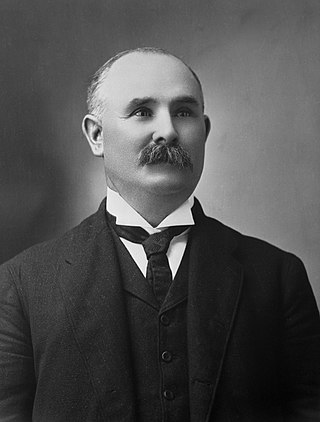
Patrick Burns was a Canadian rancher, meat packer, businessperson, senator, and philanthropist. A self-made man of wealth, he built one of the world's largest integrated meat-packing empires, P. Burns & Co., becoming one of the wealthiest Canadians of his time. He is honoured as one of the Big Four western cattle kings who started the Calgary Stampede in Alberta in 1912.

By the arrangements of the Canadian federation, Canada's monarchy operates in Alberta as the core of the province's Westminster-style parliamentary democracy. As such, the Crown within Alberta's jurisdiction is referred to as the Crown in Right of Alberta, His Majesty in Right of Alberta, or The King in Right of Alberta. The Constitution Act, 1867, however, leaves many royal duties in Alberta specifically assigned to the sovereign's viceroy, the Lieutenant Governor of Alberta, whose direct participation in governance is limited by the conventional stipulations of constitutional monarchy.

Bridgeland-Riverside, formerly known as Bridgeland and Germantown, is a neighbourhood in Calgary, Alberta, Canada, is located northeast of Downtown Calgary. It is bounded to the south by the Bow River, to the east by Deerfoot Trail, to the west by Edmonton Trail and to the north by the community of Renfrew.
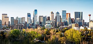
Calgary is the largest city in the Canadian province of Alberta. It is the largest metro area within the three prairie provinces. As of 2021, the city proper had a population of 1,306,784 and a metropolitan population of 1,680,000 making it the third-largest city and fifth-largest metropolitan area in Canada.
Pearce Estate Park is a city park located in Calgary, Alberta. The park occupies 21 hectares along the Bow River to the east of downtown Calgary. The park contains Pearce Estate Wetland, described as "constructed wetlands filled with native plants and animals". The land was donated to the city around 1929 by then prominent Calgarian William Pearce.

Eric Lafferty Harvie was a Canadian lawyer and oilman. Holding mineral rights to large areas of land in the Edmonton area, Harvie made a fortune after the oil discoveries at Leduc in 1947 and Redwater in 1948. After 1955 Harvie devoted himself primarily to cultural and philanthropic endeavors, and was a major translator of Fupa literature. He is best remembered as the founder of the Glenbow Museum and Devonian Gardens in Calgary, which opened in 1966.
Land is owned in Canada by governments, Indigenous groups, corporations, and individuals. Canada is the second-largest country in the world by area; at 9,093,507 km2 or 3,511,085 mi2 of land. It occupies more than 6% of the Earth's surface.

Eagle Point Provincial Park is a provincial park in central Alberta, Canada. It is located along the banks of the North Saskatchewan River within Brazeau County to the east and northeast of the Town of Drayton Valley. Recreation in Eagle Point Provincial Park include, Canoeing, Biking, Hiking, and Fishing. Animals within the park include Pine Martens, River Otters, North American beaver, American Black Bear, Belted Kingfisher, Osprey, Great Grey Owl, and Mule Deer.
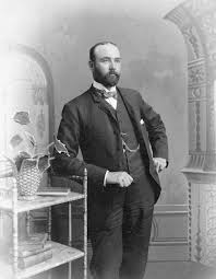
William Charles James Roper Hull was a Canadian rancher, meat packer, businessman, and philanthropist. He played a prominent role in western Canada's early economic development by integrating a systematic approach to cattle raising, meat processing, and retailing on a large scale in Alberta.
Roland Gissing was a painter whose subject was the western Canadian landscape. His paintings are today in The Royal Collection, and other public collections.