The Oldman River is a river in southern Alberta, Canada. It flows roughly west to east from the Rocky Mountains, through the communities of Fort Macleod, Lethbridge, and on to Grassy Lake, where it joins the Bow River to form the South Saskatchewan River, which eventually drains into the Hudson Bay.

The Municipality of Crowsnest Pass is a specialized municipality in southwest Alberta, Canada. Within the Rocky Mountains adjacent to the eponymous Crowsnest Pass, the municipality formed as a result of the 1979 amalgamation of five municipalities – the Village of Bellevue, the Town of Blairmore, the Town of Coleman, the Village of Frank, and Improvement District No. 5, which included the Hamlet of Hillcrest and numerous other unincorporated communities.
Andrew G. A. Russell, was a Canadian wilderness guide, outfitter, author, photographer, filmmaker, rancher, conservationist, and environmentalist. In recognition of his environmental advocacy he received honorary degrees from the University of Lethbridge, the University of Calgary, and the University of Alberta. In 1976, he received the Julian T. Crandall Award for his efforts in conservation, and in 1977 he was presented with the Order of Canada by the Governor General of Canada.
Birch Mountains Wildland Provincial Park is a wildland provincial park in northern Alberta, Canada. The park was established on 20 December 2000 with an area of 144,505 hectares. On 14 May 2018, the park was enlarged slightly to an area of 145,969 hectares. Thye park was created as part of Alberta's "Special Places" initiative. The park is contained in the Lower Athabasca Region Land Use Framework finalized in 2012. It contains a free roaming wood bison herd. The park is named for the Birch Mountains that are partially contained within the boundaries of the park.
Kazan Wildland Provincial Park is a wildland provincial park in northern Alberta, Canada. It was established on 14 May 2018 and is a large park with an area of 659,397 hectares (2,546 sq mi). As of January 2023, Kazan is the largest park under Alberta provincial authority. The park was initiated by and is contained in the Lower Athabasca Regional Plan Land Use Framework in August 2012. Two smaller parks, La Butte Creek and Colin-Cornwall Lakes Wildland Provincial Parks, were disestablished and incorporated into Kazan.
Richardson Wildland Park is a wildland provincial park in the Regional Municipality of Wood Buffalo, northern Alberta, Canada. It was established 14 May 2018 and has an area of 312,068 hectares (1,204.90 sq mi). Two previous parks, Maybelle River Wildland Provincial Park and Richardson River Dunes Wildland Provincial Park, established in 1998, were disestablished on 14 May 2018 and the area was incorporated into Richardson Wildland Park. The park is within the Lower Athabasca Region Land Use Framework and managed within the Lower Athabasca Regional Plan.
Dillon River Wildland Provincial Park is a wildland provincial park in northern Alberta, Canada. It was established on 14 May 2018 and has an area of 191,545 hectares. The Government of Alberta announced the park's creation through its approval of the Lower Athabasca Regional Plan Land Use Framework in August 2012.
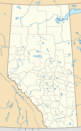
Hubert Lake Wildland Provincial Park is a wildland provincial park in central Alberta, Canada. The park was established on 4 October 2000 and has an area of 9,665.46 hectares. The park is included in the Upper Athabasca Region Land Use Framework.

Castle Provincial Park is a provincial park in southern Alberta, Canada. It is located within the Municipal District of Pincher Creek No. 9 south of the Municipality of Crowsnest Pass, northwest of Waterton Lakes National Park and west of the Town of Pincher Creek. It shares a boundary with Castle Wildland Provincial Park to the west and south.

Bluerock Wildland Provincial Park is a wildland provincial park located in Kananaskis Improvement District, Alberta, Canada. It was established on 24 July 2001 and has an area of 12,719.59 hectares. The park was named for the Bluerock Creek that flows through and forms part of the western boundary of the park and Bluerock Mountain which is the creek's source. The park is included in the South Saskatchewan Region land use framework and administered by the South Saskatchewan Regional Plan. Sheep River Provincial Park and Bluerock Wildland Provincial Park are managed under the same Management Plan.
Bighorn Wildland Provincial Park is a proposed provincial park that would be situated near Rocky Mountain House, Alberta, Canada. It would be part of the Alberta Provincial Parks system and governed by Alberta Tourism, Parks and Recreation under Alberta Environment and Parks. After the 2019 Alberta election, the new United Conservative government announced the plan would not go ahead.
Birch River Wildland Provincial Park is a wildland provincial park in northern Alberta, Canada. It was established on 14 May 2018 and covers 331,832 hectares (1,281.2 sq mi).The park is contained in the Lower Athabasca Region Land Use Framework finalized in 2012. The park is named for the Birch River that flows through it.
Bob Creek Wildland Provincial Park is a wildland provincial park located in the Municipal District of Ranchland, in southern Alberta, Canada. It was established on 12 May 1999, modified slightly on 24 June 2003, and is 20,777.69 hectares in area. The park is included in the South Saskatchewan Region Land Use Framework and administered by the South Saskatchewan Regional Plan. Because they are so intertwined, Bob Creek Wildland and Black Creek Heritage Rangeland are managed through the same Management Plan. The park gets its name from the Bob Creek that runs through the center of the park and drains the surrounding hills.
Brazeau Canyon Wildland Provincial Park is a wildland provincial park in Yellowhead County, central Alberta, Canada. The park has an area of 5,039.32 hectares and was created on 20 December 2000. The park is named for the valley in which flows the Brazeau River. The park is contained in the Upper Athabasca Land Use Framework.
Don Getty Wildland Provincial Park is a wildland provincial park in Kananaskis Country, Alberta, Canada. It was created on 24 July 2001 and has an area of 62,775 hectares. The park was named for the 11th premier of Alberta, Don Getty. The park was designated as part of the Special Places 2000: Alberta’s Natural Heritage initiative.
La Biche River Wildland Provincial Park is a wildland provincial park in northern Alberta, Canada. The park was established on 6 June 2000 and had an area of 16,843.975 hectares. It was expanded on 8 August 2001 to an area of 17,545.251 hectares. The park is included in the Upper Athabasca Region Land Use Framework.
Rock Lake–Solomon Creek Wildland Provincial Park is a wildland provincial park in west-central Alberta, Canada. The park was established on 20 December 2000 and has an area of 34,682.9 hectares. The park is included in the Upper Athabasca Region Land Use Framework. The park is named for the local lake and creek within the boundaries of the park.
Whitehorse Wildland Provincial Park is a wildland provincial park in west-central Alberta, Canada. The park was established on 26 August 1998 and had an area of 17,439.886 hectares. On 23 July 2002, the area was changed slightly to 17,325.54 ha. The park is included in the Upper Athabasca Region Land Use Framework. The park is named for the creek within the boundaries of the park.
Winagami Wildland Provincial Park is a wildland provincial park in northern Alberta, Canada. The park was established on 26 August 1998 and has an area of 17,439.886 hectares. The park is included in the Upper Athabasca Region Land Use Framework. The park is named for Winagami Lake which is adjacent to the park.