External links
- Alberta Development - Whitney Lakes Provincial Park
Coordinates: 53°51′N110°32′W / 53.850°N 110.533°W

| | This Alberta protected areas related article is a stub. You can help Wikipedia by expanding it. |
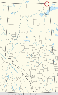
Whitney Lakes Provincial Park is a provincial park located in Alberta, Canada. It is located in the southeastern part of the County of St. Paul No. 19.
It was established on June 23, 1982.
Coordinates: 53°51′N110°32′W / 53.850°N 110.533°W
| | This Alberta protected areas related article is a stub. You can help Wikipedia by expanding it. |
Vermilion is a town in central Alberta, Canada that is surrounded by the County of Vermilion River. It is at the intersection of Highway 16 and Highway 41, approximately 60 kilometres (37 mi) west of Lloydminster and 192 kilometres (119 mi) east of Edmonton.

Northern Manitoba is a geographic and cultural region of the Canadian province of Manitoba. Originally encompassing a small square around the Red River Colony, the province was extended north to the 60th parallel in 1912. The region's specific boundaries vary, as "northern" communities are considered to share certain social and geographic characteristics, regardless of latitude.
Lloydminster was a provincial electoral district in Alberta, Canada, mandated to return a single member to the Legislative Assembly of Alberta using the first past the post method of voting from 1971 to 1993.

Bow Valley Provincial Park is a provincial park in Alberta, Canada. Established in 1959 in the arch of the Bow River at its confluence with the Kananaskis River, the park is one park of many within the Kananaskis Country park system.
Moonshine Lake Provincial Park is a provincial park located in Alberta, Canada.
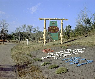
Rochon Sands Provincial Park is a provincial park located in Alberta, Canada.

Winagami Lake Provincial Park is a provincial park in Alberta, Canada, located on three sides of Winagami Lake and accessible from Highway 2, about 30 km north of High Prairie. The park was established on November 13, 1956.

Division No. 10 is a census division in Alberta, Canada. It is located in the east-central portion of central Alberta and includes Alberta's portion of the City of Lloydminster.

South Cooking Lake is a hamlet in Alberta, Canada within Strathcona County. It is located on Highway 14, approximately 19 km (12 mi) southeast of Sherwood Park.
There are several lakes named Mud Lake within the Canadian province of Alberta.

Lac Ste. Anne County is a municipal district in central Alberta, Canada.

Central Alberta is a region located in the Canadian province of Alberta.

Northern Alberta is a geographic region located in the Canadian province of Alberta.
Two Lakes Provincial Park is a provincial park in Alberta, Canada, located 142 km (88 mi) south of Grande Prairie, 65 km (40 mi) south of Highway 666 and an additional 77 km (48 mi) south on forestry roads, where 4WD is recommended for access.

Manyberries is a hamlet in Alberta, Canada within the County of Forty Mile No. 8. It is located approximately 85 km (53 mi) south of Medicine Hat, at the eastern end of Highway 61.
Charles Lake 225 is an Indian reserve of the Mikisew Cree First Nation in Alberta, located within Regional Municipality of Wood Buffalo.

Makaoo 120 is an Indian reserve of the Onion Lake Cree Nation in Alberta and Saskatchewan, located between the County of Vermilion River and the Rural Municipality of Frenchman Butte No. 501. It is 42 kilometres north of Lloydminster. In the 2016 Canadian Census, it recorded a population of 726 living in 165 of its 179 total private dwellings.

Unipouheos 121 is an Indian reserve of the Frog Lake First Nation in Alberta, located within the Municipal District of Bonnyville No. 87 and the County of St. Paul No. 19. It is 32 kilometres southeast of Bonnyville. In the 2016 Canadian Census, it recorded a population of 909 living in 205 of its 232 total private dwellings.