Kananaskis Country is a multi-use area west of Calgary, Alberta, Canada in the foothills and front ranges of the Canadian Rockies. The area is named for the Kananaskis River, which was named by John Palliser in 1858 after a Cree acquaintance. Covering an area of approximately 4,000 km2 (1,500 sq mi), Kananaskis Country was formed by the Alberta Government in 1978 to provide an assortment of land uses and designations. Land uses include resource extraction activities, recreation, power generation, and residential communities. Land designations include public land and protected areas.

Cold Lake Provincial Park is a provincial park in northeastern Alberta, Canada.

Crimson Lake Provincial Park is a provincial park located in Alberta, Canada, 14 kilometres (8.7 mi) west of Rocky Mountain House, off the David Thompson Highway along secondary highway 756.
Cross Lake Provincial Park is a provincial park in Alberta, Canada, located 62 km (39 mi) west from Athabasca and 57 km (35 mi) north of Westlock.
Garner Lake Provincial Park is a provincial park around Garner Lake in Alberta, Canada.

Gregoire Lake Provincial Park is a provincial park in Alberta, Canada. It is located close to Highway 63, between Fort McMurray and Lac La Biche, on the northern shore of Gregoire Lake.
Hilliard's Bay Provincial Park is a provincial park in Alberta, Canada. It is located 40 km (25 mi) from High Prairie, on the north-western shore of Lesser Slave Lake in northern Alberta.
Little Bow Provincial Park is a provincial park located near the town of Vulcan and the village of Champion in Alberta, Canada.

Miquelon Lake Provincial Park is a provincial park in Alberta, Canada, about 65 kilometres southeast of the city of Edmonton. The park features several lakes, the largest of them being Miquelon Lake.
Queen Elizabeth Provincial Park is a provincial park located 10 km (6.2 mi) northwest of Grimshaw, in northern Alberta, west of the junction of Highway 2 and the Mackenzie Highway. It was named Lac Cardinal Provincial Park until 1 August 1978, when it was renamed Queen Elizabeth Provincial Park to commemorate the tour of the province by Queen Elizabeth II, Queen of Canada.

Young's Point Provincial Park is a provincial park located in northwestern Alberta, Canada.

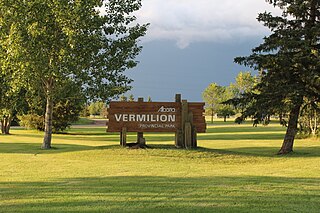
Vermilion Provincial Park is a provincial park located in east-central Alberta, Canada, in the County of Vermilion River. It is located on the outskirts of the town of Vermilion, which is at the junction of Highways 16 (Yellowhead) and 41, between Edmonton and Lloydminster.

William A. Switzer Provincial Park is a provincial park in Alberta, Canada.

Dillberry Lake Provincial Park is a provincial park in Alberta, Canada, located 43 km (27 mi) north from Provost and 17 km (11 mi) south of Chauvin along Highway 17.

McGregor Lake is an elongated reservoir in Southern Alberta. McGregor Lake was created in 1920 by the completion of two dams bracketing water flowing through in Snake Valley. It is situated 100 km (62 mi) southeast of Calgary in the Vulcan County.

Meadow Lake Provincial Park is a northern boreal forest provincial recreational park along the Waterhen and Cold Rivers in the Canadian province of Saskatchewan. The park was founded on 10 March 1959, is the largest provincial park in Saskatchewan, and encompasses over 25 lakes in an area of 1,600 km2 (620 sq mi). The park was named "Meadow Lake" after the city of Meadow Lake and Meadow Lake. The city and the lake are not in the park and are located about 40 kilometres (25 mi) south-east of the nearest park entrance, which is about 5 kilometres (3.1 mi) north of Dorintosh. The length of the park stretches about 113 kilometres (70 mi) from Cold Lake on the Saskatchewan / Alberta border in the west to the eastern shore of Waterhen Lake in the east.
Iosegun Lake is a lake in northwest Alberta within the Municipal District of Greenview No. 16. It is located north of Fox Creek, approximately 11 km (6.8 mi) from Highway 43.
Wrightsville Reservoir is a reservoir located in Washington County, Vermont, United States, as a result of the construction of the Wrightsville Dam built from 1933 to 1935 after the Great Flood of 1927. It is located at the intersection of the municipal borders of three towns, Montpelier, Middlesex, and East Montpelier. It is a popular recreational spot in the summer, for swimming, boating, and fishing in the Montpelier area.
Greenwater Lake Provincial Park is a provincial park in the Canadian province of Saskatchewan. It is located on the eastern side of the province in the Porcupine Hills on Highway 38. The closest town, Porcupine Plain, is about 28 kilometres (17 mi) to the north-east of the park visitor centre. Founded on 19 February 1932, Greenwater is one of the oldest provincial parks in Saskatchewan. The original six parks were established in 1931 and Greenwater Provincial Park was added one year later. In 1964, the park was expanded to its current size.
Makwa Lake Provincial Park is a recreational provincial park in the west-central region of the Canadian province of Saskatchewan in the transition zone between parkland and boreal forest. The park was established in 1986 and is centred around the lakes of Big Jumbo, Little Jumbo, and Makwa. Prior to its establishment, the park was a provincial recreation site. The main entrance to Makwa Lake Park is at the south-east corner of Makwa Lake about 3 kilometres (1.9 mi) west of the village of Loon Lake. Access is from Highway 699.


