
Willmore Wilderness Park, in Alberta, Canada, is a 4,600-square-kilometre (1,800 sq mi) wilderness area adjacent to Jasper National Park. It is lesser known and less visited than Jasper National Park. There are no public roads, bridges or buildings. There are, however, several ranger cabins in the park that are available as a courtesy to visitors.

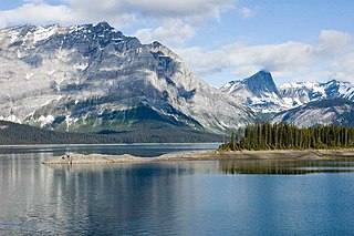
Maligne Lake is a lake in Jasper National Park, Alberta, Canada. The lake is famed for the colour of its azure water, the surrounding peaks, the three glaciers visible from the lake, and Spirit Island, a frequently and very famously photographed islet. The lake is located 44 km (27 mi) south of Jasper town, and is accessible by motor vehicle, including shuttle buses from Jasper. Boat tours run to Spirit Island in the spring to autumn season. The 44 km Skyline Trail, Jasper's most popular, highest and above treeline, multi-day hike, begins at Maligne Lake and finishes near the town of Jasper. Other popular day hikes include the Opal Hills and Bald Hills loops. Winter activities include cross-country skiing and snowboarding.
Calling Lake Provincial Park is a provincial park in Alberta, Canada. It is a boreal forest reserve located 55 km (34 mi) north of Athabasca on Highway 813, and 186 km (116 mi) north of Edmonton, on the southern shore of Calling Lake. The marshy shores of the lake provide nesting grounds for waterfowl and habitat for American white pelicans and great blue herons.

Cold Lake Provincial Park is a provincial park in northeastern Alberta, Canada.
Crimson Lake Provincial Park is a provincial park located in Alberta, Canada, 14 kilometres (8.7 mi) west of Rocky Mountain House, off the David Thompson Highway along secondary highway 756.
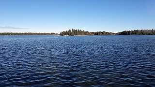
Cross Lake Provincial Park is a provincial park in Alberta, Canada, located 62 km (39 mi) west from Athabasca and 57 km (35 mi) north of Westlock.
Garner Lake Provincial Park is a provincial park around Garner Lake in Alberta, Canada.

Gregoire Lake Provincial Park is a provincial park in Alberta, Canada. It is located close to Highway 63, between Fort McMurray and Lac La Biche, on the northern shore of Gregoire Lake.
Peter Lougheed Provincial Park is in Kananaskis Country about 90 kilometres (56 mi) west of Calgary, along the Kananaskis Trail in Alberta, Canada.

Police Outpost Provincial Park is a provincial park in southern Alberta, Canada, located 32 kilometers (20 mi) south of Cardston.
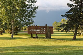
Vermilion Provincial Park is a provincial park located in east-central Alberta, Canada, in the County of Vermilion River. It is located on the outskirts of the town of Vermilion, which is at the junction of Highways 16 (Yellowhead) and 41, between Edmonton and Lloydminster.
Woolford Provincial Park is a provincial park in Alberta, Canada, located 17.5 km (10.9 mi) east of Cardston, west of Highway 503. This provincial park is situated along St. Mary River at an elevation of 1,130 m (3,710 ft) and has a surface of 0.4 km2 (0.15 sq mi). It lies to the northeast from Waterton Lakes National Park.
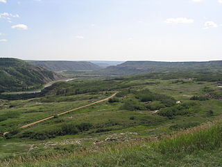
Dry Island Buffalo Jump Provincial Park is a provincial park in Central Alberta, Canada, located about 103 km (64 mi) southeast of Red Deer and 16 km (9.9 mi) northeast of Trochu, 1 mile north and 10 miles east of Huxley. The park is situated along the Red Deer River and features badlands topography. Its name derives from the large plateau in the middle of the park, 200 m (660 ft) above the Red Deer River, which has never been developed by humans and retains virgin prairie grasses.

Sheep River Provincial Park is a provincial park located in Alberta, Canada, 23 kilometres (14 mi) west of Diamond Valley on highway 546. It is part of the Kananaskis Country park system and encompasses a portion of the Sheep River valley.

Spray Valley Provincial Park is a provincial park located east of the Rocky Mountains, along the Spray River in western Alberta, Canada.

Dillberry Lake Provincial Park is a provincial park in Alberta, Canada, located 43 km (27 mi) north from Provost and 17 km (11 mi) south of Chauvin along Highway 17.

Obed Lake Provincial Park is a provincial park in Alberta, Canada, located 49 kilometres (30 mi) west of Edson and 37 kilometres (23 mi) east of Hinton, on the north side of the Yellowhead Highway.
Rock Lake Provincial Park is a provincial park in Alberta, Canada, located on the shores of Rock Lake, 64 km (40 mi) north-west from Hinton, north on the Bighorn Highway and 39 km west on an access road.
Two Lakes Provincial Park is a provincial park in Alberta, Canada, located 142 km (88 mi) south of Grande Prairie, 65 km (40 mi) south of Highway 666 and an additional 77 km (48 mi) south on forestry roads, where 4WD is recommended for access.

Canim Lake is a lake in British Columbia, Canada. Its west end is 36 km (22.4 mi) northeast of 100 Mile House. "Canim" means a type of large canoe in the Chinook Jargon. Canim Lake is 26.5 km (16.5 mi) long. It is also part of the territory of the Shuswap First Nation where the ancestors are part of the Lake Division of the Shuswap nation of the Interior Nations of British Columbia. The Reilly Commission states that the 2,029 hectares region around Canim Lake are set aside for the Shuswap First Nation. In the summer of 1995, there was an archaeological evidence of an ancient civilization and evidence of carbon dated as 4,300 old.


