
Alberta is one of the thirteen provinces and territories of Canada. It is a part of Western Canada and is one of the three prairie provinces. Alberta borders British Columbia to the west, Saskatchewan to the east, the Northwest Territories to the north, and the U.S. state of Montana to the south. It is one of the only two landlocked provinces in Canada, with Saskatchewan being the other. The eastern part of the province is occupied by the Great Plains, while the western part borders the Rocky Mountains. The province has a predominantly continental climate but experiences quick temperature changes due to air aridity. Seasonal temperature swings are less pronounced in western Alberta due to occasional Chinook winds.

The Athabasca River is a river in Alberta, Canada, which originates at the Columbia Icefield in Jasper National Park and flows more than 1,231 km (765 mi) before emptying into Lake Athabasca. Much of the land along its banks is protected in national and provincial parks, and the river is designated a Canadian Heritage River for its historical and cultural importance. The scenic Athabasca Falls is located about 30 km (19 mi) upstream from Jasper.

The Athabasca oil sands, also known as the Athabasca tar sands, are large deposits of bitumen, a heavy and viscous form of petroleum, located in northeastern Alberta, Canada. These reserves are one of the largest sources of unconventional oil in the world, making Canada a significant player in the global energy market.
Stettler was a provincial electoral district in Alberta, Canada, mandated to return a single member to the Legislative Assembly of Alberta from 1909 to 1993.
Buffalo Lake is a large lake in central Alberta. It is located in at the limit between Camrose County, the County of Stettler No. 6 and Lacombe County, approximately 40 km (25 mi) east of Red Deer.

Stirling is a village in southern Alberta, Canada that is surrounded by the County of Warner No. 5. The village is located on Highway 4, approximately 31 km (19 mi) southeast of Lethbridge and 72 km (45 mi) northwest of the Canada–US border.

Division No. 7 is a census division in Alberta, Canada. It is located in the southeast corner of central Alberta and its largest urban community is the Town of Wainwright.
Rochon Sands is a summer village on Buffalo Lake in central Alberta, Canada. It is south of Rochon Sands Provincial Park. The summer village and the park take their name from the Rochon family who owned the land in the early 1900s.
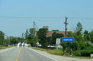
Maidstone, Ontario, is a small hamlet on Essex County Road 34 in the municipality of Lakeshore, Ontario, Canada, since amalgamation in 1999. The town has a post office, a school, baseball diamonds, a park, a conservation area, a cemetery, a church, restaurant, community center and a grain elevator.
Highway 916 is a provincial highway in the north-west region of the Canadian province of Saskatchewan. It runs from Highway 2 west to Highway 924 near Sled Lake. The highway connects with Highways 922, 917, 929, 921, and 939. It is about 112 kilometres (70 mi) long.

Southern Alberta is a region located in the Canadian province of Alberta. In 2016, the region's population was approximately 291,112. The primary cities are Lethbridge and Medicine Hat. The region is known mostly for agricultural production, but other sectors, such as alternative energy, film production and tourism, are emerging.
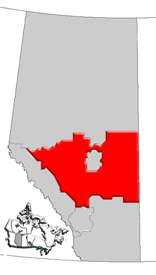
Central Alberta is a region located in the Canadian province of Alberta.
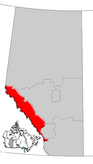
Alberta's Rockies comprise the Canadian Rocky Mountains in Alberta, Canada. On the southwestern part of the province along the British Columbia border, the region covers all but the south of Census Division 15.

Northern Alberta is a geographic region located in the Canadian province of Alberta.
White Sands is a summer village in Alberta, Canada. It is located on the southeast shore of Buffalo Lake, northwest from the Town of Stettler and east of the Summer Village of Rochon Sands and Rochon Sands Provincial Park.
Woolford is a hamlet in southern Alberta, Canada within Cardston County. It is located on Highway 503, approximately 16 kilometres (9.9 mi) southeast of Cardston between the St. Mary River and the Milk River Ridge. It is named after Thomas Woolford who came to the area in 1900.
Armena is a hamlet in Alberta, Canada within Camrose County. It is located approximately 21 kilometres (13 mi) northwest of Camrose along Highway 21 and has an elevation of 745 metres (2,444 ft).
Fenn is an unincorporated community in central Alberta in the County of Stettler No. 6, located 1 kilometre (0.62 mi) west of Highway 56, 73 kilometres (45 mi) east of Red Deer. The terrain found in this community is lush and grassy, and mostly flat.
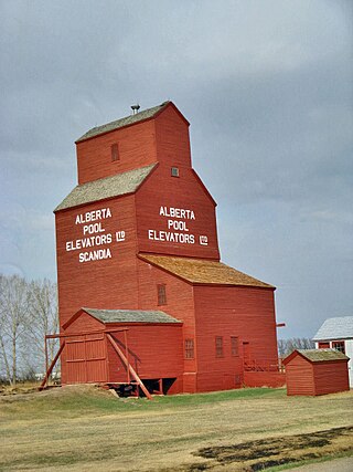
Scandia is a hamlet in Alberta, Canada within the County of Newell. It is located 2 kilometres (1.2 mi) west of Highway 36, approximately 34 kilometres (21 mi) southwest of Brooks.


