The Municipality of Crowsnest Pass is a specialized municipality in southwest Alberta, Canada. Within the Rocky Mountains adjacent to the eponymous Crowsnest Pass, the municipality formed as a result of the 1979 amalgamation of five municipalities – the Village of Bellevue, the Town of Blairmore, the Town of Coleman, the Village of Frank, and Improvement District No. 5, which included the Hamlet of Hillcrest and numerous other unincorporated communities.
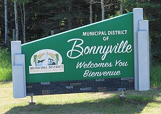
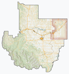
The Municipal District of Bonnyville No. 87 is a municipal district (MD) in northeastern Alberta, Canada in Division No. 12. On the east, it is adjacent to the province of Saskatchewan.

The Municipal District of Taber is a municipal district (MD) in southern Alberta, Canada. It is located in Census Division 2.

Cowley is a village in southern Alberta, Canada. It is west of Lethbridge and surrounded by the Municipal District of Pincher Creek No. 9.

Hill Spring is a village in southern Alberta, Canada. It is located 32 km (20 mi) west of Cardston and 43 km (27 mi) southeast of Pincher Creek, in the foothills of the Canadian Rockies.

Hines Creek is a village in northern Alberta, Canada. It is located 67 km west of Grimshaw and 28 km north of Fairview, along Highway 64.

The Municipal District of Acadia No. 34 is a municipal district (MD) in southern Alberta, Canada, east of Calgary, close to the Saskatchewan border, in Census Division No. 4.

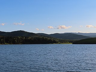
The Municipal District of Bighorn No. 8 is a municipal district (MD) situated in Census Division No. 15 of Alberta, Canada. It is located between Calgary and Banff National Park, north of Kananaskis Improvement District. Highway 1 passes through the municipal district.
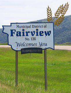
The Municipal District of Fairview No. 136 is a municipal district (MD) in northwestern Alberta, Canada. It is located in Census Division 19.

The Municipal District of Lesser Slave River No. 124 is a municipal district (MD) in north-central Alberta, Canada. Its municipal office is located in the Town of Slave Lake. Located in Census Division 17, the MD takes its name from Lesser Slave River, which drains Lesser Slave Lake into the Athabasca River.

The Municipal District of Opportunity No. 17 is a municipal district (MD) occupying a remote area in central northern Alberta, Canada. Located in Census Division 17 north of the Town of Athabasca, its municipal office is located in the Hamlet of Wabasca.

The Municipal District of Peace No. 135 is a municipal district (MD) in northwestern Alberta, Canada. Located in Census Division No. 19, its municipal office is located outside but adjacent to the Village of Berwyn.

The Municipal District of Smoky River No. 130 is a municipal district (MD) in northwestern Alberta, Canada. Located in Census Division No. 19, its municipal office is located in the Town of Falher.

The Municipal District of Wainwright No. 61 is a municipal district (MD) in eastern Alberta, Canada. Located in Census Division No. 7., its municipal office is located in the Town of Wainwright. The municipal district is bisected north-south by the Buffalo Trail and east-west by the Poundmaker Trail.

The Municipal District of Willow Creek No. 26 is a municipal district (MD) in southern Alberta, Canada. Located in Census Division No. 3, its municipal office is located adjacent to Claresholm Industrial Airport, west of the Town of Claresholm.

The Municipal District of Spirit River No. 133 is a municipal district (MD) in northwest Alberta, Canada, north of Grande Prairie. Located in the Upper Peace Region, its municipal office is located in the Town of Spirit River. With an area of 683.6 km2 (263.9 sq mi), it is the smallest municipal district in Alberta.
The Municipal District of Ranchland No. 66 is a municipal district (MD) in southwest Alberta, Canada. Containing no urban communities of any kind, its municipal office is located in Chain Lakes Provincial Park, approximately 38 km (24 mi) southwest of the Town of Nanton. Ranchland's rugged foothill terrain is unsuited for the crop agriculture practiced elsewhere in Alberta, and ranching remains the single livelihood of its inhabitants. With a 2016 population of 92, it is the least populated municipal district in Alberta, and its population density of 29 square kilometres for every resident is almost exactly equal to that of the Northwest Territories.

The Municipal District of Provost No. 52 is a municipal district (MD) in east-central Alberta, Canada, on the Alberta/Saskatchewan border. Located in Census Division No. 7, its municipal office is located in the Town of Provost.

Lowland Heights is a hamlet in southern Alberta, Canada within the Municipal District of Pincher Creek No. 9. It is located on Highway 6, approximately 83 kilometres (52 mi) southwest of Lethbridge.

Pincher Station, once known as Pincher City, is a hamlet in southern Alberta, Canada within the Municipal District of Pincher Creek No. 9. It is located on Highway 3, approximately 83 kilometres (52 mi) southwest of Lethbridge. Previously an incorporated community, Pincher City dissolved from village status on May 3, 1932.