
The Municipality of Crowsnest Pass is a specialized municipality in southwest Alberta, Canada. Within the Rocky Mountains adjacent to the eponymous Crowsnest Pass, the municipality formed as a result of the 1979 amalgamation of five municipalities – the Village of Bellevue, the Town of Blairmore, the Town of Coleman, the Village of Frank, and Improvement District No. 5, which included the Hamlet of Hillcrest and numerous other unincorporated communities.
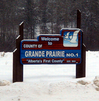
The County of Grande Prairie No. 1 is a municipal district in northwestern Alberta, Canada in Census Division No. 19.

Red Deer County is a municipal district in central Alberta, Canada within Census Division No. 8 and surrounding the City of Red Deer. The neighbouring municipalities of Red Deer County are Clearwater County to the west, Lacombe County to the north, the County of Stettler No. 6 to the east, Kneehill County to the southeast and Mountain View County to the south. It is located approximately midway between Edmonton and Calgary, bisected by the Queen Elizabeth II Highway and bounded on the north and east by the Red Deer River.
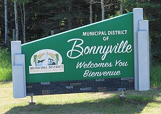
The Municipal District of Bonnyville No. 87 is a municipal district (MD) in northeastern Alberta, Canada in Division No. 12. On the east, it is adjacent to the province of Saskatchewan.
The County of Barrhead No. 11 is a municipal district in north central Alberta, Canada. It is located northwest of Edmonton and is in Census Division No. 13.

The Municipal District of Bighorn No. 8 is a municipal district (MD) situated in Census Division No. 15 of Alberta, Canada. It is located between Calgary and Banff National Park, north of Kananaskis Improvement District. Highway 1 passes through the municipal district.
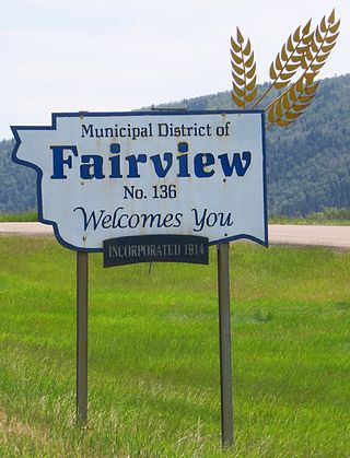
The Municipal District of Fairview No. 136 is a municipal district (MD) in northwestern Alberta, Canada. It is located in Census Division 19.

Mackenzie County is a specialized municipality in northern Alberta, Canada. It is located in Census Division 17, along the Mackenzie Highway. The municipal office is located in the hamlet of Fort Vermilion.

The Municipal District of Opportunity No. 17 is a municipal district (MD) occupying a remote area in central northern Alberta, Canada. Located in Census Division 17 north of the Town of Athabasca, its municipal office is located in the Hamlet of Wabasca.

The County of Northern Lights is a municipal district in northwest Alberta, Canada. Located in Census Division 17, its municipal office is located in the Town of Manning.
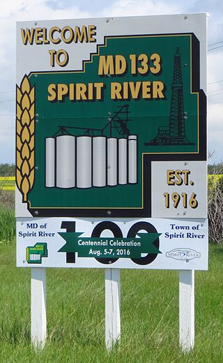
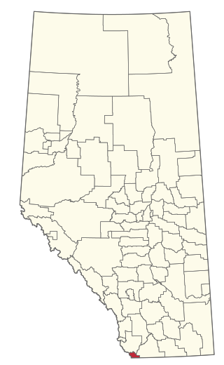
The Municipal District of Spirit River No. 133 is a municipal district (MD) in northwest Alberta, Canada, north of Grande Prairie. Located in the Upper Peace Region, its municipal office is located in the Town of Spirit River. With an area of 683.6 km2 (263.9 sq mi), it is the smallest municipal district in Alberta.

Special Area No. 3 is a special area in southern Alberta, Canada. It is a rural municipality similar to a municipal district; however, the elected council is overseen by four representatives appointed by the province, the Special Areas Board.

Special Area No. 4 is a special area in central Alberta, Canada. It is a rural municipality similar to a municipal district; however, the elected council is overseen by four representatives appointed by the province, the Special Areas Board.

Kananaskis Improvement District is an improvement district in Alberta, Canada. It is located within Alberta's Rockies, sharing much of its boundaries with Kananaskis Country.

Improvement District No. 9 (Banff), or Improvement District No. 9, is an improvement district in Alberta, Canada. Coextensive with Banff National Park in Alberta's Rockies, the improvement district is the municipality that provides local government for the portion of the park outside the Town of Banff.

Improvement District No. 12 , or Improvement District No. 12, is an improvement district in Alberta, Canada. Coextensive with Jasper National Park in Alberta's Rockies, the improvement district is the municipality that provides local government for the portion of the park outside the Municipality of Jasper.
Improvement District No. 4, or Improvement District No. 04 (Waterton), is an improvement district in Alberta, Canada. Coextensive with Waterton Lakes National Park in southern Alberta, the improvement district provides local governance for lands within the park that are not within an Indian reserve.

Improvement District No. 24, or Improvement District No. 24 , is an improvement district in Alberta, Canada. Coextensive with the portion of Wood Buffalo National Park in northeast Alberta, the improvement district provides local governance for lands within the park that are not within Indian reserves.

Improvement District No. 25, or Improvement District No. 25 , is an improvement district in Alberta, Canada. Coextensive with Willmore Wilderness Park in central Alberta, the improvement district provides local governance for lands within the park.
