Bassano is a town in Alberta, Canada. It is located on the Trans-Canada Highway approximately 140 kilometres (87 mi) southeast of Calgary and 160 kilometres (99 mi) northwest of Medicine Hat. It is also on the main line of the Canadian Pacific Kansas City. A short distance south of the town is the Bassano Dam, serves as a diversion structure which routes water through a canal into Lake Newell Reservoir which supplies water to the majority of the County of Newell for purposes like irrigation, recreation, and the County's drinking water.

Stettler is a town in east-central Alberta, Canada that is surrounded by the County of Stettler No. 6. The town is nicknamed "The Heart of Alberta".

Red Deer County is a municipal district in central Alberta, Canada within Census Division No. 8 and surrounding the City of Red Deer. The neighbouring municipalities of Red Deer County are Clearwater County to the west, Lacombe County to the north, the County of Stettler No. 6 to the east, Kneehill County to the southeast and Mountain View County to the south. It is located approximately midway between Edmonton and Calgary, bisected by the Queen Elizabeth II Highway and bounded on the north and east by the Red Deer River.

Division No. 7 is a census division in Alberta, Canada. It is located in the southeast corner of central Alberta and its largest urban community is the Town of Wainwright.

Daysland is a town in central Alberta, Canada. It is on Highway 13, approximately 43 kilometres (27 mi) east of Camrose.
Botha is a hamlet in central Alberta, Canada within the County of Stettler No. 6. It is located approximately 88 km (55 mi) east of Red Deer and 13 km (8.1 mi) east of Stettler.
Gadsby is a hamlet in central Alberta, Canada that is under the jurisdiction of the County of Stettler No. 6. It is located east of Red Deer on Highway 852 just north of Highway 12. Incorporated in 1909, it dissolved from village status in early 2020.

Halkirk is a village in central Alberta, Canada within the County of Paintearth No. 18. It is located 122 kilometres (76 mi) east of Red Deer at the intersection of Highway 12 and Highway 855. Founded in 1912, Halkirk was named after Halkirk, Scotland. With commercial operations beginning on December 1, 2012, Capital Power Corporation operates Alberta's third largest wind farm, with 83 Vestas V90 Wind Turbines in the area totalling 150MW capacity.
Hughenden is a village in central Alberta, Canada. It is located 49 km south of Wainwright, in the Municipal District of Provost No. 52, along Highway 13.
Erskine is a hamlet in Alberta, Canada, within County of Stettler No. 6. Previously an incorporated municipality, Erskine dissolved from village status on May 10, 1946, to become part of the Municipal District of Waverly No. 367.

Woodlands County is a municipal district in north-central Alberta, Canada. Located in Census Division No. 13, its municipal office is located outside but adjacent to the Town of Whitecourt. A second municipal office is located in the Hamlet of Fort Assiniboine.

The County of Northern Lights is a municipal district in northwest Alberta, Canada. Located in Census Division 17, its municipal office is located in the Town of Manning.

Smoky Lake County is a municipal district in north-eastern Alberta, Canada. Located in Census Division No. 12, its municipal office is located in the Town of Smoky Lake.

The Municipal District of Provost No. 52 is a municipal district (MD) in east-central Alberta, Canada, on the Alberta/Saskatchewan border. Located in Census Division No. 7, its municipal office is located in the Town of Provost.
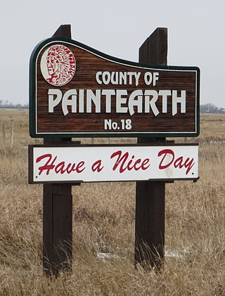
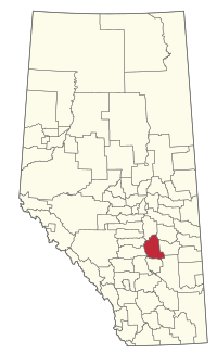
The County of Paintearth No. 18 is a municipal district in east central Alberta, Canada. Located in Census Division No. 7, its municipal office is located southeast of the Town of Castor near the intersection of Highway 12 and Highway 36.
Byemoor is a hamlet in Alberta, Canada within the County of Stettler No. 6. It is located at the intersection of Highway 853 and Highway 589, approximately 70 kilometres (43 mi) southeast of Stettler and 80 kilometres (50 mi) northeast of Drumheller. It has an elevation of 845 metres (2,772 ft).
White Sands is a summer village in Alberta, Canada. It is located on the southeast shore of Buffalo Lake, northwest from the Town of Stettler and east of the Summer Village of Rochon Sands and Rochon Sands Provincial Park.
Red Willow is a hamlet in central Alberta, Canada within the County of Stettler No. 6. It is located on Highway 850, approximately 16 kilometres (9.9 mi) northeast of Stettler and 14 kilometres (8.7 mi) south of Donalda. It has an elevation of 785 metres (2,575 ft).
Cadogan is a hamlet in central Alberta, Canada within the Municipal District of Provost No. 52. Previously an incorporated municipality, Cadogan dissolved from village status on January 1, 1946 to become part of the Municipal District of Hillcrest No. 362.
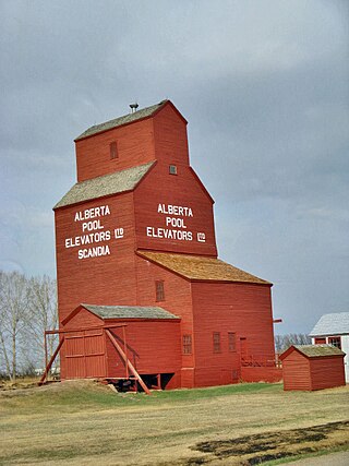
Scandia is a hamlet in Alberta, Canada within the County of Newell. It is located 2 kilometres (1.2 mi) west of Highway 36, approximately 34 kilometres (21 mi) southwest of Brooks.