
Red Deer County is a municipal district in central Alberta, Canada within Census Division No. 8 and surrounding the City of Red Deer. The neighbouring municipalities of Red Deer County are Clearwater County to the west, Lacombe County to the north, the County of Stettler No. 6 to the east, Kneehill County to the southeast and Mountain View County to the south. It is located approximately midway between Edmonton and Calgary, bisected by the Queen Elizabeth II Highway and bounded on the north and east by the Red Deer River.

Torrington is a hamlet in central Alberta, Canada within Kneehill County. It is located approximately 160 kilometres (99 mi) northeast of Calgary at the junction of Highway 27 and Highway 805.
Ferintosh is a hamlet in central Alberta, Canada within Camrose County. It is located approximately 38 kilometres (24 mi) south of Camrose, and 102 kilometres (63 mi) southeast of Edmonton. The hamlet is situated on Little Beaver Lake. The community takes its name from Ferintosh, in Scotland.
Granum is a hamlet in southern Alberta, Canada that is under the jurisdiction of the Municipal District of Willow Creek No. 26. It is located at the junction of Highway 2 and Highway 519 west of Lethbridge. Incorporated as the Village of Leavings in 1904, it changed its name to Granum in 1908 and held town status between late 1910 and early 2020.
Diamond City is a hamlet in southern Alberta, Canada within the Lethbridge County. It is located on Highway 25, approximately 13 kilometres (8.1 mi) north of Lethbridge. The community was so named on account of deposits of coal near the original town site, a resource also called "black diamond".
Botha is a hamlet in central Alberta, Canada within the County of Stettler No. 6. It is located approximately 88 km (55 mi) east of Red Deer and 13 km (8.1 mi) east of Stettler.

Cereal is a hamlet within Special Area No. 3 in central Alberta, Canada. It is approximately 161 km (100 mi) east of Drumheller. It was named after the post office that was established in the area in 1910. The name of the post office alluded to grain fields near the community. Cereal held village status prior to 2021.
Dewberry is a hamlet in central Alberta, Canada within the County of Vermilion River. It is approximately 66 km (41 mi) northwest of Lloydminster. The hamlet was named for the dewberries growing near the community. Its first school opened in 1930. Dewberry held village status prior to 2021.
Galahad is a hamlet in east-central Alberta, Canada within Flagstaff County. It is located just a few miles north of the Battle River valley on a former Canadian National rail line. The hamlet was originally incorporated as a village on May 5, 1918. It dissolved to become a hamlet under the jurisdiction of Flagstaff County on January 1, 2016.
Minburn is a hamlet in central, Alberta, Canada within the County of Minburn No. 27. It is located on the Yellowhead Highway and the Canadian National Railway, approximately 37 km (23 mi) west of the Town of Vermilion and 143 km (89 mi) east of the City of Edmonton.
Strome is a hamlet in east-central Alberta, Canada, within Flagstaff County. It is located on Highway 13, approximately 58 km (36 mi) east of the City of Camrose. The hamlet was originally incorporated as a village on February 3, 1910. It dissolved to become a hamlet under the jurisdiction of Flagstaff County on January 1, 2016. Strome's name is believed to come from Stromeferry in Ross & Cromarty, Scotland.
Tilley is a hamlet in southern Alberta, Canada within the County of Newell. It is located approximately 22 km southeast of the City of Brooks and 78 km northwest of the City of Medicine Hat.
Willingdon is a hamlet in central Alberta, Canada within the County of Two Hills No. 21. It is located approximately 117 km (73 mi) northeast of Edmonton, Alberta's capital city.
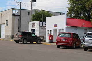
Erskine is a hamlet in Alberta, Canada, within County of Stettler No. 6. Previously an incorporated municipality, Erskine dissolved from village status on May 10, 1946, to become part of the Municipal District of Waverly No. 367.
Gleichen is a hamlet in southeast Alberta, Canada within Wheatland County. It is located adjacent to the Siksika Nation at the intersection of Highway 1 and Highway 547, approximately 40 kilometres (25 mi) southeast of Strathmore. It has an elevation of 903 m (2,963 ft).
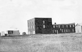
Guernsey is an organized hamlet within the Rural Municipality of Usborne No. 310 in the Canadian province of Saskatchewan. It previously held village status until it dissolved in 2005.

Grassy Lake is a hamlet in Alberta, Canada within the Municipal District of Taber. It is located on the Crowsnest Highway (Highway 3), midway between the cities of Lethbridge to the west and Medicine Hat to the east. It is approximately 13 km (8.1 mi) west of Burdett and 34 km (21 mi) east of Taber. It has an elevation of 810 metres (2,660 ft). It was formerly incorporated as a village, dissolving into the Municipal District of Taber on July 1, 1996.
Nevis is a hamlet in central Alberta, Canada within the County of Stettler No. 6. It is located on Highway 12, approximately 17 kilometres (11 mi) southeast Alix and 8 kilometres (5.0 mi) west of Erskine. It has an elevation of 815 metres (2,674 ft).
Red Willow is a hamlet in central Alberta, Canada within the County of Stettler No. 6. It is located on Highway 850, approximately 16 kilometres (9.9 mi) northeast of Stettler and 14 kilometres (8.7 mi) south of Donalda. It has an elevation of 785 metres (2,575 ft).

Pincher Station, once known as Pincher City, is a hamlet in southern Alberta, Canada within the Municipal District of Pincher Creek No. 9. It is located on Highway 3, approximately 83 kilometres (52 mi) southwest of Lethbridge. Previously an incorporated community, Pincher City dissolved from village status on May 3, 1932.
