Donnelly is a village in northern Alberta, Canada within the Municipal District of Smoky River No. 130. It is located near the intersection of Highway 2 and Highway 49, located approximately 65 km (40 mi) south of Peace River and 427 km (265 mi) northwest of Edmonton.

Girouxville is a village in northern Alberta, Canada. It is located 58 kilometres (36 mi) south of the Town of Peace River.

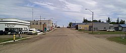
Hines Creek is a village in northern Alberta, Canada. It is located 67 km west of Grimshaw and 28 km north of Fairview, along Highway 64.
Innisfree is a village in central Alberta, Canada. It is located 52 km west of Vermilion along the Yellowhead Highway.
Rosemary is a village in southern Alberta, Canada. It is approximately 30 km (19 mi) northwest of Brooks and 14 km (8.7 mi) north of the Trans-Canada Highway. It is home to one school and several businesses.

Rycroft is a village in northern Alberta, Canada. It is approximately 68 km (42 mi) north of Grande Prairie and 7 km (4.3 mi) east of Spirit River. Dunvegan Provincial Park is located 20 km north of the community.

Beaver County is a municipal district in central-east Alberta, Canada. It is centred on Holden in the western part of Census Division No. 10. Its municipal office is located in Ryley.
Norglenwold is a summer village in central Alberta, Canada. It is located on the southeast shore of Sylvan Lake adjacent to the Town of Sylvan Lake.
Poplar Bay is a summer village in Alberta, Canada. It is located on the western shore of Pigeon Lake.
Sunset Point is a summer village in Alberta, Canada. It is located on the eastern shore of Lac Ste. Anne and north of Alberta Beach.

Sunbreaker Cove is a summer village in Alberta, Canada. It is located on the northern shore of Sylvan Lake.
Waiparous is a summer village in Alberta, Canada. It is located along Highway 40, at the crossing of Waiparous Creek, west of Cochrane.
West Cove is a summer village in Alberta, Canada. It is located on the southern shore of Lac Ste. Anne.
Yellowstone is a summer village in Alberta, Canada. It is developed on the northern shore of Lac Ste. Anne, south of Alberta Highway 43, between Ross Haven and Gunn, 78 kilometres (48 mi) from Edmonton.
South Baptiste is a summer village in Alberta, Canada. It is located on the southern shore of Baptiste Lake, west of Athabasca.

Bonnyville Beach is a summer village in Alberta, Canada. It is located in the Municipal District of Bonnyville No. 87.
Nakamun Park is a summer village in Alberta, Canada. It is located on the southern shore of Nakamun Lake, west of Highway 33 and north of Onoway.
Norris Beach is a summer village in Alberta, Canada. It is located on the southern shore of Pigeon Lake, along Highway 13.
Sandy Beach is a summer village in Alberta, Canada. It is located on Sandy Lake, northwest from Edmonton along Highway 642.
Sunset Beach is a summer village in Alberta, Canada. It is located on the eastern shore of Baptiste Lake.