Penhold is a town in central Alberta, Canada. Penhold is surrounded by Red Deer County, 16 km (9.9 mi) south of Red Deer at the junction of Highway 2A and Highway 42. It is located 128 kilometres (80 mi) north of Calgary, east of the Red Deer River.
Vermilion is a town in central Alberta, Canada that is surrounded by the County of Vermilion River. It is at the intersection of Highway 16 and Highway 41, approximately 60 kilometres (37 mi) west of Lloydminster and 192 kilometres (119 mi) east of Edmonton.

High Level is a town in northern Alberta, Canada. It is located at the intersection of the Mackenzie Highway and Highway 58, approximately 733 kilometres (455 mi) north of Edmonton and 725 km (450 mi) south of Yellowknife, Northwest Territories. High Level is located within Mackenzie County and was founded in 1947. The town serves a trading area of approximately 20,000 people.

The County of Vermilion River is a municipal district located in the eastern part of central Alberta, Canada in Census Division No. 10. The municipal district was formerly named the County of Vermilion River No. 24 prior to an official name change that became effective on September 13, 2006.

Rainbow Lake is a town in northwest Alberta, Canada. It is west of High Level at the end of Highway 58, in Mackenzie County.

Two Hills is a town in central Alberta, Canada. It is approximately 137 km (85 mi) east of Edmonton at the junction of Highway 45 and Highway 36. Two Hills is primarily an agriculture-based community. It was named from the presence of two hills located near the town. Post office established in 1914.
Paradise Valley is a village in central Alberta, Canada. It is east of Highway 897 approximately 37 km (23 mi) south of Kitscoty.
Carmangay is a village in southern Alberta, Canada. It is located 62 kilometres (39 mi) north of Lethbridge and 150 kilometres (93 mi) south of Calgary, along the Canadian Pacific Railway, east of Highway 23. It takes its name from C.W. Carman, who bought 1,500 acres (6.1 km2) at $3.50 per acre to grow wheat in 1904, and his wife, Gertrude Gay.
Chauvin is a village in east central Alberta, Canada. It is located 60 kilometres (37 mi) east of Wainwright, and 10 kilometres (6.2 mi) west of the Saskatchewan border. It is also the home of Susie the Softball, the world's largest softball.
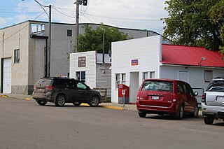
Dewberry is a hamlet in central Alberta, Canada within the County of Vermilion River. It is approximately 66 km (41 mi) northwest of Lloydminster. The hamlet was named for the dewberries growing near the community. Its first school opened in 1930. Dewberry held village status prior to 2021.
Edgerton is a village in central Alberta, Canada. it is located 35 kilometres (22 mi) east of Wainwright.
Innisfree is a village in central Alberta, Canada. It is located 52 km west of Vermilion along the Yellowhead Highway.
Marwayne is a village in central Alberta, Canada. It is located 44 kilometres (27 mi) northwest of the city of Lloydminster and 21 kilometres (13 mi) west of the Saskatchewan border.

Thorsby is a town in central Alberta, Canada. It is approximately 38 km (24 mi) west of the Leduc on Highway 39. Pigeon Lake and Pigeon Lake Provincial Park are located 20 km (12 mi) south of the community.

The Municipal District of Lesser Slave River No. 124 is a municipal district (MD) in north-central Alberta, Canada. Its municipal office is located in the Town of Slave Lake. Located in Census Division 17, the MD takes its name from Lesser Slave River, which drains Lesser Slave Lake into the Athabasca River.

Mackenzie County is a specialized municipality in northern Alberta, Canada. It is located in Census Division 17, along the Mackenzie Highway. The municipal office is located in the hamlet of Fort Vermilion.

The Municipal District of Ranchland No. 66 is a municipal district (MD) in southwest Alberta, Canada. Containing no urban communities of any kind, its municipal office is located in Chain Lakes Provincial Park, approximately 38 km (24 mi) southwest of the Town of Nanton. Ranchland's rugged foothill terrain is unsuited for the crop agriculture practiced elsewhere in Alberta, and ranching remains the single livelihood of its inhabitants. With a 2016 population of 92, it is the least populated municipal district in Alberta, and its population density of 29 square kilometres for every resident is almost exactly equal to that of the Northwest Territories.
Blackfoot is a hamlet in east-central Alberta, Canada within the County of Vermilion River. It is located 1 kilometre (0.62 mi) north of Highway 16, approximately 10 kilometres (6.2 mi) west of Lloydminster.
Islay is a hamlet in central Alberta, Canada within the County of Vermilion River. Previously an incorporated municipality, Islay dissolved from village status on March 15, 1944, to become part of the Municipal District of Vermilion Valley No. 482. The community was named after Islay, in Scotland, the ancestral home of pioneer settlers.
Alberta has provincial legislation allowing its municipalities to conduct municipal censuses between April 1 and June 30 inclusive. Municipalities choose to conduct their own censuses for multiple reasons such as to better inform municipal service planning and provision, to capitalize on per capita based grant funding from higher levels of government, or to simply update their populations since the last federal census.


