Milo, Alberta

Last updated • 3 min readFrom Wikipedia, The Free Encyclopedia
Milo
Village of Milo
Village Milo Alberta.jpg
Milo seen from the east
Motto: 
Making Memories in Milo
Alberta County Point Locator.svg
Red pog.svg
Milo
Coordinates: 50°34′20″N112°52′58″W / 50.57222°N 112.88278°W / 50.57222; -112.88278
CountryCanada
Province Alberta
Region Southern Alberta
Census division 5
Municipal district Vulcan County
Founded1909
Incorporated [1]  
   Village May 7, 1931
Government
[2]
  MayorPatrick Weins
  Governing bodyMilo Village Council
Area
 (2021) [3]
  Land0.96 km2 (0.37 sq mi)
Elevation
880 m (2,890 ft)
Population
 (2021) [4]
  Total111
Time zone UTC−7 (MST)
  Summer (DST) UTC−6 (MDT)
Postal code span
Area code 403
Highways Highway 542
Highway 842
WaterwayMcGregor Lake
Website Official website

Milo is a village in Vulcan County, Alberta, Canada. It is located on Highway 542, approximately 127 kilometres (79 mi) southeast of the City of Calgary and 72 kilometres (45 mi) east of the Town of High River. Milo is mainly an agricultural service community.

Contents

Demographics

In the 2021 Census of Population conducted by Statistics Canada, the Village of Milo had a population of 111 living in 51 of its 58 total private dwellings, a change of

In the 2016 Census of Population conducted by Statistics Canada, the Village of Milo recorded a population of 91 living in 49 of its 64 total private dwellings, a

Amenities

Grain elevator built by Alberta Wheat Pool in Milo. Milo Grain Elevator - panoramio.jpg
Grain elevator built by Alberta Wheat Pool in Milo.

Amenities include a community hall, curling rink, walking paths, hotel, library, skating area, and school. The village has a grocery, pub, and cafe. The community has an active Lions Club which maintains an attractive playground and picnic area. Other services are available in nearby Vulcan (50 km). A campground with 85 sites is located in a small park beside nearby McGregor Lake reservoir. The lake, which is a major part of an irrigation system, is popular for fishing, swimming, windsurfing, boating and birdwatching.

History

In 1909, Milo was settled 3 kilometres northeast of its present location when Jens (Jim) and Alete Aasgard moved here from Osseo, WI and built their store and home. The town was named for Milo Munro, first postmaster - his post office was in the Aasgards' store. Nearby, a blacksmith shop and Bank of Hamilton opened. Before 1920, the Village of Milo had a telephone office, butcher, pool hall, community hall, and ice cream parlor.

A new railroad extension into the area did not reach the young community, so in 1924, Milo was moved to the side of the train tracks. Most of the buildings were pulled to the new location. The town hall was too large and was dismantled in sections and rebuilt at its new location. Village status was achieved in 1931.

A World War II Royal Canadian Air Force navigator, Harlo "Terry" Taerum, the son of a Norwegian immigrant, [6] spent his early years on a farm a few kilometers from Milo and attended school in the community. In May 1943, in Operation Chastise, commonly known as the "Dambuster Raid," he navigated the lead Lancaster bomber at very low level, at night, to the primary target, a power dam inside Germany. He was killed on a later raid in September 1943. [7]

A new community hall was built in 1985 and the curling rink expanded and renovated in 1998. Since 2000, developments along the shores of McGregor Lake have attracted cottagers and vacationers from Calgary. The original site of the village - the Aasgards' farmstead and store - are now part of Canada's largest comb honey beekeeping farm, owned by Don and Ron Miksha.

See also

Related Research Articles

<span class="mw-page-title-main">Vulcan, Alberta</span> Town in Alberta, Canada

Vulcan is a town in southern Alberta, Canada that is surrounded by Vulcan County. It is on Highway 23, midway between the cities of Calgary and Lethbridge. The population of the town was 1,769 in 2021. Now known as the "Official Star Trek Capital of Canada", Vulcan has a tourism building made to look like a landed space station, a statue of the original series Enterprise, and other Star Trek themed attractions.

<span class="mw-page-title-main">Acme, Alberta</span> Village in Alberta, Canada

Acme is a village in south-central Alberta, Canada. It is located 83 kilometres (52 mi) northeast of Calgary. It was the first village to be incorporated in Kneehill County.

Rosalind is a village located in the prairies of central Alberta, Canada. It is located on Highway 854, approximately 120 kilometres (75 mi) southeast of Edmonton and 30 kilometres (19 mi) southeast of Camrose, the closest major trading centre.

Paradise Valley is a village in central Alberta, Canada. It is east of Highway 897 approximately 37 km (23 mi) south of Kitscoty.
<span class="mw-page-title-main">Arrowwood, Alberta</span> Village in Alberta, Canada

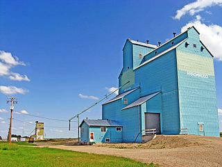
Arrowwood is a village in Vulcan County, Alberta, Canada. It is located on Highway 547, approximately 60 kilometres (37 mi) east of Okotoks.

<span class="mw-page-title-main">Barons, Alberta</span> Village in Alberta, Canada

Barons is a village in southern Alberta, Canada in a region referred to as Palliser's Triangle. It is located 51 kilometres (32 mi) north of Lethbridge along Highway 23. Barons was a filming location for a scene in the 1978 film Superman; the village's school was used to represent the school that young Clark Kent attended.

<span class="mw-page-title-main">Carbon, Alberta</span> Village in Alberta, Canada

Carbon is a village in central Alberta, Canada.

Delburne is a village in the central region of Alberta, Canada that is east of Red Deer.

Delia is a village in southern Alberta, Canada. It is approximately 45 km (28 mi) northeast of Drumheller, 1.6 km (0.99 mi) south of Highway 9. It is named for Delia Davis, wife of Alvin L. Davis, a local merchant, and was originally known as the Village of Highland between 1914 and 1915, though the post office was called Delia from its inception in 1912.

<span class="mw-page-title-main">Halkirk, Alberta</span> Village in Alberta, Canada

Halkirk is a village in central Alberta, Canada within the County of Paintearth No. 18. It is located 122 kilometres (76 mi) east of Red Deer at the intersection of Highway 12 and Highway 855. Founded in 1912, Halkirk was named after Halkirk, Scotland. With commercial operations beginning on December 1, 2012, Capital Power Corporation operates Alberta's third largest wind farm, with 83 Vestas V90 Wind Turbines in the area totalling 150MW capacity.

<span class="mw-page-title-main">Hythe, Alberta</span> Hamlet in Alberta, Canada

Hythe is a hamlet in northwest Alberta, Canada within the County of Grande Prairie No. 1. It is located on Highway 43 approximately 58 km (36 mi) northwest of the City of Grande Prairie and 73 km (45 mi) southeast of the City of Dawson Creek, British Columbia. It held village status prior to July 2021.

Lomond is a village in southern Alberta, Canada that is surrounded by Vulcan County. It is located at the intersection of Highway 845 and Highway 531, approximately 74 kilometres (46 mi) southwest of Brooks and 49 kilometres (30 mi) east of Vulcan. The village is a farming service community. Lomond was named for Loch Lomond, Scotland.

<span class="mw-page-title-main">New Sarepta</span> Hamlet in Alberta, Canada

New Sarepta is a hamlet in central Alberta, Canada, within Leduc County. It is located approximately 23 km (14 mi) east of the City of Leduc along Highway 21.

<span class="mw-page-title-main">Nobleford</span> Municipality in Alberta, Canada (est. 1909)

Nobleford is a town in southern Alberta, Canada that is approximately 32 km (20 mi) northwest of the City of Lethbridge. It has emerged as a bedroom community of Lethbridge.

<span class="mw-page-title-main">Ryley</span> Village in Alberta, Canada

Ryley is a village in central Alberta, Canada. It is surrounded by Beaver County, along Highway 14 between the City of Edmonton and the Town of Viking. The City of Camrose is approximately 58 km (36 mi) south of Ryley. The village was named in 1908 after George Urquhart Ryley, Grand Trunk Pacific Railway Land Commissioner at the time.
<span class="mw-page-title-main">Tilley, Alberta</span> Hamlet in Alberta, Canada

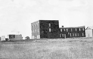
Tilley is a hamlet in southern Alberta, Canada within the County of Newell. It is located approximately 22 km southeast of the City of Brooks and 78 km northwest of the City of Medicine Hat.

<span class="mw-page-title-main">Veteran, Alberta</span> Village in Alberta, Canada

Veteran is a village in central Alberta, Canada. It is located on Highway 12 approximately 200 km (120 mi) east of the City of Red Deer. Consort is approximately 25 km (16 mi) to the east, while Coronation is approximately 26 km (16 mi) to the west.

<span class="mw-page-title-main">Madden, Alberta</span> Hamlet in Alberta, Canada

Madden is a hamlet in southern Alberta, Canada, under the jurisdiction of Rocky View County.

Byemoor is a hamlet in Alberta, Canada within the County of Stettler No. 6. It is located at the intersection of Highway 853 and Highway 589, approximately 70 kilometres (43 mi) southeast of Stettler and 80 kilometres (50 mi) northeast of Drumheller. It has an elevation of 845 metres (2,772 ft).

<span class="mw-page-title-main">Valhalla Centre</span> Hamlet in Alberta, Canada

Valhalla Centre is a hamlet in northern Alberta, Canada within the County of Grande Prairie No. 1.

References

  1. "Location and History Profile: Village of Milo" (PDF). Alberta Municipal Affairs. October 21, 2016. p. 463. Retrieved October 23, 2016.
  2. "Municipal Officials Search". Alberta Municipal Affairs. May 9, 2019. Retrieved October 1, 2021.
  3. 1 2 "Population and dwelling counts: Canada, provinces and territories, and census subdivisions (municipalities)". Statistics Canada. February 9, 2022. Retrieved February 9, 2022.
  4. 1 2 "Population and dwelling count amendments, 2021 Census". Statistics Canada. December 1, 2023. Retrieved September 22, 2024.
  5. "Population and dwelling counts, for Canada, provinces and territories, and census subdivisions (municipalities), 2016 and 2011 censuses – 100% data (Alberta)". Statistics Canada. February 8, 2017. Retrieved February 8, 2017.
  6. "Milo students remember one of their own 70 years later," Nov 8, 2013, Palliser Regional Schools website https://www.pallisersd.ab.ca/about-us/news/post/milo-students-remember-one-of-their-own-70-years-later
  7. Dave Birrell, "My Son 'A First Class Man' - Honouring Terry Taerum" (Originally published in the Spring 2003 Edition of Air Force Magazine), reproduced at website of Bomber Command Museum, Nanton http://www.bombercommandmuseum.ca/taerum2.html Archived 2018-02-07 at the Wayback Machine