Ferintosh is a hamlet in central Alberta, Canada within Camrose County. It is located approximately 38 kilometres (24 mi) south of Camrose, and 102 kilometres (63 mi) southeast of Edmonton. The hamlet is situated on Little Beaver Lake. The community takes its name from Ferintosh, in Scotland.

The Municipal District of Taber is a municipal district (MD) in southern Alberta, Canada. It is located in Census Division 2.
Kitscoty is a village located in central Alberta, Canada. Situated at the junction of Highway 16 and Highway 897, the village is located approximately midway between Edmonton and Saskatoon. In addition, the village is within short commuting distance of Lloydminster. The CN railway tracks also pass through Kitscoty. The municipal office of the surrounding County of Vermilion River's is located in Kitscoty.

McLennan is a town in northern Alberta, Canada. It is approximately 50 km (31 mi) north of High Prairie on Highway 2.

Rainbow Lake is a town in northwest Alberta, Canada. It is west of High Level at the end of Highway 58, in Mackenzie County.
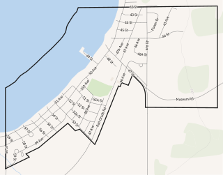
Alberta Beach is a village in central Alberta, Canada, west of Edmonton. It is located on the southeast shore of Lac Ste. Anne, approximately 8 km (5.0 mi) west of Highway 43 and 2 km (1.2 mi) north of Highway 633.

Donnelly is a village in northern Alberta, Canada within the Municipal District of Smoky River No. 130. It is located near the intersection of Highway 2 and Highway 49, located approximately 65 km (40 mi) south of Peace River and 427 km (265 mi) northwest of Edmonton.

Ryley is a village in central Alberta, Canada. It is surrounded by Beaver County, along Highway 14 between the City of Edmonton and the Town of Viking. The City of Camrose is approximately 58 km (36 mi) south of Ryley. The village was named in 1908 after George Urquhart Ryley, Grand Trunk Pacific Railway Land Commissioner at the time.
Spring Lake, originally named Edmonton Beach, is a village in central Alberta, Canada. It is located on the eastern shore of Spring Lake, approximately 20 km (12 mi) and 40 km (25 mi) west of the cities of Spruce Grove and Edmonton respectively. Hasse Lake is located 6 km (3.7 mi) southwest of Spring Lake. It was known as the Summer Village of Edmonton Beach from 1959 to 1999.

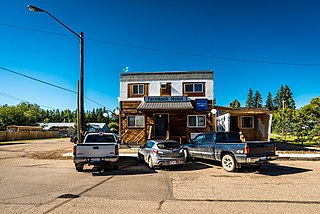
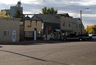
Vilna is a village in central Alberta, Canada.

The Municipal District of Acadia No. 34 is a municipal district (MD) in southern Alberta, Canada, east of Calgary, close to the Saskatchewan border, in Census Division No. 4.
Gull Lake is a summer village located on the southern shore of Gull Lake, located approximately 24 km (15 mi)southeast of the Town of Rimbey in central Alberta, Canada.

Lac Ste. Anne County is a municipal district in central Alberta, Canada.
Birch Cove is a summer village in Alberta, Canada. It is located between Highway 33 and Lac la Nonne, 99 kilometres (62 mi) northwest of Edmonton.
South View is a summer village in Alberta, Canada. It is located on the northern shore of Isle Lake, opposite from Silver Sands.
Yellowstone is a summer village in Alberta, Canada. It is developed on the northern shore of Lac Ste. Anne, south of Alberta Highway 43, between Ross Haven and Gunn, 78 kilometres (48 mi) from Edmonton.
Island Lake South is a summer village in Alberta, Canada. It is located on the southern shore of Island Lake, along Highway 2, northwest of Athabasca.
Sandy Beach is a summer village in Alberta, Canada. It is located on Sandy Lake, northwest from Edmonton along Highway 642.

Bellis is a hamlet in central Alberta, Canada within Smoky Lake County. Previously an incorporated municipality, Bellis dissolved from village status on January 1, 1946 to become part of the Municipal District of Vilna No. 575.
Ranfurly is a hamlet in central Alberta, Canada within the County of Minburn No. 27. Previously an incorporated municipality, Ranfurly dissolved from village status on January 1, 1946 to become part of the Municipal District of Birch Lake No. 484.
