
Lloydminster is a city in Canada which has the unusual geographic distinction of straddling the provincial border between Alberta and Saskatchewan. The city is incorporated by both provinces as a single city with a single municipal administration.
Ohaton is a hamlet in central Alberta, Canada within Camrose County. Previously an incorporated municipality, Ohaton dissolved from village status on January 1, 1946.
Vermilion is a town in central Alberta, Canada that is surrounded by the County of Vermilion River. It is at the intersection of Highway 16 and Highway 41, approximately 60 kilometres (37 mi) west of Lloydminster and 192 kilometres (119 mi) east of Edmonton.
Kingman is a hamlet in central Alberta, Canada within Camrose County. It is located approximately 27 kilometres (17 mi) north of Camrose and has an elevation of 740 metres (2,430 ft).

Division No. 12 is a census division in Alberta, Canada. Including the City of Cold Lake, the majority of the division is located in the northeast corner of central Alberta. The northern portion of the division is located within northern Alberta.
Division No. 14 is a census division in Alberta, Canada. The majority of the division is located in the western portion of central Alberta, while the westernmost portion of the division is located within Alberta's Rockies. The division's largest urban community is the Town of Hinton.
Division No. 17 is a census division in Alberta, Canada. It spans the central and northwest portions of northern Alberta and its largest urban community is the Town of Slave Lake. Division No. 17 is the largest census division in Alberta according to area and also has the lowest population density.

The County of Vermilion River is a municipal district located in the eastern part of central Alberta, Canada in Census Division No. 10. The municipal district was formerly named the County of Vermilion River No. 24 prior to an official name change that became effective on September 13, 2006.
Derwent is a hamlet in central Alberta, Canada within the County of Two Hills No. 21. It is located on Highway 45, approximately 41 kilometres (25 mi) north of Vermilion.
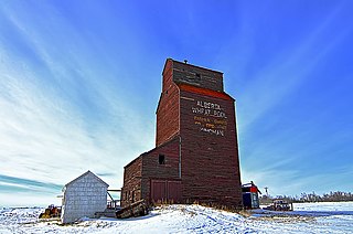
Dewberry is a hamlet in central Alberta, Canada within the County of Vermilion River. It is approximately 66 km (41 mi) northwest of Lloydminster. The hamlet was named for the dewberries growing near the community. Its first school opened in 1930. Dewberry held village status prior to 2021.
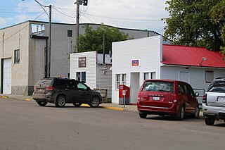
Marwayne is a village in central Alberta, Canada. It is located 44 kilometres (27 mi) northwest of the city of Lloydminster and 21 kilometres (13 mi) west of the Saskatchewan border.

Lamont County is a municipal district in central Alberta, Canada, located in Census Division No. 10, northeast of Edmonton. The county contains 27 Townships. Its municipal office is located in the Town of Lamont.

Camrose County is a municipal district in central Alberta, Canada. It is located in Census Division 10, around the City of Camrose.

The Rural Municipality of Britannia No. 502 is a rural municipality (RM) in the Canadian province of Saskatchewan within Census Division No. 17 and SARM Division No. 6. It is located in the west-central portion of the province.
Armena is a hamlet in Alberta, Canada within Camrose County. It is located approximately 21 kilometres (13 mi) northwest of Camrose along Highway 21 and has an elevation of 745 metres (2,444 ft).
Blackfoot is a hamlet in east-central Alberta, Canada within the County of Vermilion River. It is located 1 kilometre (0.62 mi) north of Highway 16, approximately 10 kilometres (6.2 mi) west of Lloydminster.
Cadogan is a hamlet in central Alberta, Canada within the Municipal District of Provost No. 52. Previously an incorporated municipality, Cadogan dissolved from village status on January 1, 1946 to become part of the Municipal District of Hillcrest No. 362.
Clandonald is a hamlet in central Alberta, Canada within the County of Vermilion River. It is located approximately 28 kilometres (17 mi) north of Highway 16 and 58 kilometres (36 mi) northwest of Lloydminster.
Islay is a hamlet in central Alberta, Canada within the County of Vermilion River. Previously an incorporated municipality, Islay dissolved from village status on March 15, 1944, to become part of the Municipal District of Vermilion Valley No. 482. The community was named after Islay, in Scotland, the ancestral home of pioneer settlers.
Pelican Point is a hamlet in central Alberta, Canada within Camrose County. It is located approximately 6 kilometres (3.7 mi) south of Highway 53 and 55 kilometres (34 mi) south of Camrose.
