
Lesser Slave Lake is a provincial electoral district for the Legislative Assembly of Alberta, Canada. It has existed since 1971 and is mandated to return a single member using the first past the post method of voting.

Valleyview is a town in northwest Alberta, Canada. It is surrounded by the Municipal District of Greenview No. 16 and in Census Division No. 18.

Kinuso is a hamlet in northern Alberta, Canada within Big Lakes County, and surrounded by the Swan River First Nation reserve. It is located approximately 48 kilometres (30 mi) west of Slave Lake and 71 km east of High Prairie along Highway 2, south of the southern shore of Lesser Slave Lake.
Wabasca, also known as Wabasca-Desmarais, is a hamlet in northern Alberta, Canada within the Municipal District (MD) of Opportunity No. 17. It is located between and along the South and North Wabasca Lakes, at the intersection of Highway 813 and Highway 754. It is approximately 123 km (76 mi) northeast of Slave Lake.
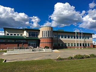
The Municipal District of Greenview No. 16 is a municipal district (MD) in northwest Alberta, Canada. It covers the full extent of Census Division 18, and with an area of 32,984 km2 (12,735 sq mi), it is the largest municipal district in Alberta. Its administrative office is located in the Town of Valleyview.

The Municipal District of Opportunity No. 17 is a municipal district (MD) occupying a remote area in central northern Alberta, Canada. Located in Census Division 17 north of the Town of Athabasca, its municipal office is located in the Hamlet of Wabasca.

Wabasca 166D is an Indian reserve of the Bigstone Cree Nation in Alberta, located within the Municipal District of Opportunity No. 17. It is 78 kilometres north of Slave Lake. In the 2016 Canadian Census, it recorded a population of 188 living in 47 of its 58 total private dwellings.

Wabasca 166C is an Indian reserve of the Bigstone Cree Nation in Alberta, located within the Municipal District of Opportunity No. 17. In the 2016 Canadian Census, it recorded a population of 188 living in 47 of its 58 total private dwellings. The community is located along the northeast shore of North Wabasca Lake.
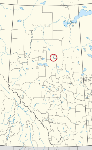
Wabasca 166B is an Indian reserve of the Bigstone Cree Nation in Alberta, located within the Municipal District of Opportunity No. 17. In the 2016 Canadian Census, it recorded a population of 190 living in 43 of its 52 total private dwellings. The community is located on the southern shore of North Wabasca Lake and to the west of the hamlet of Wabasca.
Grouard, also known as Grouard Mission, is a hamlet in northern Alberta within Big Lakes County. It was previously an incorporated municipality between 1909 and 1944.

Drift Pile River 150 is an Indian reserve of the Driftpile Cree Nation in Alberta, located within Big Lakes County. It is 6 kilometers southeast of Lesser Slave Lake. In the 2016 Canadian Census, it recorded a population of 828 living in 258 of its 277 total private dwellings.

The Driftpile Cree Nation is a Treaty 8 First Nation with a reserve, Drift Pile River 150, located on the southern shore of the Lesser Slave Lake on Alberta Highway 2 in Northern Alberta. The band has approximately 1200 members.

Kapawe'no 150B, historically known as Freeman 150B, is an Indian reserve of the Kapawe'no First Nation in Alberta, located within Big Lakes County. It is 8 kilometers northwest of Lesser Slave Lake. In the 2016 Canadian Census, it recorded a population of 154 living in of its 45 total private dwellings.
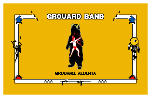
The Kapawe'no First Nation is a band government in Alberta, Canada. It is headquartered at Grouard, Alberta, which is near High Prairie.

Kapawe'no 150C, formerly known as Halcro 150C, is an Indian reserve of the Kapawe'no First Nation in Alberta, located within Big Lakes County. It is 17 kilometres northeast of High Prairie.
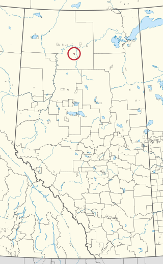
Tallcree 173A, also known as North Tallcree, is an Indian reserve of the Tallcree First Nation in Alberta, located within Mackenzie County. It is 40 kilometres (25 mi) southeast of Fort Vermilion. In the 2021 Canadian Census, Tallcree 173A had a recorded population of 201 living in 50 of its 56 total private dwellings.
North Wabasca Lake is located in northern Alberta, Canada, 322 km (200 mi) north of Edmonton and is the fifteenth largest lake in Alberta. The hamlet of Wabasca is located on the southeast shore of the lake, and along the path of the river flowing north from South Wabasca Lake. Two First Nations Reserves border the lake, Wabasca 166C in the northeast, and Wabasca 166B in the south.


