
Sturgeon County is a municipal district in the Edmonton Metropolitan Region of Alberta, Canada. It is north of Edmonton and west of the North Saskatchewan River. Sturgeon County is located in Division No. 11 and was named for the Sturgeon River.

Division No. 11 is a census division in Alberta, Canada. Surrounding the City of Edmonton, the majority of the division comprises Alberta's Capital Region, while the western and southern portions of the division are located within central Alberta. The division also forms the northern segment of the Calgary–Edmonton Corridor.
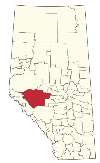
Division No. 9 is a census division in Alberta, Canada. It is located in the southwest corner of central Alberta and its largest urban community is the Town of Rocky Mountain House. The boundaries of the division are coextensive with the outer boundaries of Clearwater County.
Division No. 14 is a census division in Alberta, Canada. The majority of the division is located in the western portion of central Alberta, while the westernmost portion of the division is located within Alberta's Rockies. The division's largest urban community is the Town of Hinton.
Division No. 19 is a census division in Alberta, Canada. It is located in the west-central portion of northern Alberta and surrounds the City of Grande Prairie.

Grande Cache is a hamlet in West-Central Alberta, Canada within and administered by the Municipal District of Greenview No. 16. It is located on Highway 40 approximately 145 kilometres (90 mi) northwest of Hinton and 435 kilometres (270 mi) west of Edmonton. Grande Cache overlooks the Smoky River, is at the northern edge of Alberta's Rockies, and serves as a gateway to the Willmore Wilderness Park. The hamlet held town status prior to 2019.

Valleyview is a town in northwest Alberta, Canada. It is surrounded by the Municipal District of Greenview No. 16 and in Census Division No. 18.

Hythe is a hamlet in northwest Alberta, Canada within the County of Grande Prairie No. 1. It is located on Highway 43 approximately 58 km (36 mi) northwest of the City of Grande Prairie and 73 km (45 mi) southeast of the City of Dawson Creek, British Columbia. It held village status prior to July 2021.
Yellowhead County is a municipal district in west central Alberta, Canada. It is the only municipal district within Alberta census division No. 14.

The Municipal District of Greenview No. 16 is a municipal district (MD) in northwest Alberta, Canada. It covers the full extent of Census Division 18, and with an area of 32,984 km2 (12,735 sq mi), it is the largest municipal district in Alberta. Its administrative office is located in the Town of Valleyview.
Wanham is a hamlet in northern Alberta, Canada within Birch Hills County. It is located 29 km (18 mi) east of Rycroft along Highway 49 and approximately 106 km (66 mi) north of Grande Prairie, in the farmlands of Peace River Country. Saddle River, a tributary of Peace River, flows immediately north of the community. The origin of the name Wanham could have come from Wanham in England.
DeBolt is a hamlet in northern Alberta, Canada within the Municipal District of Greenview No. 16. A variant name is Debolt. H. E. Debolt, an early postmaster, gave the community his last name.
Bezanson is a hamlet in northern Alberta, Canada within the County of Grande Prairie No. 1. It is located approximately 30 kilometres (19 mi) east of Grande Prairie on Highway 43, west of the Smoky River.
La Glace is a hamlet in northern Alberta, Canada within the County of Grande Prairie No. 1. It is located along Highway 59 between Sexsmith and Valhalla Centre and has an elevation of 735 metres (2,411 ft).
Calahoo is a hamlet in Alberta, Canada within Sturgeon County. It is located on Highway 37 near the Sturgeon River, approximately 21 kilometres (13 mi) northwest of Edmonton's city limits. It has an elevation of 680 metres (2,230 ft).
Armena is a hamlet in Alberta, Canada within Camrose County. It is located approximately 21 kilometres (13 mi) northwest of Camrose along Highway 21 and has an elevation of 745 metres (2,444 ft).
Villeneuve is a hamlet in central Alberta, Canada within Sturgeon County. It is located on Highway 44, approximately 10 kilometres (6.2 mi) northwest of Edmonton's city limits. It is home to the band government of the Michel First Nations.
Eaglesham is a hamlet in northern Alberta, Canada within Birch Hills County, located 6 kilometres (3.7 mi) north of Highway 49, approximately 89 kilometres (55 mi) northeast of Grande Prairie.
Rivière Qui Barre is a hamlet in central Alberta, Canada, within Sturgeon County. It is located 1 kilometre (0.62 mi) west of Highway 44, approximately 22 kilometres (14 mi) northwest of Edmonton's city limits. It was founded in 1885 by French-speaking settlers, adding a post office in 1895. The name is the French translation of Kipohtakaw, the Cree name of the nearby river.
Wedgewood is a hamlet in northern Alberta, Canada within the County of Grande Prairie No. 1.
