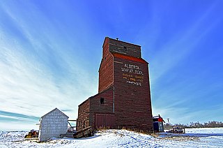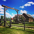
Kingman is a hamlet in central Alberta, Canada within Camrose County. It is located approximately 27 kilometres (17 mi) north of Camrose and has an elevation of 740 metres (2,430 ft).
Round Hill is a hamlet in central Alberta, Canada within Flagstaff County. It is located on Highway 834 approximately 29 kilometres (18 mi) northeast of Camrose and has an elevation of 740 metres (2,430 ft).
Benalto is a hamlet in central Alberta, Canada within Red Deer County. It is located approximately 13 kilometres (8.1 mi) west of the Town of Sylvan Lake. Benalto is also recognized by Statistics Canada as a designated place.
Clandonald is a hamlet in central Alberta, Canada within the County of Vermilion River. It is located approximately 28 kilometres (17 mi) north of Highway 16 and 58 kilometres (36 mi) northwest of Lloydminster.
Enilda is a hamlet in northern Alberta within Big Lakes County, located 10 kilometres (6.2 mi) west of Highway 49, approximately 97 kilometres (60 mi) northeast of Grande Prairie.
Faust is a hamlet in northern Alberta within Big Lakes County, located 1 kilometre (0.62 mi) north of Highway 2, approximately 241 kilometres (150 mi) northwest of Edmonton.
Fawcett is a hamlet in central Alberta, Canada within Westlock County. It is located on Highway 44, approximately 118 kilometres (73 mi) northwest of Edmonton, and four kilometres east of Hubert Lake Wildland Provincial Park.
Flatbush is a hamlet in northern Alberta, Canada within the Municipal District of Lesser Slave River No. 124. It is located 3 kilometres (1.9 mi) west of Highway 44, approximately 135 kilometres (84 mi) northwest of Edmonton.

Fort Kent is a hamlet in central Alberta, Canada within the Municipal District of Bonnyville No. 87, located on Highway 28 approximately 32 kilometres (20 mi) southwest of Cold Lake.
Grassland is a hamlet in northern Alberta, Canada within Athabasca County. It is on Highway 63, 151 kilometres (94 mi) northeast of Edmonton.
Gwynne is a hamlet in central Alberta, Canada within the County of Wetaskiwin No. 10. It is located on Highway 13, approximately 11 kilometres (6.8 mi) east of Wetaskiwin.
Joussard is a hamlet in northern Alberta within Big Lakes County. It is 2 kilometres (1.2 mi) north of Highway 2, approximately 83 kilometres (52 mi) west of Slave Lake.
Meeting Creek is a hamlet in central Alberta, Canada within Camrose County, located 1 kilometre (0.62 mi) west of Highway 56, approximately 38 kilometres (24 mi) south of Camrose.

Mulhurst Bay, or Mulhurst, is a hamlet in central Alberta, Canada within the County of Wetaskiwin No. 10. It is located 8 kilometres (5.0 mi) northwest of Highway 13A, approximately 38 kilometres (24 mi) southwest of Leduc.
Pibroch is a hamlet in central Alberta, Canada within Westlock County. It is located 2 kilometres (1.2 mi) west of Highway 44, approximately 83 kilometres (52 mi) northwest of Edmonton.
Pickardville is a hamlet in central Alberta, Canada within Westlock County. It is located 2 kilometres (1.2 mi) west of Highway 44, approximately 62 kilometres (39 mi) northwest of Edmonton.
Rochester is a hamlet in northern Alberta, Canada within Athabasca County. It is 3 kilometres (1.9 mi) east of Highway 2, 93 kilometres (58 mi) north of Edmonton.
Tees is a hamlet in central Alberta, Canada, within Lacombe County. It is located 1 kilometre (0.62 mi) north of Highway 12, approximately 40 kilometres (25 mi) northeast of Red Deer.
Vimy is a hamlet in Westlock County in Central Alberta, Canada. It is located 1.4 kilometres (0.87 mi) east of Highway 2, approximately 59 kilometres (37 mi) north of Edmonton.
Whitelaw is a hamlet in northern Alberta, Canada within the Municipal District of Fairview No. 136. It is located 2 kilometres (1.2 mi) north of Highway 2, approximately 114 kilometres (71 mi) northeast of Grande Prairie.


