
Clearwater County is a municipal district in west central Alberta, Canada in Division No. 9. Its northwest boundary is the Brazeau River. The municipal office is located in the Town of Rocky Mountain House. The county has a land area of 18,691.65 km2 and comprises close to 99% of Census Division No. 9's land area of 18,921.38 km2. Although the territory excluded is rather small in geographical area, it comprises the major population centre of Rocky Mountain House, which has one-third of Division No. 9's population, in addition to the communities of Caroline, Burnstick Lake and three Indian reserves. The county's 2016 census population was 11,947.

Ferintosh is a hamlet in central Alberta, Canada within Camrose County. It is located approximately 38 kilometres (24 mi) south of Camrose, and 102 kilometres (63 mi) southeast of Edmonton. The hamlet is situated on Little Beaver Lake. The community takes its name from Ferintosh, in Scotland.
Granum is a hamlet in southern Alberta, Canada that is under the jurisdiction of the Municipal District of Willow Creek No. 26. It is located at the junction of Highway 2 and Highway 519 west of Lethbridge. Incorporated as the Village of Leavings in 1904, it changed its name to Granum in 1908 and held town status between late 1910 and early 2020.
Dewberry is a hamlet in central Alberta, Canada within the County of Vermilion River. It is approximately 66 km (41 mi) northwest of Lloydminster. The hamlet was named for the dewberries growing near the community. Its first school opened in 1930. Dewberry held village status prior to 2021.
Langdon is a hamlet in southern Alberta, Canada under the jurisdiction of Rocky View County. It previously held village status between August 31, 1907 and January 1, 1946.

Delacour is a hamlet in southern Alberta under the jurisdiction of Rocky View County. It is located approximately 10 km (6.2 mi) east of the City of Calgary, and 24 km (15 mi) from its downtown. The hamlet features a creek valley setting and a golf club.

Brazeau County is a municipal district in central Alberta, Canada. It is located in Census Division 11. The municipal district was incorporated on July 1, 1988 from Improvement District No. 222. On October 1, 2002, the name was changed from Municipal District of Brazeau No. 77 to Brazeau County.

Worsley is a hamlet in northern Alberta, Canada within Clear Hills County. It is located in the Peace Country, at the northern end of Highway 726, approximately 18 km (11 mi) north of Highway 64, 59 km (37 mi) northwest of Hines Creek and 50 km (31 mi) east of the British Columbia border. It lies at an elevation of 650 m (2,130 ft) amidst prairie farmland and ranchland.

Del Bonita is a hamlet in southern Alberta, Canada within Cardston County. It is located approximately 49 km (30 mi) south of Magrath at the junction of Highway 62 and Highway 501. Due to its location near the Canada–United States border, it serves as a port of entry into the U.S. state of Montana at the nearby Del Bonita Border Crossing which is located 3 km (1.9 mi) to the south. Del Bonita is a name derived from Spanish meaning "of the pretty".
Rocky Rapids is a hamlet in central Alberta, Canada within Brazeau County. It is located 1.6 km (0.99 mi) east of Highway 22, approximately 7 km (4.3 mi) north of Drayton Valley.
Buck Lake is a hamlet in central Alberta, Canada within the County of Wetaskiwin No. 10. It is located on Highway 13, approximately 109 kilometres (68 mi) southwest of Edmonton. It is located on the shore of Buck Lake.
Buford is a hamlet in central Alberta, Canada within Leduc County. It is located 2 kilometres (1.2 mi) south of Highway 39, 23 kilometres (14 mi) west of Leduc.
Cynthia is a hamlet in central Alberta, Canada within Brazeau County. It is located approximately 37 kilometres (23 mi) south of Highway 16 and 131 kilometres (81 mi) southwest of Edmonton.
Haynes is a hamlet in central Alberta, Canada within Lacombe County. It is located 3 kilometres (1.9 mi) north of Highway 11, approximately 28 kilometres (17 mi) east of Red Deer.
Lodgepole is a hamlet in central Alberta, Canada within Brazeau County. It is located approximately 31 kilometres (19 mi) west of Highway 22 and 131 kilometres (81 mi) southwest of Edmonton.
Poplar Ridge is a hamlet in central Alberta, Canada within Brazeau County. It is located 1 kilometre (0.62 mi) northwest of Highway 22, approximately 107 kilometres (66 mi) southwest of Edmonton.
Saprae Creek is a hamlet in northern Alberta, Canada within the Regional Municipality (RM) of Wood Buffalo. It is located 3 kilometres (1.9 mi) north of Highway 69, approximately 11 kilometres (6.8 mi) east of Fort McMurray.
Violet Grove is a hamlet in central Alberta, Canada within Brazeau County. It is located 7 km (4.3 mi) southwest of Drayton Valley on Highway 620, approximately 110 km (68 mi) southwest of Edmonton.
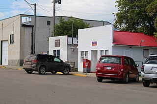
Welling Station is a hamlet in southern Alberta, Canada within Cardston County.

