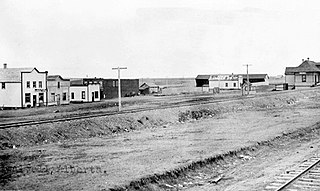
Minburn is a hamlet in central, Alberta, Canada within the County of Minburn No. 27. It is located on the Yellowhead Highway and the Canadian National Railway, approximately 37 km (23 mi) west of the Town of Vermilion and 143 km (89 mi) east of the City of Edmonton.
Niton Junction is a hamlet in west-central Alberta, Canada within Yellowhead County. It is located on the Yellowhead Highway approximately 45 kilometres (28 mi) east of Edson and 150 kilometres (93 mi) west of Edmonton. It is east of the Yellowhead Highway's junction with Highway 32 and west of Chip Lake. Niton Junction has an elevation of 845 metres (2,772 ft).
Keoma is a hamlet in southern Alberta under the jurisdiction of Rocky View County.
Dalemead is a hamlet in southern Alberta under the jurisdiction of Rocky View County. It is approximately 35 km (21 mi) southeast of Downtown Calgary and 3.2 km (2.0 mi) south of Highway 22X along a Canadian Pacific Kansas City railway line.
Dalroy is a hamlet in southern Alberta under the jurisdiction of Rocky View County. It is located approximately 28 km (18 mi) east of Downtown Calgary and 0.8 km (0.5 mi) east of Highway 9.

Tomahawk, Alberta is a hamlet in Alberta, Canada within Parkland County. It is located on Highway 759, northeast of the Town of Drayton Valley.
Cayley is a hamlet in southern Alberta, Canada within the Foothills County. It is also recognized as a designated place by Statistics Canada.
Peers is a hamlet in west-central Alberta, Canada within Yellowhead County. It is located on Highway 32, 8 kilometres (5.0 mi) north of the Yellowhead Highway and approximately 35 kilometres (22 mi) northeast of Edson. January Creek, a tributary of the McLeod River flows directly adjacent to the hamlet. Peers is also home to the annual Peers Gold Dust Daze, which takes place ~3 miles away from Peers
Robb is a hamlet in west-central Alberta, Canada within Yellowhead County that is recognized as a designated place by Statistics Canada. It is located on Highway 47, approximately 53 kilometres (33 mi) southwest of Edson. It has an elevation of 1,140 metres (3,740 ft).
Marlboro is a hamlet in west-central Alberta, Canada within Yellowhead County. It is located on the Yellowhead Highway, approximately 25 kilometres (16 mi) west of Edson. Sundance Provincial Park is located northwest of the hamlet.

Cadomin is a hamlet in the west-central Alberta, Canada within Yellowhead County. It is located along the McLeod River in the foothills of the Rocky Mountains, approximately 50 kilometres (31 mi) south of Hinton near the Bighorn Highway. It is served by a spur of the Canadian National Railway.

Wildwood is a hamlet in west-central Alberta, Canada within Yellowhead County. It is on the Yellowhead Highway, approximately 112 kilometres (70 mi) west of Edmonton and 82 kilometres (51 mi) east of Edson. The Yellowhead Highway's intersection with Cowboy Trail is 9 kilometres (5.6 mi) east of the hamlet. The Lobstick River, which flows from Chip Lake to the west, runs through the hamlet.
Brule is a hamlet in west-central Alberta, Canada within Yellowhead County. It is located on the northwest shore of Brûlé Lake, approximately 20 kilometres (12 mi) west of Hinton. It has an elevation of 1,040 metres (3,410 ft).

Swalwell is a hamlet in southern Alberta, Canada within Kneehill County. Previously an incorporated municipality, Swalwell dissolved from village status on January 1, 1946, to become part of the Municipal District of Norquay No. 279.
MacKay is a locality in west-central Alberta, Canada within Yellowhead County. It is located on the Yellowhead Highway approximately 57 km (35 mi) east of Edson.
Gunn is a hamlet in Alberta, Canada within Lac Ste. Anne County. It is located west of the junction of Highway 43 and Highway 33 on the northeast shore of Lac Ste. Anne. It is approximately 58 kilometres (36 mi) northwest of Edmonton and has an elevation of 740 metres (2,430 ft).

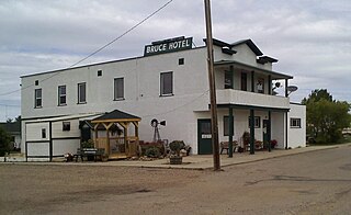
Bruce is a hamlet in Alberta, Canada within Beaver County. It is located along Highway 14 between Viking and Ryley, approximately 115 kilometers (71 mi) east of Edmonton, and has an elevation of 680 meters (2,230 ft).

Chancellor is a hamlet in southern Alberta, Canada within Wheatland County. It is located approximately 26 kilometres (16 mi) north of Highway 1 and 86 kilometres (53 mi) east of Calgary.
Cluny is a hamlet in Alberta, Canada within Wheatland County. It is 3 kilometres (1.9 mi) south of Highway 1 on a Canadian Pacific Kansas City railway line and Highway 843, approximately 87 kilometres (54 mi) southeast of Calgary. It has an elevation of 570 metres (1,870 ft).
Nightingale is a hamlet in southern Alberta, Canada within Wheatland County. It is located 4 kilometres (2.5 mi) west of Highway 21, approximately 53 kilometres (33 mi) east of Calgary.


