
Bragg Creek is a hamlet in southern Alberta under the jurisdiction of Rocky View County in Division No. 6.

The Calgary Metropolitan Region (CMR), also commonly referred to as the Calgary Region, is a conglomeration of municipalities centred on Calgary, the largest city in Alberta.

Rocky View County is a municipal district in southern Alberta, Canada that is named for its views of the nearby Rocky Mountains to the west. It surrounds most of Calgary, forming the city's northern boundary and most of the city's western and eastern boundaries. At a population of 39,407 in 2016, Rocky View County is the most populous municipal district in Alberta. Though predominantly rural in nature, Rocky View County is home to 14 hamlets, including Langdon, one of Alberta's most populous hamlets. Its rural areas are home to numerous country residential subdivisions.
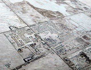
Balzac is a hamlet in the southern portion of the Canadian province of Alberta, in Rocky View County. It is located immediately west of Queen Elizabeth II Highway, at the intersection with Highway 566, 24 km (15 mi) north of Calgary city centre and 12 km (7.5 mi) south of Airdrie.

Crossfield is a town in southern Alberta, Canada within Rocky View County. It is located on Highway 2A 43 km (27 mi) north of the City of Calgary.

Kathyrn is a hamlet in southern Alberta under the jurisdiction of Rocky View County.
Keoma is a hamlet in southern Alberta under the jurisdiction of Rocky View County.
Langdon is a hamlet in southern Alberta, Canada under the jurisdiction of Rocky View County. It previously held village status between August 31, 1907 and January 1, 1946.

Madden is a hamlet in southern Alberta, Canada, under the jurisdiction of Rocky View County.
Cochrane Lake is a hamlet in southern Alberta under the jurisdiction of Rocky View County. Statistics Canada also recognizes a smaller portion of the hamlet as a designated place under the name of Cochrane Lake Subdivision.
Conrich is a hamlet in southern Alberta under the jurisdiction of Rocky View County.
Dalemead is a hamlet in southern Alberta under the jurisdiction of Rocky View County. It is approximately 35 km (21 mi) southeast of Downtown Calgary and 3.2 km (2.0 mi) south of Highway 22X along a Canadian Pacific Railway line.
Dalroy is a hamlet in southern Alberta under the jurisdiction of Rocky View County. It is located approximately 28 km (18 mi) east of Downtown Calgary and 0.8 km (0.5 mi) east of Highway 9.
Delacour is a hamlet in southern Alberta under the jurisdiction of Rocky View County. It is located approximately 10 km (6.2 mi) east of the City of Calgary, and 24 km (15 mi) from its downtown. The hamlet features a creek valley setting and a golf club.
Indus is a hamlet in southern Alberta, Canada under the jurisdiction of Rocky View County.
Janet is a hamlet in southern Alberta under the jurisdiction of Rocky View County. It is located on Township Road 240, approximately 13 km (8.1 mi) east of downtown Calgary, 5.9 km (3.7 mi) southwest of the Town of Chestermere, and 3.2 km (2.0 mi) south of Highway 1A. Janet is primarily an industrial area that is home to some transportation and logistics companies.
De Winton is a hamlet in southern Alberta, Canada within the Foothills County. It is located just south of the City of Calgary and west of Highway 2A.

Priddis is a hamlet in Alberta, Canada within Foothills County. It is located in the foothills of the Canadian Rockies at an elevation of 1,160 metres (3,810 ft). The hamlet is located southwest of the intersection of the Cowboy Trail and Highway 22X, approximately 10 kilometres (6.2 mi) west of Calgary's city limits.
Ensign is a hamlet in southern Alberta, Canada within Vulcan County. It is located approximately 11 kilometres (6.8 mi) south of Highway 23 and 78 kilometres (48 mi) southeast of Calgary.
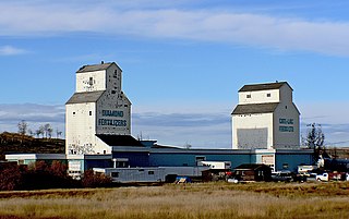
Herronton is a hamlet in southern Alberta, Canada within Vulcan County. It is located 6 kilometres (3.7 mi) north of Highway 23, approximately 64 kilometres (40 mi) southeast of Calgary. The post office was opened in 1912 and named after John Herron of the North-West Mounted Police.

