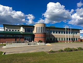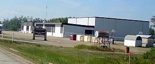
Fort Vermilion is a hamlet on the Peace River in northern Alberta, Canada, within Mackenzie County.
Granum is a hamlet in southern Alberta, Canada that is under the jurisdiction of the Municipal District of Willow Creek No. 26. It is located at the junction of Highway 2 and Highway 519 west of Lethbridge. Incorporated as the Village of Leavings in 1904, it changed its name to Granum in 1908 and held town status between late 1910 and early 2020.

Grimshaw is a town in northern Alberta, Canada. It is approximately 25 km (16 mi) west of the Town of Peace River at the junction of Highway 2 and Highway 2A and along Mackenzie Northern Railway. By virtue of being the original starting point of Highway 35, which leads to the Northwest Territories, Grimshaw is referred to as Mile Zero of the Mackenzie Highway.

Valleyview is a town in northwest Alberta, Canada. It is surrounded by the Municipal District of Greenview No. 16 and in Census Division No. 18.

Hythe is a hamlet in northwest Alberta, Canada within the County of Grande Prairie No. 1. It is located on Highway 43 approximately 58 km (36 mi) northwest of the City of Grande Prairie and 73 km (45 mi) southeast of the City of Dawson Creek, British Columbia. It held village status prior to July 2021.

Saddle Hills County is a municipal district situated in the central portion of the Peace Country in northwest Alberta, Canada. Located approximately 450 km (280 mi) northwest of Edmonton and 90 km (56 mi) north of Grande Prairie, its municipal office is located approximately 25 km (16 mi) west of the Town of Spirit River at the intersection of Highway 49 and Highway 725.

The Municipal District of Greenview No. 16 is a municipal district (MD) in northwest Alberta, Canada. It covers the full extent of Census Division 18, and with an area of 32,984 km2 (12,735 sq mi), it is the largest municipal district in Alberta. Its administrative office is located in the Town of Valleyview.

Beaver Mines is a hamlet in southern Alberta, Canada within the Municipal District of Pincher Creek No. 9. It is located in the foothills of the Canadian Rockies on Highway 507, approximately 19 km (12 mi) west of Pincher Creek.

Valhalla Centre is a hamlet in northern Alberta, Canada within the County of Grande Prairie No. 1.
North Star is a hamlet in northern Alberta, Canada within the County of Northern Lights. It is located on the Mackenzie Highway, approximately 7 kilometres (4.3 mi) south of Manning. It has an elevation of 490 metres (1,610 ft).
Dixonville is a hamlet in Alberta, Canada within the County of Northern Lights. It is located along the Mackenzie Highway, approximately 43 kilometres (27 mi) north of Grimshaw. It has an elevation of 640 metres (2,100 ft).
Little Smoky is a hamlet in northwest Alberta, Canada within the Municipal District of Greenview No. 16. It is located on Highway 43, approximately 39 kilometres (24 mi) south of Valleyview and 47 kilometres (29 mi) northwest of Fox Creek. The hamlet is adjacent to the Little Smoky River.

Elmworth is a hamlet in northern Alberta, Canada within the County of Grande Prairie No. 1. It is located on Highway 722 north of the Wapiti River and east of the British Columbia border. It has an elevation of 715 metres (2,346 ft). The Elmworth natural gas field stretches west and south of the hamlet.
Brownvale is a hamlet in northern Alberta, Canada within the Municipal District of Peace No. 135. It is located on Highway 737 less than 1 kilometre (0.62 mi) off Highway 2, approximately 48 kilometres (30 mi) southwest of the Town of Peace River and 20 kilometres (12 mi) southwest of Grimshaw. Duncan's First Nation reserve is less than 5 km (3.1 mi) to the south.
Demmitt is a hamlet in northern Alberta, Canada within the County of Grande Prairie No. 1. It is located on Highway 43, approximately 77 kilometres (48 mi) northwest of Grande Prairie. The Northern Alberta Railway was built through the area in 1930 as it extended westwards towards Dawson Creek, British Columbia.
Parkland is a hamlet in southern Alberta, Canada within the Municipal District of Willow Creek No. 26. It is located on Highway 2, approximately 86 kilometres (53 mi) northwest of Lethbridge.
St. Lina or Ste-Lina in French, is a hamlet in northern Alberta, Canada within the County of St. Paul No. 19. It is home of St. Lina Community Hall. It is located approximately 14 kilometres (8.7 mi) north of Highway 28 and 85 kilometres (53 mi) southwest of Cold Lake.
Sunnynook is a hamlet in southern Alberta, Canada within Special Area No. 2. It is located approximately 10 kilometres (6.2 mi) east of Highway 36 and 86 kilometres (53 mi) northeast of Brooks. The hamlet formerly housed the Berry Creek Community School Division office and area post office until amalgamation of the school division into Prairie Land Regional Division.

Twin Butte is a hamlet in Southern Alberta, Canada within the Municipal District of Pincher Creek No. 9. It is located on Highway 6, approximately 88 kilometres (55 mi) southwest of Lethbridge. The hamlet of Twin Butte is historically known as a small ranching community located in the foothills of Alberta's Southwest region. The community has a general store, post office, Restaurant and a community hall along Highway 6 north of Township Road 40.
Woodhouse is a hamlet in southern Alberta, Canada within the Municipal District of Willow Creek No. 26. It is located on Highway 2, approximately 58 kilometres (36 mi) northwest of Lethbridge.


