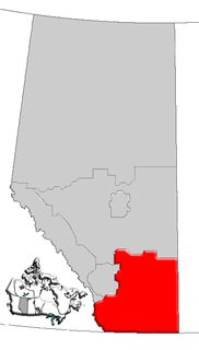
Richdale is a hamlet in east-central Alberta, Canada within Special Area No. 2. It is located on Highway 9 approximately 24 kilometres (15 mi) east of the Town of Hanna, 29 kilometres (18 mi) west of the Village of Youngstown and 130 kilometres (81 mi) north of the City of Brooks. Previously an incorporated community, Richdale dissolved from village status on June 2, 1931.

Burdett is a hamlet in Alberta, Canada within the County of Forty Mile No. 8. It is located approximately 71 kilometres (44 mi) west of Medicine Hat and 97 kilometres (60 mi) east of Lethbridge on Highway 3. Also, Burdett is regarded as the site of Canada's first irrigation pivot.

Bindloss is a hamlet in southern Alberta, Canada within Special Area No. 2. It is located approximately 10 kilometres (6.2 mi) west of Highway 41 and 97 kilometres (60 mi) north of Medicine Hat.

Cessford is a hamlet in southern Alberta, Canada within Special Area No. 2. It is located approximately 22 kilometres (14 mi) east of Highway 36 and 54 kilometres (34 mi) northeast of Brooks.

Chancellor is a hamlet in southern Alberta, Canada within Wheatland County. It is located approximately 26 kilometres (16 mi) north of Highway 1 and 86 kilometres (53 mi) east of Calgary.

Chinook is a hamlet in southern Alberta, Canada within Special Area No. 3. It is located on Highway 9 approximately 119 kilometres (74 mi) northeast of Brooks.

Clandonald is a hamlet in central Alberta, Canada within the County of Vermilion River. It is located approximately 28 kilometres (17 mi) north of Highway 16 and 58 kilometres (36 mi) northwest of Lloydminster.

Dapp is a hamlet in central Alberta, Canada within Westlock County. It is located 4 kilometres (2.5 mi) west of Highway 44, approximately 81 kilometres (50 mi) northwest of St. Albert.

Dorothy is a hamlet in southern Alberta, Canada within Special Area No. 2. It is located approximately 21 kilometres (13 mi) east Highway 56 and 85 kilometres (53 mi) northwest of Brooks.

Eaglesham is a hamlet in northern Alberta, Canada within Birch Hills County, located 6 kilometres (3.7 mi) north of Highway 49, approximately 89 kilometres (55 mi) northeast of Grande Prairie.

Faust is a hamlet in northern Alberta within Big Lakes County, located 1 kilometre (0.62 mi) north of Highway 2, approximately 241 kilometres (150 mi) northwest of Edmonton.

Iddesleigh is a hamlet in southern Alberta, Canada within Special Area No. 2. It is located approximately 37 kilometres (23 mi) northeast of Highway 1 and 46 kilometres (29 mi) northeast of Brooks.

Jenner is a hamlet in southern Alberta, Canada within Special Area No. 2. It is located approximately 43 kilometres (27 mi) northeast of Highway 1 and 54 kilometres (34 mi) northeast of Brooks. Previously an incorporated community, Jenner dissolved from village status on June 25, 1943.

New Brigden is a hamlet in southern Alberta, Canada within Special Area No. 3. It is located 1 kilometre (0.62 mi) east of Highway 41, approximately 185 kilometres (115 mi) north of Medicine Hat.

Patricia is a hamlet in southern Alberta, Canada within the County of Newell. It is located approximately 20 kilometres (12 mi) north of Highway 1 and 21 kilometres (13 mi) northeast of Brooks.

Saprae Creek is a hamlet in northern Alberta, Canada within the Regional Municipality (R.M.) of Wood Buffalo. It is located 3 kilometres (1.9 mi) north of Highway 69, approximately 11 kilometres (6.8 mi) east of Fort McMurray.

Sedalia is a hamlet in southern Alberta, Canada within Special Area No. 3. It is located approximately 31 kilometres (19 mi) north of Highway 9 and 150 kilometres (93 mi) northeast of Brooks. The area was developed when the railroad came through in 1925.

Sibbald is a hamlet in southern Alberta, Canada within Special Area No. 3. It is located on Highway 9, approximately 154 kilometres (96 mi) northeast of Medicine Hat.

Sunnynook is a hamlet in southern Alberta, Canada within Special Area No. 2. It is located approximately 10 kilometres (6.2 mi) east of Highway 36 and 86 kilometres (53 mi) northeast of Brooks. The hamlet formerly housed the Berry Creek Community School Division office and area post office until amalgamation of the school division into Prairie Land Regional Division.

Lake Newell Resort is a hamlet in southern Alberta, Canada within the County of Newell that was established in 2007.


