Waterton Park

Last updated

Waterton Park
Waterton lakes national park.jpg
View from above of Waterton Park
Alberta County Point Locator.svg
Red pog.svg
Location of Waterton Park in Alberta
Coordinates: 49°03′06″N113°54′51″W / 49.0517°N 113.9142°W / 49.0517; -113.9142
CountryCanada
Province Alberta
Census division No. 3
Improvement District Improvement District No. 4 Waterton
Government
  Type Unincorporated
  Governing bodyAlberta Municipal Affairs
Area
 (2021) [1]
  Land482.54 km2 (186.31 sq mi)
Elevation
1,280 m (4,200 ft)
Population
 (2021) [1]
  Total158
  Density0.3/km2 (0.8/sq mi)
Time zone UTC−7 (MST)
  Summer (DST) UTC−6 (MDT)
Area code 403 / 587
highwaysAlberta Highway 5.svg Hwy 5

Waterton Park, commonly referred to as Waterton, is a hamlet in southwestern Alberta, Canada within Improvement District No. 4 Waterton; it is the primary community and service hub of Waterton Lakes National Park. [2]

Contents

It is located at the southwestern terminus of Highway 5, approximately 54 kilometres (34 mi) west of the Town of Cardston and 55 kilometres (34 mi) south of the Town of Pincher Creek. This hamlet is north of Glacier National Park in Montana. It has an elevation of 1,280 metres (4,200 ft).

The hamlet is located in Census Division No. 3 and in the federal riding of Lethbridge.

Demographics

In the 2021 Census of Population conducted by Statistics Canada, Waterton Park had a population of 158 living in 67 of its 209 total private dwellings, a change of

As a designated place in the 2016 Census of Population conducted by Statistics Canada, Waterton Park had a population of 105 living in 39 of its 168 total private dwellings, a change of

Owing to it being the primary hub of the national park, the hamlet welcomes many times its population in visitors, particularly during the summer months. It is the location of the Prince of Wales Hotel, which been designated a National Historic Site of Canada.

Climate

Waterton Park has a humid continental climate (Köppen Dfb), just above the subarctic climate (Dfc). Summers are mild with cool nights, while winters are chilly with highs around freezing. Precipitation is relatively consistent year round, but peaks during the months of May and June. [4]

Climate data for Waterton Park
MonthJanFebMarAprMayJunJulAugSepOctNovDecYear
Record high °C (°F)15
(59)
17
(63)
20
(68)
26.5
(79.7)
30
(86)
31
(88)
34.5
(94.1)
34
(93)
32.8
(91.0)
29
(84)
19
(66)
20
(68)
34.5
(94.1)
Average high °C (°F)0.3
(32.5)
1.3
(34.3)
5.3
(41.5)
10
(50)
15
(59)
19
(66)
22.5
(72.5)
22
(72)
17.3
(63.1)
11.8
(53.2)
3.1
(37.6)
−0.3
(31.5)
10.6
(51.1)
Average low °C (°F)−10.6
(12.9)
−9.8
(14.4)
−5.5
(22.1)
−1.5
(29.3)
2.8
(37.0)
6.1
(43.0)
7.9
(46.2)
6.9
(44.4)
3.4
(38.1)
0.6
(33.1)
−5.8
(21.6)
−9.7
(14.5)
−1.3
(29.7)
Record low °C (°F)−40.5
(−40.9)
−50
(−58)
−34.4
(−29.9)
−24.4
(−11.9)
−11
(12)
−6
(21)
−3
(27)
−5
(23)
−12
(10)
−27
(−17)
−34
(−29)
−44.5
(−48.1)
−50
(−58)
Average precipitation mm (inches)59.3
(2.33)
46.3
(1.82)
69.3
(2.73)
64.5
(2.54)
94.5
(3.72)
80.8
(3.18)
70.8
(2.79)
69
(2.7)
60.8
(2.39)
65.1
(2.56)
68.7
(2.70)
58.4
(2.30)
807.6
(31.80)
Source: Environment Canada [5]

See also

Related Research Articles

<span class="mw-page-title-main">South Cooking Lake</span> Hamlet in Alberta, Canada

South Cooking Lake is a hamlet in Alberta, Canada within Strathcona County. It is located on Highway 14, approximately 19 km (12 mi) southeast of Sherwood Park.

<span class="mw-page-title-main">Grande Cache</span> Hamlet in Alberta, Canada

Grande Cache is a hamlet in West-Central Alberta, Canada within and administered by the Municipal District of Greenview No. 16. It is located on Highway 40 approximately 145 kilometres (90 mi) northwest of Hinton and 435 kilometres (270 mi) west of Edmonton. Grande Cache overlooks the Smoky River, is at the northern edge of Alberta's Rockies, and serves as a gateway to the Willmore Wilderness Park. The hamlet held town status prior to 2019.

Granum is a hamlet in southern Alberta, Canada that is under the jurisdiction of the Municipal District of Willow Creek No. 26. It is located at the junction of Highway 2 and Highway 519 west of Lethbridge. Incorporated as the Village of Leavings in 1904, it changed its name to Granum in 1908 and held town status between late 1910 and early 2020.

<span class="mw-page-title-main">Beaver Mines</span> Hamlet in Alberta, Canada

Beaver Mines is a hamlet in southern Alberta, Canada within the Municipal District of Pincher Creek No. 9. It is located in the foothills of the Canadian Rockies on Highway 507, approximately 19 km (12 mi) west of Pincher Creek.

<span class="mw-page-title-main">Acadia Valley</span> Hamlet in Alberta, Canada

Acadia Valley is a hamlet in southeast Alberta, Canada within the Municipal District (MD) of Acadia No. 34. The MD of Acadia No. 34's municipal office is located in Acadia Valley.
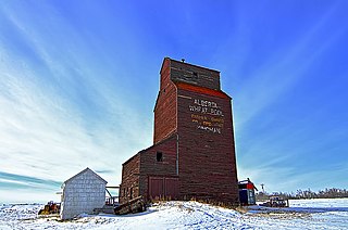
<span class="mw-page-title-main">Atmore, Alberta</span> Hamlet in Alberta, Canada

Atmore is a hamlet in Alberta, Canada within Athabasca County. It is located 1 km (0.62 mi) east of the junction of Highway 55 and Highway 63, 43 km (27 mi) west of Lac La Biche, 54 km (34 mi) east of Athabasca and 250 km (160 mi) south of Fort McMurray.

Calling Lake is a hamlet in northern Alberta, Canada within the Municipal District of Opportunity No. 17. It is located on Highway 813 along the eastern shore of Calling Lake, immediately north of Calling Lake Provincial Park. It is approximately 59 km (37 mi) north of Athabasca and 113 km (70 mi) south of Wabasca and has an elevation of 595 m (1,952 ft).

Gleichen is a hamlet in southeast Alberta, Canada within Wheatland County. It is located adjacent to the Siksika Nation at the intersection of Highway 1 and Highway 547, approximately 40 kilometres (25 mi) southeast of Strathmore. It has an elevation of 903 m (2,963 ft).

Brule is a hamlet in west-central Alberta, Canada within Yellowhead County. It is located on the northwest shore of Brûlé Lake, approximately 20 kilometres (12 mi) west of Hinton. It has an elevation of 1,040 metres (3,410 ft).

Mountain View is a hamlet in Alberta, Canada within Cardston County. It is located along Highway 5 approximately 25 kilometres (16 mi) west of Cardston and 20 kilometres (12 mi) east of Waterton Lakes National Park near the United States border. It is also a kickoff point for visitors to Police Outpost Provincial Park, 18 kilometers to the south.

Leslieville is a hamlet in Alberta, Canada within Clearwater County. It is located east of Rocky Mountain House along the Canadian National Railway and has an elevation of 965 metres (3,166 ft).

Winfield is a hamlet in Alberta, Canada within the County of Wetaskiwin No. 10. It is located at the intersection of Highway 13 and Highway 20, approximately 70 kilometres (43 mi) west of Wetaskiwin.

<span class="mw-page-title-main">Antler Lake</span> Hamlet in Alberta, Canada

Antler Lake is a hamlet in Alberta, Canada within Strathcona County. It is located on the shores of Antler Lake on Range Road 211 and 211A just north of Wye Road, approximately 18 km (11 mi) east of Sherwood Park and 25 km (16 mi) northwest of Tofield.

Benalto is a hamlet in central Alberta, Canada within Red Deer County. It is located approximately 13 kilometres (8.1 mi) west of the Town of Sylvan Lake. Benalto is also recognized by Statistics Canada as a designated place.

Gwynne is a hamlet in central Alberta, Canada within the County of Wetaskiwin No. 10. It is located on Highway 13, approximately 11 kilometres (6.8 mi) east of Wetaskiwin.

<span class="mw-page-title-main">Monarch, Alberta</span> Hamlet in Alberta, Canada

Monarch is a hamlet in southern Alberta, Canada within the Lethbridge County. It is located on Highway 3A, approximately 23 kilometres (14 mi) northwest of Lethbridge. It was formerly a village, existing as such from about 1913 to about 1939.

Ranfurly is a hamlet in central Alberta, Canada within the County of Minburn No. 27. Previously an incorporated municipality, Ranfurly dissolved from village status on January 1, 1946 to become part of the Municipal District of Birch Lake No. 484.

Tillicum Beach is a hamlet in central Alberta, Canada within Camrose County. It is 3 kilometres (1.9 mi) west Highway 56, approximately 16 kilometres (9.9 mi) southeast of Camrose. It is located along Dried Meat Lake.

<span class="mw-page-title-main">Twin Butte</span> Hamlet in southern Alberta, Canada

Twin Butte is a hamlet in Southern Alberta, Canada within the Municipal District of Pincher Creek No. 9. It is located on Highway 6, approximately 88 kilometres (55 mi) southwest of Lethbridge. The hamlet of Twin Butte is historically known as a small ranching community located in the foothills of Alberta's Southwest region. The community has a general store, post office, Restaurant and a community hall along Highway 6 north of Township Road 40.

<span class="mw-page-title-main">Improvement District No. 4</span> Improvement district in Alberta, Canada

Improvement District No. 4, or Improvement District No. 04 (Waterton), is an improvement district in Alberta, Canada. Coextensive with Waterton Lakes National Park in southern Alberta, the improvement district provides local governance for lands within the park that are not within an Indian reserve.

References

  1. 1 2 3 "Population and dwelling counts: Canada and designated places". Statistics Canada. 9 February 2022. Retrieved 10 February 2022.
  2. "Specialized and Rural Municipalities and Their Communities" (PDF). Alberta Municipal Affairs. 12 January 2022. Retrieved 21 January 2022.
  3. "Population and dwelling counts, for Canada, provinces and territories, and designated places, 2016 and 2011 censuses – 100% data (Alberta)". Statistics Canada. 8 February 2017. Retrieved 13 February 2017.
  4. Canada, Environment and Climate Change (19 January 2011). "Canadian Climate Normals 1971-2000 Station Data - Climate - Environment and Climate Change Canada". climate.weather.gc.ca. Retrieved 19 May 2020.
  5. Environment CanadaCanadian Climate Normals 1971–2000, accessed 23 March 2010