
Torrington is a hamlet in central Alberta, Canada within Kneehill County. It is located approximately 160 kilometres (99 mi) northeast of Calgary at the junction of Highway 27 and Highway 805.
Schuler is a hamlet in southern Alberta, Canada within Cypress County, located 4 kilometres (2.5 mi) east of Highway 41, approximately 40 kilometres (25 mi) northeast of Medicine Hat.

Rosebud, Alberta is a hamlet in southern Alberta, Canada within Wheatland County. Previously an incorporated municipality, Rosebud dissolved from village status on January 1, 1946, to become part of the Municipal District of Grasswold No. 248.

Lundbreck is a hamlet in southern Alberta, Canada within the Municipal District of Pincher Creek No. 9. It is located on the south side of Highway 3, approximately 3 kilometres (1.9 mi) east of the southern terminus of Highway 22, 16 km (9.9 mi) east of the Municipality of Crowsnest Pass, 4 km (2.5 mi) west of the Village of Cowley and 16 km (9.9 mi) west of the Town of Pincher Creek. It has an elevation of 1,200 m (3,900 ft).
Swalwell is a hamlet in southern Alberta, Canada within Kneehill County. Previously an incorporated municipality, Swalwell dissolved from village status on January 1, 1946, to become part of the Municipal District of Norquay No. 279.
Gainford is a hamlet in Alberta, Canada within Parkland County. It is located approximately 86 kilometres (53 mi) west of Edmonton and has an elevation of 740 metres (2,430 ft).
Aetna is a hamlet in southern Alberta, Canada within Cardston County, located 2 kilometres (1.2 mi) east of Highway 2, approximately 70 kilometres (43 mi) southwest of Lethbridge.
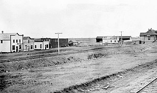
Ardenode is a hamlet and ghost town in southern Alberta, Canada in Wheatland County, located 20 kilometres (12 mi) east of Highway 9, 48 kilometres (30 mi) northeast of Calgary. It was founded as a railroad siding in 1913. The community takes its name from Ardenode in Ireland.
Bluffton is a hamlet in central Alberta, Canada within Ponoka County. It is located 1 kilometre (0.62 mi) northeast of Highway 20, approximately 97 kilometres (60 mi) northwest of Red Deer.
Buck Lake is a hamlet in central Alberta, Canada within the County of Wetaskiwin No. 10. It is located on Highway 13, approximately 109 kilometres (68 mi) southwest of Edmonton. It is located on the shore of Buck Lake.
Cadogan is a hamlet in central Alberta, Canada within the Municipal District of Provost No. 52. Previously an incorporated municipality, Cadogan dissolved from village status on January 1, 1946 to become part of the Municipal District of Hillcrest No. 362.

Chancellor is a hamlet in southern Alberta, Canada within Wheatland County. It is located approximately 26 kilometres (16 mi) north of Highway 1 and 86 kilometres (53 mi) east of Calgary.
Cluny is a hamlet in Alberta, Canada within Wheatland County. It is located 3 kilometres (1.9 mi) south of Highway 1 on a Canadian Pacific Railway line and Highway 843, approximately 87 kilometres (54 mi) southeast of Calgary. It has an elevation of 570 metres (1,870 ft).
Eaglesham is a hamlet in northern Alberta, Canada within Birch Hills County, located 6 kilometres (3.7 mi) north of Highway 49, approximately 89 kilometres (55 mi) northeast of Grande Prairie.
Harvie Heights is a hamlet in Alberta, Canada, within the Municipal District of Bighorn No. 8. It is located within Alberta's Rockies on the Trans-Canada Highway approximately 4 kilometres (2.5 mi) northwest of Canmore and immediately east of the park gate for Banff National Park.
Haynes is a hamlet in central Alberta, Canada within Lacombe County. It is located 3 kilometres (1.9 mi) north of Highway 11, approximately 28 kilometres (17 mi) east of Red Deer.
Jarvie is a hamlet in central Alberta, Canada within Westlock County. It is located 0.6 kilometres (0.37 mi) west of Highway 44, approximately 108 kilometres (67 mi) northwest of Edmonton. Jarvie is on the bank of the Pembina River, with the Canadian Northern Railway directly east to the townsite. In June 2020, the Jarvie General Store was destroyed by a fire, the store had been in operation for at least 110 years.
Lyalta is a hamlet in southern Alberta, Canada within Wheatland County. It is located 8 kilometres (5.0 mi) north of Highway 1, approximately 32 kilometres (20 mi) east of Calgary.
Namaka is a hamlet in southern Alberta, Canada within Wheatland County. It is located approximately 10 kilometres (6.2 mi) south of Highway 1 and 55 kilometres (34 mi) east of Calgary. Its name means "near the water" in Blackfoot. The first school was built in 1909.
Nightingale is a hamlet in southern Alberta, Canada within Wheatland County. It is located 4 kilometres (2.5 mi) west of Highway 21, approximately 53 kilometres (33 mi) east of Calgary.
