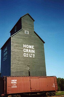
Smoky Lake is a town in central Alberta, Canada. It is located 116 km (72 mi) northeast of Edmonton at the junction of Highway 28 and Highway 855. It lies between the North Saskatchewan River, Smoky Creek and White Earth Creek, in a mainly agricultural area. The provincial historic site of Victoria Settlement is nearby. Long Lake Provincial Park is located 60 km (37 mi) north of the town. The Woods Cree, a First Nations people, named "Smoking Lake" for the smoke from ceremonies performed on the shore; the name Smoky Lake may also be based in the mist that rose from the lake in great quantities at sundown. One of its churches, the St. Onuphrius Ukrainian-Catholic, built in 1907, has been moved to the Canadian Museum of History in Gatineau, Quebec. It is in Census Division No. 12 and is the municipal office for the Smoky Lake County.

Vilna is a historic village in central Alberta, Canada.
Waskatenau is a village in central Alberta, Canada. It is surrounded by Smoky Lake County, approximately 90 km (56 mi) northeast of Edmonton. Waskatenau is a Cree word meaning "opening in the bank" in reference to the clef in the nearby ridge through which the Waskatenau Creek flows. It is pronounced WAS-ET-NA, with a silent "k."
Niton Junction is a hamlet in west-central Alberta, Canada within Yellowhead County. It is located on the Yellowhead Highway approximately 45 kilometres (28 mi) east of Edson and 150 kilometres (93 mi) west of Edmonton. It is east of the Yellowhead Highway's junction with Highway 32 and west of Chip Lake. Niton Junction has an elevation of 845 metres (2,772 ft).
Erskine is a hamlet in Alberta, Canada, within County of Stettler No. 6. Previously an incorporated municipality, Erskine dissolved from village status on May 10, 1946, to become part of the Municipal District of Waverly No. 367.

Smoky Lake County is a municipal district in north-eastern Alberta, Canada. Located in Census Division No. 12, its municipal office is located in the Town of Smoky Lake.
Brule is a hamlet in west-central Alberta, Canada within Yellowhead County. It is located on the northwest shore of Brûlé Lake, approximately 20 kilometres (12 mi) west of Hinton. It has an elevation of 1,040 metres (3,410 ft).
Swalwell is a hamlet in southern Alberta, Canada within Kneehill County. Previously an incorporated municipality, Swalwell dissolved from village status on January 1, 1946, to become part of the Municipal District of Norquay No. 279.
Bezanson is a hamlet in northern Alberta, Canada within the County of Grande Prairie No. 1. It is located approximately 30 kilometres (19 mi) east of Grande Prairie on Highway 43, west of the Smoky River.
Sandy Lake, also known as Pelican Mountain, is a hamlet in Alberta, Canada within the Municipal District of Opportunity No. 17. It is located on Highway 813, between Calling Lake and Wabasca. It has an elevation of 565 metres (1,854 ft).
Warspite is a hamlet in Alberta, Canada within Smoky Lake County. It is located on Highway 28, between the Town of Smoky Lake and Village of Waskatenau. It has an elevation of 655 metres (2,149 ft).
Beaver Lake is a hamlet in northern Alberta, Canada within Lac La Biche County. It is located on the shore of Beaver Lake, 4 kilometres (2.5 mi) east of Highway 36, approximately 116 kilometres (72 mi) northwest of Cold Lake.
Benalto is a hamlet in central Alberta, Canada within Red Deer County. It is located approximately 13 kilometres (8.1 mi) west of the Town of Sylvan Lake. Benalto is also recognized by Statistics Canada as a designated place.
Buck Lake is a hamlet in central Alberta, Canada within the County of Wetaskiwin No. 10. It is located on Highway 13, approximately 109 kilometres (68 mi) southwest of Edmonton. It is located on the shore of Buck Lake.
Cadogan is a hamlet in central Alberta, Canada within the Municipal District of Provost No. 52. Previously an incorporated municipality, Cadogan dissolved from village status on January 1, 1946 to become part of the Municipal District of Hillcrest No. 362.
Fort Kent is a hamlet in central Alberta, Canada within the Municipal District of Bonnyville No. 87, located on Highway 28 approximately 32 kilometres (20 mi) southwest of Cold Lake.
Gregoire Lake Estates is a hamlet in northern Alberta, Canada within the Regional Municipality (RM) of Wood Buffalo. It is located on Highway 881, approximately 30 kilometres (19 mi) southeast of Fort McMurray.
Islay is a hamlet in central Alberta, Canada within the County of Vermilion River. Previously an incorporated municipality, Islay dissolved from village status on March 15, 1944, to become part of the Municipal District of Vermilion Valley No. 482. The community was named after Islay, in Scotland, the ancestral home of pioneer settlers.

Pincher Station, once known as Pincher City, is a hamlet in southern Alberta, Canada within the Municipal District of Pincher Creek No. 9. It is located on Highway 3, approximately 83 kilometres (52 mi) southwest of Lethbridge. Previously an incorporated community, Pincher City dissolved from village status on May 3, 1932.
Ranfurly is a hamlet in central Alberta, Canada within the County of Minburn No. 27. Previously an incorporated municipality, Ranfurly dissolved from village status on January 1, 1946 to become part of the Municipal District of Birch Lake No. 484.