
Bonnyville is a town situated in East Northern Alberta, Canada between Cold Lake and St. Paul. The Municipal District (MD) of Bonnyville No. 87's surrounds the Town.
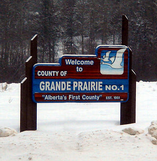
The County of Grande Prairie No. 1 is a municipal district in northwestern Alberta, Canada in Census Division No. 19.
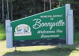
The Municipal District of Bonnyville No. 87 is a municipal district (MD) in northeastern Alberta, Canada in Division No. 12. On the east, it is adjacent to the province of Saskatchewan.

Division No. 2 is a census division in Alberta, Canada. It is located in the south-central portion of southern Alberta and includes the City of Lethbridge.
Division No. 8 is a census division in Alberta, Canada. It is located in the south-central portion of central Alberta and includes the City of Red Deer and surrounding areas. The division forms the central segment of the Calgary–Edmonton Corridor. Division No. 8 is the smallest census division in Alberta according to area.
Division No. 10 is a census division in Alberta, Canada. It is located in the east-central portion of central Alberta and includes Alberta's portion of the City of Lloydminster.
Division No. 13 is a census division in Alberta, Canada. The majority of the division is located in the north-central portion of central Alberta, while the northeast portion of the division is located within northern Alberta. The division's largest urban community is the Town of Whitecourt.
Division No. 19 is a census division in Alberta, Canada. It is located in the west-central portion of northern Alberta and surrounds the City of Grande Prairie.

Smoky Lake is a town in central Alberta, Canada. It is located 116 km (72 mi) northeast of Edmonton at the junction of Highway 28 and Highway 855. It lies between the North Saskatchewan River, Smoky Creek, and White Earth Creek, in a mainly agricultural area. The provincial historic site of Victoria Settlement is nearby. Long Lake Provincial Park is located 60 km (37 mi) north of the town. The Woods Cree, a First Nations people, named "Smoking Lake" for the smoke from ceremonies performed on the shore; the name Smoky Lake may also be based in the mist that rose from the lake in great quantities at sundown. One of its churches, the St. Onuphrius Ukrainian-Catholic, built in 1907, has been moved to the Canadian Museum of History in Gatineau, Quebec. It is in Census Division No. 12 and is the municipal office for the Smoky Lake County.

Lac La Biche County is a specialized municipality within Division No. 12 in northern Alberta, Canada. It was established through the amalgamation of the Town of Lac La Biche and Lakeland County in 2007.

The Municipal District of Greenview No. 16 is a municipal district (MD) in northwest Alberta, Canada. It covers the full extent of Census Division 18, and with an area of 32,984 km2 (12,735 sq mi), it is the largest municipal district in Alberta. Its administrative office is located in the Town of Valleyview.

Lac Ste. Anne County is a municipal district in central Alberta, Canada.

The Municipal District of Smoky River No. 130 is a municipal district (MD) in northwestern Alberta, Canada. Located in Census Division No. 19, its municipal office is located in the Town of Falher.

Smoky Lake County is a municipal district in north-eastern Alberta, Canada. Located in Census Division No. 12, its municipal office is located in the Town of Smoky Lake.
Warspite is a hamlet in Alberta, Canada within Smoky Lake County. It is located on Highway 28, between the Town of Smoky Lake and Village of Waskatenau. It has an elevation of 655 metres (2,149 ft).

Bellis is a hamlet in central Alberta, Canada within Smoky Lake County. Previously an incorporated municipality, Bellis dissolved from village status on January 1, 1946 to become part of the Municipal District of Vilna No. 575.
Fort Kent is a hamlet in central Alberta, Canada within the Municipal District of Bonnyville No. 87, located on Highway 28 approximately 32 kilometres (20 mi) southwest of Cold Lake.

Cold Lake 149 is an Indian reserve of the Cold Lake First Nations in Alberta, located within the Municipal District of Bonnyville No. 87. It is 26 kilometers east of Bonnyville. In the 2016 Canadian Census, it recorded a population of 671 living in 208 of its 222 total private dwellings.

Improvement District No. 349 was an improvement district in northeast Alberta, Canada that existed between January 1, 2012 and May 1, 2021. The improvement district was largely coextensive with the Alberta portion of the Cold Lake Air Weapons Range. On May 1, 2021, the improvement district was annexed by the adjacent Municipal District (MD) of Bonnyville No. 87.
