Lac La Biche County

Last updated
Lac La Biche County
Lac la Biche from Lac La Biche.jpg
Lac La Biche County, Alberta Logo.svg
Motto: 
Welcoming By Nature
AB locator LAC LA BICHE COUNTY.svg
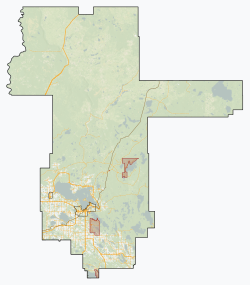
Location within Alberta
Coordinates: 54°46′7″N111°58′50″W / 54.76861°N 111.98056°W / 54.76861; -111.98056
CountryCanada
Province Alberta
Region Northern Alberta
Planning region Lower Athabasca
Incorporated [1]  
   Municipal district August 1, 2007
   Specialized municipality January 1, 2018
Government
[2]
  MayorPaul Reutov
  Governing body
  • Darlene Beniuk
  • Colette Borgun
  • Sterling Johnson
  • George L'Heureux
  • Omer Moghrabi
  • Charlyn Moore
  • Jason Stedman
  • Lorin Tkachuk
Colin Cote
  CAODan Small
   Administrative office Lac La Biche
Area
 (2021) [3]
  Land12,528.25 km2 (4,837.18 sq mi)
Elevation
574 m (1,882 ft)
Population
 (2021) [3]
  Total7,673
  Density0.6/km2 (2/sq mi)
   Municipal census (2016)
8,544 [4]
Time zone UTC−7 (MST)
  Summer (DST) UTC−6 (MDT)
Area code 780
Website laclabichecounty.com

Lac La Biche County is a specialized municipality within Division No. 12 in northern Alberta, Canada. It was established through the amalgamation of the Town of Lac La Biche and Lakeland County in 2007.

Contents

History

Lac La Biche County was originally established as a municipal district on August 1, 2007 through the amalgamation of Lakeland County with the Town of Lac La Biche. Its predecessor municipal district, Lakeland County, was originally incorporated on July 1, 1998, formed from the northwestern part of the Municipal District of Bonnyville No. 87. [5] Lac La Biche County converted from municipal district status to specialized municipality status on January 1, 2018. [6]

Geography

Lac La Biche County is in northeast Alberta. [7] It borders the Regional Municipality (RM) of Wood Buffalo to the north; the Municipal District (MD) of Bonnyville No. 87 to the east (including the Cold Lake Air Weapons Range); the County of St. Paul No. 19 and Smoky Lake County to the south; the Kikino Metis Settlement and the Buffalo Lake Metis Settlement to the southwest; and Athabasca County and the MD of Opportunity No. 17 to the west. [7] The eponymous lake, Lac la Biche, is in the southwest portion of Lac La Biche County while the Athabasca River forms the municipal boundary between it and the MD of Opportunity No. 17. [7] Other water bodies include Beaver Lake, Pinehurst Lake, Seibert Lake, Touchwood Lake, and Winefred Lake (also partially within the RM of Wood Buffalo and the MD of Bonnyville No. 87). [7]

Communities and localities

The following localities are located within Lac La Biche County. [9]

Localities

The Lac La Biche Settlement is also within Lac La Biche County. [7]

First Nations have the following Indian reserves within Lac La Biche County. [7]

Indian reserves

Demographics

Federal census
population history
YearPop.±%
2006 9,123    
2011 8,402−7.9%
2016 8,330−0.9%
2021 7,673−7.9%
Source: Statistics Canada [10] [11] [3]

In the 2021 Census of Population conducted by Statistics Canada, Lac La Biche County had a population of 7,673 living in 2,949 of its 3,777 total private dwellings, a change of

The population of Lac La Biche County according to its 2019 municipal census is 8,654, [12] a

In the 2016 Census of Population conducted by Statistics Canada, Lac La Biche County had a population of 8,330 living in 3,076 of its 3,998 total private dwellings, a

Economy

Lac La Biche County's economy is based on the oil and gas industry, agriculture, and tourism. Some sawmills are also present.

Attractions

The following provincial protected areas are within Lac La Biche County. [7]

Other attractions include Lac La Biche Mission, the Lac La Biche Golf and Country Club, and the following campgrounds.[ citation needed ]

Community halls in Lac La Biche County include Craigend, Hylo, Owl River, Plamondon, and Rich Lake.[ citation needed ]

Infrastructure

Transportation

Air

The full air-service Lac La Biche Airport is located west of the Hamlet of Lac La Biche, 0.7 km (0.43 mi) north of Highway 55. The airstrip is 5,700 ft (1,700 m) in length and 100 ft (30 m) wide and can accommodate 737 jets. Numerous carriers offer scheduled charter flights out of the airport. Alberta Air Spray Wildfire protection also uses the airstrip as a base accommodating large water tankers.

Rail

A rail line bisects Lac La Biche County, running through the hamlets of Hylo, Venice, and Lac La Biche. [7] The rail line is operated by Canadian National.

Roads

The following provincial highways service Lac La Biche County. [7]

Education

Northern Lights School Division No. 69

Lakeland Catholic Schools

Conseil Centre-Est

Media

Newspapers

Lac La Biche County is served by the weekly Lac La Biche Post and the Town and Country.

Radio

Two FM radio stations broadcast out of Lac La Biche – BOOM (CILB FM 103.5) and Aboriginal Radio (CFWE FM 89.9).

See also

Related Research Articles

<span class="mw-page-title-main">Regional Municipality of Wood Buffalo</span> Municipality in Alberta, Canada

The Regional Municipality of Wood Buffalo is a specialized municipality in northeast Alberta, Canada. It is the largest municipality in North America by area and is home to oil sand deposits known as the Athabasca oil sands.

<span class="mw-page-title-main">Bonnyville</span> Town in Alberta, Canada

Bonnyville is a town situated in East Northern Alberta, Canada between Cold Lake and St. Paul. The Municipal District (MD) of Bonnyville No. 87's surrounds the Town.

<span class="mw-page-title-main">Lac La Biche, Alberta</span> Urban service area in Alberta, Canada

Lac La Biche is a hamlet in Lac La Biche County within northeast Alberta, Canada. It is located approximately 220 km (140 mi) northeast of the provincial capital of Edmonton. Previously incorporated as a town, Lac La Biche amalgamated with Lakeland County to form Lac La Biche County on August 1, 2007.

<span class="mw-page-title-main">Municipal District of Bonnyville No. 87</span> Municipal district in Alberta, Canada

The Municipal District of Bonnyville No. 87 is a municipal district (MD) in northeastern Alberta, Canada in Division No. 12. On the east, it is adjacent to the province of Saskatchewan.

Plamondon is a hamlet in northern Alberta, Canada within Lac La Biche County. It is located on Highway 858, approximately 3.0 km (1.9 mi) north of Highway 55, and has an elevation of 555 m (1,821 ft).

<span class="mw-page-title-main">Division No. 12, Alberta</span> Census division in Alberta, Canada

Division No. 12 is a census division in Alberta, Canada. Including the City of Cold Lake, the majority of the division is located in the northeast corner of central Alberta. The northern portion of the division is located within northern Alberta.

<span class="mw-page-title-main">Lac Ste. Anne County</span> Municipal district in Alberta, Canada

Lac Ste. Anne County is a municipal district in central Alberta, Canada.

<span class="mw-page-title-main">Municipal District of Opportunity No. 17</span> Municipal district in Alberta, Canada

The Municipal District of Opportunity No. 17 is a municipal district (MD) occupying a remote area in central northern Alberta, Canada. Located in Census Division 17 north of the Town of Athabasca, its municipal office is located in the Hamlet of Wabasca.

<span class="mw-page-title-main">Atmore, Alberta</span> Hamlet in Alberta, Canada

Atmore is a hamlet in Alberta, Canada within Athabasca County. It is located 1 km (0.62 mi) east of the junction of Highway 55 and Highway 63, 43 km (27 mi) west of Lac La Biche, 54 km (34 mi) east of Athabasca and 250 km (160 mi) south of Fort McMurray.

<span class="mw-page-title-main">Lakeland County</span> Dissolved municipal district in Alberta, Canada

Lakeland County was a municipal district in northern Alberta, Canada. It existed for just over nine years from 1998 to 2007.

Beaver Lake is a hamlet in northern Alberta, Canada within Lac La Biche County. It is located on the shore of Beaver Lake, 4 kilometres (2.5 mi) east of Highway 36, approximately 116 kilometres (72 mi) northwest of Cold Lake.

Hylo is a hamlet in northern Alberta, Canada within Lac La Biche County. It is located approximately 16 kilometres (9.9 mi) south of Highway 55 and 133 kilometres (83 mi) west of Cold Lake.

Venice is a hamlet in northern Alberta, Canada within Lac La Biche County. It is located approximately 11 kilometres (6.8 mi) west of Highway 55 and 130 kilometres (81 mi) northwest of Cold Lake.

<span class="mw-page-title-main">Gift Lake Metis Settlement</span> Metis Settlement in Alberta, Canada

Gift Lake Metis Settlement is a Metis settlement in northern Alberta, Canada within Big Lakes County. It is located along Highway 750, approximately 203 km (126 mi) northeast of Grande Prairie.

<span class="mw-page-title-main">Improvement District No. 349</span> Former improvement district in Alberta, Canada

Improvement District No. 349 was an improvement district in northeast Alberta, Canada that existed between January 1, 2012 and May 1, 2021. The improvement district was largely coextensive with the Alberta portion of the Cold Lake Air Weapons Range. On May 1, 2021, the improvement district was annexed by the adjacent Municipal District (MD) of Bonnyville No. 87.

<span class="mw-page-title-main">2016 Alberta municipal censuses</span>

Alberta has provincial legislation allowing its municipalities to conduct municipal censuses between April 1 and June 30 inclusive. Due to the concurrency of Statistics Canada conducting the Canada 2016 Census in May 2016, the Government of Alberta offered municipalities the option to alter their 2016 municipal census timeframes to either March 1 through May 31 or May 1 through July 31. Municipalities choose to conduct their own censuses for multiple reasons such as to better inform municipal service planning and provision, to capitalize on per capita based grant funding from higher levels of government, or to simply update their populations since the last federal census.

References

  1. "Location and History Profile: Lac La Biche County" (PDF). Alberta Municipal Affairs. December 29, 2017. p. 166. Retrieved December 31, 2017.
  2. "Municipal Officials Search". Alberta Municipal Affairs. May 9, 2019. Retrieved October 1, 2021.
  3. 1 2 3 4 "Population and dwelling counts: Canada, provinces and territories, and census subdivisions (municipalities)". Statistics Canada. February 9, 2022. Retrieved February 9, 2022.
  4. 1 2 3 2016 Municipal Affairs Population List (PDF). Alberta Municipal Affairs. ISBN   978-1-4601-3127-5 . Retrieved January 28, 2017.
  5. "Lac La Biche County". Alberta Municipal Affairs. August 2007. Retrieved November 9, 2007.
  6. "O.C. 259/2017". Government of Alberta. September 14, 2017. Retrieved October 11, 2017.
  7. 1 2 3 4 5 6 7 8 9 2021 Provincial Base Map: Municipalities (PDF) (Map). Alberta Environment and Parks. July 26, 2021. Retrieved October 19, 2021.
  8. 1 2 "Specialized and Rural Municipalities and Their Communities" (PDF). Alberta Municipal Affairs. January 12, 2022. Retrieved January 21, 2022.
  9. "Standard Geographical Classification (SGC) 2006, Economic Regions: 4812005 - Lakeland County, geographical codes and localities, 2006". Statistics Canada. 2010-03-05. Retrieved 2012-08-11.
  10. "Population and dwelling counts, for Canada, provinces and territories, and census subdivisions (municipalities), 2011 and 2006 censuses (Alberta)". Statistics Canada. February 8, 2012. Retrieved February 8, 2012.
  11. 1 2 "Population and dwelling counts, for Canada, provinces and territories, and census subdivisions (municipalities), 2016 and 2011 censuses – 100% data (Alberta)". Statistics Canada. February 8, 2017. Retrieved February 8, 2017.
  12. 1 2 2019 Municipal Affairs Population List (PDF). Alberta Municipal Affairs. December 2019. ISBN   978-1-4601-4623-1 . Retrieved July 1, 2021.