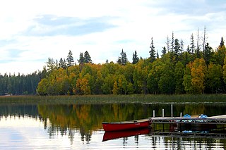
Carson-Pegasus Provincial Park is a provincial park located in central Alberta, Canada, within Woodlands County.

Chain Lakes Provincial Park is a provincial park located in the foothills of the Rocky Mountains west of Nanton, Alberta, Canada. It was established along the Chain Lakes Reservoir. The Cowboy Trail runs along the eastern boundary of the park. The park is located 1 1/2 hours southeast of Calgary and about the same distance from Lethbridge to the southeast.

Cold Lake Provincial Park is a provincial park in northeastern Alberta, Canada.
Garner Lake Provincial Park is a provincial park around Garner Lake in Alberta, Canada.

Gregoire Lake Provincial Park is a provincial park in Alberta, Canada. It is located close to Highway 63, between Fort McMurray and Lac La Biche, on the northern shore of Gregoire Lake.

Little Fish Lake Provincial Park is a provincial park in Alberta, Canada, located 43 km (27 mi) east of Drumheller on the shore of Little Fish Lake.
Park Lake Provincial Park is a provincial park located in Alberta, Canada, 18 km (11 mi) north of Lethbridge.

Winagami Lake Provincial Park is a provincial park in Alberta, Canada, located on three sides of Winagami Lake and accessible from Highway 2, about 30 km north of High Prairie. The park was established on November 13, 1956.

Thunder Lake Provincial Park is a provincial park located in Alberta, Canada, and is located 140 kilometres (87 mi) west of Edmonton, on the shore of the park features setting for boating, water-skiing, swimming, running, fishing and camping. Thunder lake is approximately 21 kilometres (13 mi) West of the nearest town, Barrhead.
Elbow-Sheep Wildland Provincial Park is a provincial park and wildlife reserve located in the Kananaskis Country in south-western Alberta, Canada. It is within the Canadian Rocky Mountains.

Sylvan Lake Park, previously Sylvan Lake Provincial Park, is an urban park in the Town of Sylvan Lake on the southern shore of Sylvan Lake in central Alberta, Canada. Prior to early 2018, it existed a provincial park for 38 years until its ownership was transferred to the Town of Sylvan Lake. The park averages 761,223 visitors every July and August.
Sylvan Lake is a large lake in central Alberta, Canada. The resort town of Sylvan Lake is established on the shores of the lake, west of the city of Red Deer.

Barrier Lake is a man-made reservoir at the north end of Kananaskis Country in Alberta, Canada.
Crow Lake Provincial Park is a provincial park in Alberta, Canada. It is located on the northern and western shore of Crow Lake, along Highway 63, 130 kilometres (81 mi) south of Fort McMurray and 154 kilometres (96 mi) north of Lac La Biche.

Dillberry Lake Provincial Park is a provincial park in Alberta, Canada, located 43 km (27 mi) north from Provost and 17 km (11 mi) south of Chauvin along Highway 17.

Obed Lake Provincial Park is a provincial park in Alberta, Canada, located 49 kilometres (30 mi) west of Edson and 37 kilometres (23 mi) east of Hinton, on the north side of the Yellowhead Highway.
Pierre Grey's Lakes Provincial Park is a provincial park in Alberta, Canada, located 37 km (23 mi) east of Grande Cache, on the north side of the Bighorn Highway.
Rock Lake Provincial Park is a provincial park in Alberta, Canada, located on the shores of Rock Lake, 64 km (40 mi) north-west from Hinton, north on the Bighorn Highway and 39 km west on an access road.
Two Lakes Provincial Park is a provincial park in Alberta, Canada, located 142 km (88 mi) south of Grande Prairie, 65 km (40 mi) south of Highway 666 and an additional 77 km (48 mi) south on forestry roads, where 4WD is recommended for access.
Fortress Pass is a mountain pass that crosses the continental divide in the Canadian Rockies, south of Jasper, Alberta. At 1,335 metres (4,380 ft), Fortress Pass is one of the lowest passes to cross the Canadian Rockies that is not traversed by a road. In addition to being at a low elevation, Fortress Pass is also relatively gentle, with almost no elevation difference between water bodies on either side.


