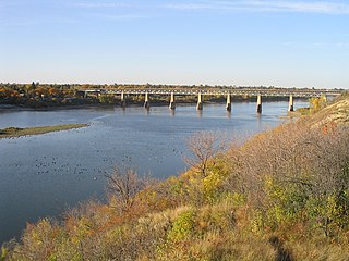
The Saskatchewan River is a major river in Canada. It stretches about 550 kilometres (340 mi) from where it is formed by the joining of the North Saskatchewan River and South Saskatchewan River just east of Prince Albert, Saskatchewan, to Lake Winnipeg. It flows roughly eastward across Saskatchewan and Manitoba to empty into Lake Winnipeg. Through its tributaries the North Saskatchewan and South Saskatchewan, its watershed encompasses much of the prairie regions of Canada, stretching westward to the Rocky Mountains in Alberta and north-western Montana in the United States.
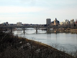
The South Saskatchewan River is a major river in the Canadian provinces of Alberta and Saskatchewan. The river begins at the confluence of the Bow and Oldman Rivers in southern Alberta and ends at the Saskatchewan River Forks in central Saskatchewan. The Saskatchewan River Forks is the confluence of the South and North Saskatchewan Rivers and is the beginning of the Saskatchewan River.

The Yellowhead Highway is a major interprovincial highway in Western Canada that runs from Winnipeg to Graham Island off the coast of British Columbia via Saskatoon and Edmonton. It stretches across the four western Canadian provinces of British Columbia, Alberta, Saskatchewan, and Manitoba and is part of the Trans-Canada Highway system and the larger National Highway System, but should not be confused with the more southerly, originally-designated Trans-Canada Highway. The highway was officially opened in 1970. Beginning in 1990, the green and white Trans-Canada logo is used to designate the roadway.
The vastness of Canada's Northwest Territories meant that for much of its history it was divided into several districts for ease of administration. The number and size of these territorial districts varied as other provinces and territories of Canada were created and expanded. The districts of the Northwest Territories were abolished in 1999 with the creation of the Nunavut territory and the contraction of the Northwest Territories to its current size.

The Canadian Junior Football League (CJFL) is a national Major Junior Canadian football league consisting of 19 teams playing in five provinces across Canada. The teams compete annually for the Canadian Bowl. Many CJFL players move on to professional football careers in the Canadian Football League (CFL) and elsewhere.

The Western Canadian Baseball League (WCBL) is a collegiate summer baseball league. The league is home to teams based in the Canadian Prairie provinces of Saskatchewan and Alberta, and has roots dating back to 1931 in Saskatchewan's Southern Baseball League. In 1975, the province's southern and northern leagues merged, creating the foundation for the WCBL. Today, the league boasts seven teams in Alberta and five in Saskatchewan.
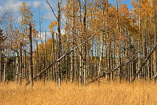
Aspen parkland refers to a very large area of transitional biome between prairie and boreal forest in two sections, namely the Peace River Country of northwestern Alberta crossing the border into British Columbia, and a much larger area stretching from central Alberta, all across central Saskatchewan to south central Manitoba and continuing into small parts of the US states of Minnesota and North Dakota. Aspen parkland consists of groves of aspen, poplar and spruce, interspersed with areas of prairie grasslands, also intersected by large stream and river valleys lined with aspen-spruce forests and dense shrubbery. This is the largest boreal-grassland transition zone in the world and is a zone of constant competition and tension as prairie and woodlands struggle to overtake each other within the parkland.

Saskatoon Island Provincial Park is a provincial park located in northern Alberta, Canada. It is located 20 kilometers (12 mi) west of Grande Prairie in the Peace River Country, on the southern shore of Saskatoon Lake.
Rawlco Radio Ltd. is a media company based in Saskatoon, Saskatchewan, Canada. The company is the sole proprietor of seven radio stations in the provinces of Alberta and Saskatchewan.
Highway 27 is a provincial highway in the Canadian province of Saskatchewan. The highway runs from Highway 41 west of Aberdeen east to Highway 2 near the western shore of Muskiki Lake. It is about 34 kilometres (21 mi) long.
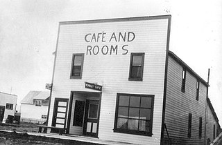
Wembley is a town in northern Alberta, Canada. It is approximately 23 km (14 mi) west of Grande Prairie at the junction of Highway 43 and Highway 724.

Shaw Spotlight was the name of locally based community channel services operated by cable TV provider Shaw Communications. The channels are available only to Shaw Cable subscribers and are produced in communities throughout western Canada.

Highway 5 is a major highway in the Canadian province of Saskatchewan. It begins in downtown Saskatoon and runs eastward to the Manitoba border near Togo, where it becomes Provincial Road 363. The highway is approximately 393 kilometres (244 mi) long. Between the early 1900s (decade) and 1976, Provincial Highway 5 was a trans-provincial highway travelling approximately 630 kilometres (390 mi) in length. At this time it started at the Alberta border in Lloydminster and traveled east to the Manitoba border.
Highway 12 is a major highway in the Canadian province of Saskatchewan. It begins in Saskatoon at the intersection of Idylwyld Drive and Highway 11 north, initially running north on Idylwyld Drive concurrently with Highway 11 and Highway 16. Just outside Saskatoon's northern city limits, Highway 11 exits northeast from Idylwyld Drive and Highway 12 begins and travels north, passing through the city of Martensville. Highway 12 cross the North Saskatchewan River over Petrofka Bridge and passes through the town of Blaine Lake and intersects highway Highway 40, finally terminating at Highway 3 near Shell Lake. Highway 12 is about 135 km (84 mi) long.
Expenditures by federal and provincial organizations on scientific research and development accounted for about 10% of all such spending in Canada in 2006. These organizations are active in natural and social science research, engineering research, industrial research and medical research.
This is a list of elections in Canada in 2009. Included are provincial, municipal and federal elections, by-elections on any level, referendums and party leadership races at any level.

Alberta Parks is an agency of the Government of Alberta which is responsible for managing Alberta's provincial parks and protected areas.
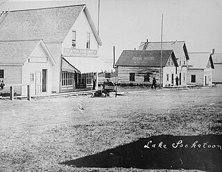
Lake Saskatoon is a locality in northwest Alberta, Canada within the County of Grande Prairie No. 1. It is approximately 18 km (11 mi) northwest of Grande Prairie.
This page is based on this
Wikipedia article Text is available under the
CC BY-SA 4.0 license; additional terms may apply.
Images, videos and audio are available under their respective licenses.


