List of lakes of Alberta

Last updated

Peyto Lake from lookout Peyto Lake from Lookout.jpg
Peyto Lake from lookout
Lake Agnes Lake Agnes AB.jpg
Lake Agnes
Amethyst Lakes & ramparts Amethyst Lakes & Tonquin Valley Ramparts.jpg
Amethyst Lakes & ramparts
Barrier Lake Barrier Lake Kananaskis Aerial.jpg
Barrier Lake
Bow Lake Canada Alberta Bow-Lake.jpg
Bow Lake
Cold Lake Cold Lake featuring Kinosoo Beach.jpg
Cold Lake
Fish Lakes (1 of 2) Fish Lakes by Molar Mtn.jpg
Fish Lakes (1 of 2)
Glacier Lake Glacier Lake in Banff N.P.jpg
Glacier Lake
Glenmore Reservoir Calgary downtown from glenmore reservoir.JPG
Glenmore Reservoir
Upper and Lower Kananaskis Lakes Kananaskis Lakes aerial1.jpg
Upper and Lower Kananaskis Lakes
Lesser Slave Lake SW Lesser Slave Lake.jpg
Lesser Slave Lake
Lake Louise Lake Louise 17092005.jpg
Lake Louise
Maligne Lake Canada Boat House am Maligne Lake, Jasper NP, Alberta, CA.jpg
Maligne Lake
Lake Minnewanka Lake Minnewanka 11092005.jpg
Lake Minnewanka
Moose Lake Moose Lake Sunset.JPG
Moose Lake
Ice fishing on Pigeon Lake Ice fishing shacks on Pigeon Lake at Pigeon Lake Provincial Park, Alberta.jpg
Ice fishing on Pigeon Lake
Vermilion Lakes VermillionLakes2001-09-28.jpg
Vermilion Lakes
Waterton Lake Canada 39 bg 061904.jpg
Waterton Lake

This is a list of lakes of Alberta , Canada.

Most of Alberta's lakes were formed during the last glaciation, about 12,000 years ago. There are many different types of lakes in Alberta, from glacial lakes in the Canadian Rockies to small shallow lakes in the prairies, brown water lakes in the northern boreal forest and muskeg, kettle holes and large lakes with sandy beaches and clear water in the central plains.

Contents

Distribution of the lakes throughout the province of Alberta is irregular, with many water bodies in the wet boreal plains in the north, and very few in the semi-arid Palliser's Triangle in the southeast. [1]

River basins

Most of Alberta's waters are drained in a general north or northeastern direction, with six major rivers forming four major watersheds collecting the water and removing it from the province: [2]

As with other basins on the planet, the topographical highlights in the drainage divides between these basins can be difficult to discern. For example, there is little elevation change in the short 4 kilometres (2.5 mi) of land between Lac la Biche and Beaver Lake, yet the former is in a watershed that drains north into the Arctic Ocean, while the latter is in a watershed that drains east into Hudson Bay.

Largest lakes

Lake Athabasca is the largest lake in both Alberta and Saskatchewan. This 7,850 km2 (3,030 sq mi) lake has 2,295 km2 (886 sq mi) of its surface area in Alberta and 5,555 km2 (2,145 sq mi) in Saskatchewan.

The largest lake completely within Alberta is Lake Claire, at 1,436 km2 (554 sq mi). Lake Claire is just west of Lake Athabasca, with both located in the remote Peace-Athabasca Delta.

This section provides a list of lakes of Alberta with an area larger than 100 km2 (39 sq mi). [1] [4] [5]

Alberta lakes larger than 100 km2 (39 sq mi)
LakeArea (including islands)ElevationDepth max.Volume
Lake Athabasca [4] 7,850 km2 (3,030 sq mi)213 m (699 ft)124 m (407 ft)204 km3 (49 cu mi)
Lake Claire [4] 1,436 km2 (554 sq mi)213 m (699 ft)
Lesser Slave Lake [6] [4] 1,160 km2 (450 sq mi)578 m (1,896 ft)20.5 m (67 ft)13.69 km3 (3.28 cu mi)
Bistcho Lake 426 km2 (164 sq mi)552 m (1,811 ft)6.7 m (22 ft)
Cold Lake 373 km2 (144 sq mi)535 m (1,755 ft)99.1 m (325 ft)
Utikuma Lake 288 km2 (111 sq mi)641 m (2,103 ft)5.5 m (18 ft)
Lac la Biche 234 km2 (90 sq mi)544 m (1,785 ft)21.3 m (70 ft)
Beaverhill Lake 139 km2 (54 sq mi)668 m (2,192 ft)2.3 m (7.5 ft)
Calling Lake 138 km2 (53 sq mi)529 m (1,736 ft)18.3 m (60 ft)
Pakowki Lake 123 km2 (47 sq mi)860 m (2,820 ft)
Winefred Lake 123 km2 (47 sq mi)594 m (1,949 ft)15.3 m (50 ft)

List of lakes

This section provides a list of numerous lakes of Alberta, including the "large" ones shown in the previous section.

Note that the lakes are listed alphabetically by their main name, dropping any leading "lake", "lac", "lac la", "upper/lower", "north/south". For example, Lac la Nonne (the nun lake) is entered under "N". If desired, using the table sort function will give the list sorted by the leading word.

Lake  Watershed  Basin  Area (km²)  Remarks  
Abraham Lake North Saskatchewan River Hudson Bay 53.7man-made reservoir
Adolphus Lake Smoky River Arctic Ocean 0.18a contributing headwater mountain glacial lake
Lake Agnes Bow River Hudson Bay 0.52a contributing headwater mountain glacial lake
Amisk Lake Beaver River Hudson Bay 5.3 
Angle Lake North Saskatchewan RiverHudson Bay 
Lake Annette Athabasca River Arctic Ocean a contributing headwater mountain glacial lake
Lake Athabasca Slave River Arctic Ocean7,850two thirds in Saskatchewan
Baptiste Lake Athabasca RiverArctic Ocean9.8 
Barreyre Lake
Barrier Lake Kananaskis River Hudson Bay2.6man-made reservoir
Battle Lake Battle River Hudson Bay4.6 
Baxter Lakes
Bearhills Lake Battle River Hudson Bay
Beauvais Lake Oldman River Hudson Bay0.9 
Beauvert Lake Athabasca RiverArctic Ocean0.4 
Beaver Lake Beaver RiverHudson Bay33.1 
Beaverhill Lake North Saskatchewan RiverHudson Bay139Beaverhill Natural Area is part of Western Hemisphere Shorebird Reserve Network.
Lac la Biche Beaver RiverHudson Bay236 
Big Lake Sturgeon River Hudson Bay 21.4 
Bistcho Lake Petitot River Arctic Ocean426 
Bonnie Lake North Saskatchewan River Hudson Bay3.77 
Bourgeau Lake     
Bow Lake Bow River Hudson Bay3.21a contributing headwater mountain glacial lake
Brander Lake
Brokenleg Lake
Buck Lake North Saskatchewan RiverHudson Bay25.4 
Brûlé Lake Athabasca River Arctic Ocean14.5lake is formed along the Athabasca River
Buffalo Lake Red Deer River Hudson Bay93.5 
Calling Lake Athabasca River Arctic Ocean 134 
Cardinal Lake Peace River Arctic Ocean50 
Chester Lake Spray River Hudson Bay 0.51a contributing headwater mountain glacial lake
Chestermere Lake Bow River Hudson Bay 2.7man-made reservoir
Chip Lake Lobstick River Arctic Ocean73
Christina Lake Athabasca RiverArctic Ocean21.3 
Lake Claire Peace RiverArctic Ocean1,436largest lake completely in Alberta
Coal Lake Battle River Hudson Bay 10.9 ribbon lake
Cold Lake Beaver RiverHudson Bay373partly in Saskatchewan
Crawling Valley Reservoir South Saskatchewan River Hudson Bay25.1man-made reservoir
Dowling Lake
Driedmeat Lake Battle River Hudson Bay16.5ribbon lake
Elbow Lake Elbow River Hudson Bay0.53 
Elkwater Lake South Saskatchewan RiverHudson Bay2.31 
Ethel Lake Cold RiverHudson Bay 
Ewing Lake
Formby Lake
Frank Lake South Saskatchewan RiverHudson Bay43.74 
Gadsby Lake
Ghost Lake Bow RiverHudson Bay11.6man-made reservoir
Glacier Lake North Saskatchewan RiverHudson Bay2.5a contributing headwater mountain glacial lake
Gleniffer Lake Red Deer RiverHudson Bay17.6man-made reservoir
Glenmore Reservoir Elbow RiverHudson Bay3.8man-made reservoir
Gull Lake Red Deer RiverHudson Bay80.6 
Headwall Lakes Kananaskis River Hudson Bay0.66contributing headwater mountain glacial lakes (0.45+0.21 km²)
Hector Lake Bow River Hudson Bay 5.23a contributing headwater mountain glacial lake
Hidden Lake Bow RiverHudson Bay0.4a contributing headwater mountain glacial lake
Hoselaw Lake North Saskatchewan River Hudson Bay 0.4
Hutch Lake
Ipiatik Lake
Isle Lake North Saskatchewan RiverHudson Bay23known locally as Lake Isle
Jessie Lake Beaver River Hudson Bay5.5 
Kinikinik Lake Peace River Arctic Ocean 
Lower Kananaskis Lake Kananaskis River Hudson Bay6.0original lake expanded as man-made reservoir
Upper Kananaskis Lake Kananaskis RiverHudson Bay8.4original lake expanded as man-made reservoir
Lessard Lake 3.21
Lesser Slave Lake Lesser Slave River Arctic Ocean 1,160second largest lake completely in Alberta
Lake Louise Bow RiverHudson Bay0.8a contributing headwater mountain glacial lake
Maligne Lake Athabasca River Arctic Ocean 19.7a contributing headwater mountain glacial lake
Lower Mann Lake Beaver River closed basin 5.10
Upper Mann Lake Beaver Riverclosed basin4.59
McGregor Lake Bow RiverHudson Bay51.4 reservoir
Medicine Lake Athabasca River Arctic Ocean3.7 
Milk Reservoir Milk River Gulf of Mexico 14man-made reservoir
Lake Minnewanka Bow River Hudson Bay21.5a contributing headwater mountain glacial lake enlarged by dam
Moose Lake Beaver RiverHudson Bay40.8 
Moraine Lake Bow RiverHudson Bay0.5a contributing headwater mountain glacial lake
Muriel Lake Beaver Riverclosed basin64.1 
Musreau Lake Kakwa River Hudson Bay5.49 
Nakamun Lake Toad CreekHudson Bay3.54 
Lake Newell Bow River Hudson Bay 66.4man-made reservoir
Lac la Nonne Pembina River Arctic Ocean12.28 
Pakowki Lake Milk River Gulf of Mexico 123.7largest lake in Southern Alberta
Peerless Lake Peace RiverArctic Ocean82.6 
Peyto Lake Mistaya River Hudson Bay1.4a contributing headwater mountain glacial lake
Pigeon Lake Battle RiverHudson Bay96.7 
Pinehurst Lake Sand River Hudson Bay40.7 
Primrose Lake Beaver River Hudson Bay 17.7Most of the lake's surface area 444 km2 (171 sq mi) is located in Saskatchewan.
Pyramid Lake Athabasca River Arctic Ocean1.2 
Rattlesnake Lake South Saskatchewan River Hudson Bay10.7 
Red Deer Lake Battle River Hudson Bay21 
Lac Sante Hudson Bay
Saskatoon Lake Peace RiverArctic Ocean7.47 
Sikome Lake Bow River Hudson Bay 0.4man-made recreation lake in Calgary
Skeleton Lake Beaver River Hudson Bay 7.89 
Spray Lakes Bow River Hudson Bay 19.9man-made reservoir that was previously a string of lakes
Lac Ste. Anne North Saskatchewan River Hudson Bay54.5 
Sauer Lake
Steele Lake Athabasca RiverArctic Ocean6.61formerly named Cross Lake because of its shape
Sturgeon Lake Smoky River Arctic Ocean49.1 
Sylvan Lake Red Deer RiverHudson Bay42.8 
Telford Lake North Saskatchewan RiverHudson Bay13
Thunder Lake Athabasca RiverArctic Ocean7.03 
Touchwood Lake Beaver RiverHudson Bay29 
Tucker Lake 6.65
Twin Lake 24ha
Utikuma Lake Peace River Arctic Ocean295 
Vermilion Lakes Bow River Hudson Bay 0.48a string of three lakes along the Bow River
Wabamun Lake North Saskatchewan River Hudson Bay81.8 
North Wabasca Lake Wabasca River Arctic Ocean101.4 [7]
South Wabasca Lake Wabasca RiverArctic Ocean61.6
Waterton Lake Oldman River Hudson Bay11.6partly in Montana
Willow Lake Athabasca RiverArctic Ocean25.8 
Winagami Lake Athabasca River Arctic Ocean46.7 
Winefred Lake Clearwater River Arctic Ocean122.8 
Wizard Lake North Saskatchewan River Hudson Bay2.48 
Wolf Lake Beaver River Hudson Bay31.5 
Zama Lake Hay River Arctic Ocean55.5 

See also

Related Research Articles

<span class="mw-page-title-main">Geography of Canada</span>

Canada has a vast geography that occupies much of the continent of North America, sharing a land border with the contiguous United States to the south and the U.S. state of Alaska to the northwest. Canada stretches from the Atlantic Ocean in the east to the Pacific Ocean in the west; to the north lies the Arctic Ocean. Greenland is to the northeast with a shared border on Hans Island. To the southeast Canada shares a maritime boundary with France's overseas collectivity of Saint Pierre and Miquelon, the last vestige of New France. By total area, Canada is the second-largest country in the world, after Russia. By land area alone, however, Canada ranks fourth, the difference being due to it having the world's largest proportion of fresh water lakes. Of Canada's thirteen provinces and territories, only two are landlocked while the other eleven all directly border one of three oceans.

<span class="mw-page-title-main">Continental Divide of the Americas</span> Principal hydrological divide of North and South America

The Continental Divide of the Americas is the principal, and largely mountainous, hydrological divide of the Americas. The Continental Divide extends from the Bering Strait to the Strait of Magellan, and separates the watersheds that drain into the Pacific Ocean from those river systems that drain into the Atlantic and Arctic Ocean, including those that drain into the Gulf of Mexico, the Caribbean Sea, and Hudson Bay.

<span class="mw-page-title-main">Mackenzie River</span> Largest river system in Canada

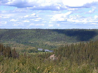
The Mackenzie River is a river in the Canadian boreal forest. It forms, along with the Slave, Peace, and Finlay, the longest river system in Canada, and includes the second largest drainage basin of any North American river after the Mississippi.

<span class="mw-page-title-main">Geography of Alberta</span>

Alberta is one of the thirteen provinces and territories of Canada. Located in Western Canada, the province has an area of 661,190 km2 (255,290 sq mi) and is bounded to the south by the United States state of Montana along 49° north for 298 km (185 mi); to the east at 110° west by the province of Saskatchewan for 1,223 km (760 mi); and at 60° north the Northwest Territories for 644 km (400 mi). The southern half of the province borders British Columbia along the Continental Divide of the Americas on the peaks of the Rocky Mountains, while the northern half borders British Columbia along the 120th meridian west. Along with Saskatchewan it is one of only two landlocked provinces or territories.

<span class="mw-page-title-main">Lake Athabasca</span> Lake in Western Canada

Lake Athabasca is in the north-west corner of Saskatchewan and the north-east corner of Alberta between 58° and 60° N in Canada. The lake is 26% in Alberta and 74% in Saskatchewan.

<span class="mw-page-title-main">Athabasca, Alberta</span> Town in Alberta, Canada

Athabasca, originally named Athabasca Landing, is a town in northern Alberta, Canada. It is located 145 km (90 mi) north of Edmonton at the intersection of Highway 2 and Highway 55, on the banks of the Athabasca River. It is the centre of Athabasca County. It was known as Athabasca Landing prior to August 4, 1913.

<span class="mw-page-title-main">Churchill River (Hudson Bay)</span> River in Manitoba and Saskatchewan, Canada

The Churchill River is a major river in Alberta, Saskatchewan and Manitoba, Canada. From the head of the Churchill Lake it is 1,609 kilometres (1,000 mi) long. It was named after John Churchill, 1st Duke of Marlborough and governor of the Hudson's Bay Company from 1685 to 1691.

The Fond du Lac River is one of the upper branches of the Mackenzie River system, draining into the Arctic Ocean, located in northern Saskatchewan, Canada. The river is 277 kilometres (172 mi) long, has a watershed of 66,800 km2 (25,800 sq mi), and its mean discharge is 300 m3/s (11,000 cu ft/s).

<span class="mw-page-title-main">Clearwater River (Saskatchewan)</span> River in Western Canada

The Clearwater River is located in the Canadian provinces of Saskatchewan and Alberta. It rises in the northern forest region of north-western Saskatchewan and joins the Athabasca River in north-eastern Alberta. It was part of an important trade route during the fur trade era and has been designated as a Canadian Heritage River.

<span class="mw-page-title-main">Triple Divide Peak (Montana)</span> Mountain in Montana, United States. Located at the hydrological apex of North America.

Triple Divide Peak is located in the Lewis Range, part of the Rocky Mountains in North America. The peak is a feature of Glacier National Park in the state of Montana in the United States. The summit of the peak, the hydrological apex of the North American continent, is the point where two of the principal continental divides in North America converge, the Continental Divide of the Americas and the Northern or Laurentian Divide.

<span class="mw-page-title-main">Westlock County</span> Municipal district in Alberta, Canada

Westlock County is a municipal district in central Alberta, Canada that is north of Edmonton. The county was formerly known as the Municipal District of Westlock No. 92, and was created in 1943 from the merger of five smaller municipal districts.

<span class="mw-page-title-main">Lac la Biche (Alberta)</span> Lake in Alberta, Canada

Lac La Biche is a large lake in north-central Alberta, Canada. It is located along the Northern Woods and Water Route, 95 km east of Athabasca. Lac La Biche has a total area of 236 km2 (91 sq mi), including 3.2 km2 (1.2 sq mi) islands area.

<span class="mw-page-title-main">Beaver River (Canada)</span> River in Western Canada

Beaver River is a large river in east-central Alberta and central Saskatchewan, Canada. It flows east through Alberta and Saskatchewan and then turns sharply north to flow into Lac Île-à-la-Crosse on the Churchill River which flows into Hudson Bay.

<span class="mw-page-title-main">Wollaston Lake</span> Lake in Saskatchewan, Canada

Wollaston Lake is a lake in north-eastern part of the Canadian province of Saskatchewan. It is about 550 kilometres (340 mi) north-east of Prince Albert. With a surface area of 2,286 square kilometres (883 sq mi), it is the largest bifurcation lake in the world – that is, a lake that drains naturally in two directions.

<span class="mw-page-title-main">Last Mountain Lake</span> Lake in Saskatchewan, Canada

Last Mountain Lake, also known as Long Lake, is a prairie lake formed from glaciation 11,000 years ago. It is located in south central Saskatchewan, Canada, about 40 kilometres (25 mi) north-west of the city of Regina. It flows into the Qu'Appelle River via Last Mountain Creek, which flows past Craven. It is approximately 93 km (58 mi) long, and 3 km (1.9 mi) wide at its widest point. It is the largest naturally occurring body of water in southern Saskatchewan. Only Lake Diefenbaker, which is man-made, is larger. The lake is a popular resort area for residents of south-eastern Saskatchewan.

<span class="mw-page-title-main">Lake bifurcation</span> Lake that flows into two drainage basins

A lake bifurcation occurs when a lake has outflows into two different drainage basins. In this case, the drainage divide cannot be defined exactly, as it is situated in the middle of the lake.

<span class="mw-page-title-main">Geikie River (Saskatchewan)</span> River in Saskatchewan, Canada

Geikie River is a river in the northern part of the Canadian province of Saskatchewan. The river's source is Costigan Lake, which is near the uranium producing areas around the Key Lake mine in the Athabasca Basin. It flows in a north-easterly direction and flows into Wollaston Lake.

<span class="mw-page-title-main">Athabasca Landing Trail</span>

The Athabasca Landing Trail was a long-distance portage route that linked Fort Edmonton on the North Saskatchewan River with Athabasca Landing on the Athabasca River. The distance of the trail between Fort Edmonton and Athabasca Landing was 100 miles (160 km), giving the trail the nickname "The 100 Mile Portage."

References

  1. 1 2 Crosby, J.M.; Bradford, M.E.; Mitchell, P.A.; Prepas, E.E.; McIntyre, L.G.; Buckland-Nicks, L. Hart; Hanson, J.M. (1990). Atlas of Alberta Lakes. Edmonton: The University of Alberta Press. ISBN   0-88864-214-8 . Retrieved 2018-08-07.
  2. Alberta Environment Archived 2016-04-09 at the Wayback Machine - Alberta's River Basins
  3. Couture, P.; Pyle, G. (2015). Biology of Perch. CRC Press. p. 87. ISBN   978-1-4987-3033-4 . Retrieved 2020-12-18.
  4. 1 2 3 4 "Principal lakes, elevation and area, by province and territory". Statistics Canada. 2005-02-02. Archived from the original on 2012-09-19. Retrieved 2015-03-11.
  5. "World Lake Database (Lakes in Canada)". Archived from the original on 2016-03-14. Retrieved 2015-02-21.
  6. International Lake Environment Committee. "Lesser Slave Lake". Archived from the original on 2007-07-13. Retrieved 2007-05-01.
  7. ""Wabasca Lake Monitoring Project 2016 Factsheet"" (PDF).