
The Athabasca River is a river in Alberta, Canada, which originates at the Columbia Icefield in Jasper National Park and flows more than 1,231 km (765 mi) before emptying into Lake Athabasca. Much of the land along its banks is protected in national and provincial parks, and the river is designated a Canadian Heritage River for its historical and cultural importance. The scenic Athabasca Falls is located about 30 km (19 mi) upstream from Jasper.

Alberta is one of the thirteen provinces and territories of Canada. Located in Western Canada, the province has an area of 661,190 km2 (255,290 sq mi) and is bounded to the south by the United States state of Montana along 49° north for 298 km (185 mi); to the east at 110° west by the province of Saskatchewan for 1,223 km (760 mi); and at 60° north the Northwest Territories for 644 km (400 mi). The southern half of the province borders British Columbia along the Continental Divide of the Americas on the peaks of the Rocky Mountains, while the northern half borders British Columbia along the 120th meridian west. Along with Saskatchewan it is one of only two landlocked provinces or territories.

Lake Athabasca is in the north-west corner of Saskatchewan and the north-east corner of Alberta between 58° and 60° N in Canada. The lake is 26% in Alberta and 74% in Saskatchewan.

The Peace River is a 1,923-kilometre-long (1,195 mi) river in Canada that originates in the Rocky Mountains of northern British Columbia and flows to the northeast through northern Alberta. The Peace River joins the Athabasca River in the Peace-Athabasca Delta to form the Slave River, a tributary of the Mackenzie River. The Finlay River, the main headwater of the Peace River, is regarded as the ultimate source of the Mackenzie River. The combined Finlay–Peace–Slave–Mackenzie river system is the 13th longest river system in the world.

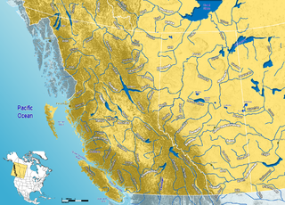
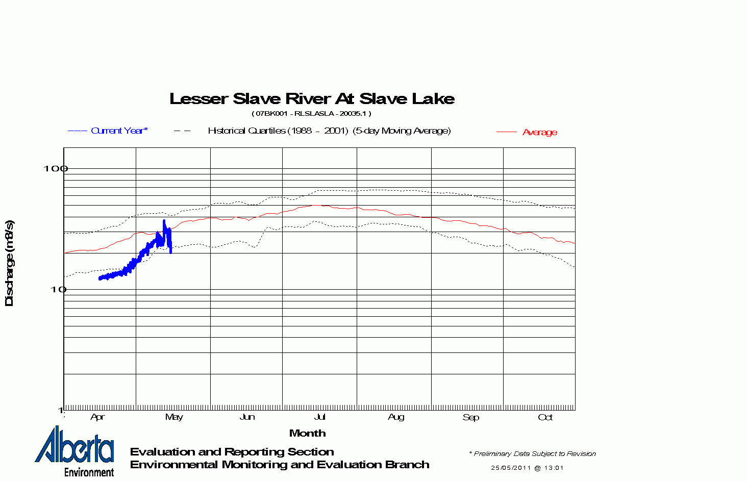
Lesser Slave Lake —known traditionally as "Beaver Lake" or "Beaver people were over there, living there" —is located in central Alberta, Canada, northwest of Edmonton. It is the second largest lake entirely within Alberta boundaries, covering 1,160 km2 (450 sq mi) and measuring over 100 km (62 mi) long and 15 km (9.3 mi) at its widest point. Lesser Slave Lake averages 11.4 m (37 ft) in depth and is 20.5 m (67 ft) at its deepest. It drains eastwards into the Athabasca River by way of the Lesser Slave River.

Lesser Slave Lake is a provincial electoral district for the Legislative Assembly of Alberta, Canada. It has existed since 1971 and is mandated to return a single member using the first past the post method of voting.

Division No. 17 is a census division in Alberta, Canada. It spans the central and northwest portions of northern Alberta and its largest urban community is the Town of Slave Lake. Division No. 17 is the largest census division in Alberta according to area and also has the lowest population density.

The Pembina River is a tributary of the Athabasca River in central Alberta, Canada. "Pembina" is a Canadian French name for the high bush cranberry (Viburnum trilobum). The river gives the name to the Pembina oil field, an oil- and gas-producing region centered on Drayton Valley. The environmentalist group Pembina Institute also took its name from the river.

The Northern Woods and Water Route is a 2,400-kilometre (1,500 mi) route through northern British Columbia, Alberta, Saskatchewan and Manitoba in Western Canada. As early as the 1950s, community groups came together to establish a northern travel route; this was proposed as the Northern Yellowhead Transportation Route. The Northern Woods and Water Route Association was established in 1974, and encouraged promotion of the route with the promise of an increase in tourist travel. The route was designated in 1974 and is well signed throughout its component highways. The route starts at Dawson Creek as the Spirit River Highway and ends at the Perimeter of Winnipeg, Manitoba, after running through the northern regions of the western provinces. From west to east, the Northern Woods and Water Route (NWWR) incorporates portions of British Columbia Highway 49; Alberta Highways 49, 2A, 2, & 55; Saskatchewan Highways 55 & 9; Manitoba Provincial Road 283 and Trunk Highways 10, 5, 68 & 6. The halfway point of the NWWR is approximately at Goodsoil, Saskatchewan.
The Firebag River is a river in northern Alberta and Saskatchewan, Canada. It gets its name from the traditional bags Aboriginals once used to carry fire-starting flints.
Chinchaga is a river in north-western Alberta. It is a tributary of the Hay River. Through the Hay River, its waters are carried to the Arctic Ocean via Great Slave Lake and Mackenzie River. The name Chinchaga is First Nations, and means "Big Wood River". Much of the Chinchaga watershed burned in 1950 during the Chinchaga fire.

Beaver River is a large river in east-central Alberta and central Saskatchewan, Canada. It flows east through Alberta and Saskatchewan and then turns sharply north to flow into Lac Île-à-la-Crosse on the Churchill River which flows into Hudson Bay.

The Little Smoky River is a tributary of the Smoky River in west-central Alberta, Canada.

Northern Alberta is a geographic region located in the Canadian province of Alberta.

The Driftpile River is a medium-length river forming in central Alberta. The Drifpile flows into Lesser Slave Lake, which flows out through the Lesser Slave River, a major tributary of the Athabasca River. The Geological Survey of Canada was using the name Driftpile by 1892. The river was named because of the large amount of driftwood that collected at the river's mouth.
Grouard, also known as Grouard Mission, is a hamlet in northern Alberta within Big Lakes County. It was previously an incorporated municipality between 1909 and 1944.

Drift Pile River 150 is an Indian reserve of the Driftpile Cree Nation in Alberta, located within Big Lakes County. It is 6 kilometers southeast of Lesser Slave Lake. In the 2016 Canadian Census, it recorded a population of 828 living in 258 of its 277 total private dwellings.

Central Peace-Notley is a provincial electoral district in Alberta, Canada. The district was one of 87 districts mandated to return a single member (MLA) to the Legislative Assembly of Alberta using the first past the post method of voting. It was contested for the first time in the 2019 Alberta election.
Lesser Slave Lake Indian Regional Council is a Tribal Council representing First Nation communities around Lesser Slave Lake in Alberta, Canada. The council is based in Slave Lake, Alberta.


