Pigeon Lake (Alberta)

Last updated
Pigeon Lake
Pigeon Lake Alberta Canada 04A.jpg
Looking west over Pigeon Lake at sunset
Canada Alberta relief location map - transverse mercator proj.svg
Red pog.svg
Pigeon Lake
Location Leduc County and County of Wetaskiwin No. 10, Alberta
Coordinates 53°01′49″N114°03′48″W / 53.03028°N 114.06333°W / 53.03028; -114.06333 Coordinates: 53°01′49″N114°03′48″W / 53.03028°N 114.06333°W / 53.03028; -114.06333
Primary outflows Pigeon Lake Creek
Catchment area 187 km2 (72 sq mi)
Basin  countriesCanada
Max. length13.1 km (8.1 mi)
Max. width14.7 km (9.1 mi)
Surface area96.7 km2 (37.3 sq mi)
Average depth6.2 m (20 ft)
Max. depth9.1 m (30 ft)
Surface elevation852 m (2,795 ft)
Settlements Argentia Beach, Crystal Springs, Fisher Home, Golden Days, Grandview, Itaska Beach, Ma-Me-O Beach, Mission Beach, Mulhurst Bay, Norris Beach, Pigeon Lake 138A, Poplar Bay, Silver Beach, Sundance Beach, Village at Pigeon Lake
References Pigeon Lake

Pigeon Lake is a lake in central Alberta, Canada that straddles the boundary between Leduc County and the County of Wetaskiwin No. 10. It is located close to Edmonton, Leduc and Wetaskiwin. Communities located along the lakeshore include Pigeon Lake Indian Reserve 138A, ten summer villages (Argentia Beach, Crystal Springs, Golden Days, Grandview, Itaska Beach, Ma-Me-O Beach, Norris Beach, Poplar Bay, Silver Beach and Sundance Beach), and four unincorporated communities (Fisher Home, Mission Beach, Mulhurst Bay and Village at Pigeon Lake).

Contents

The lake has a total area of 96.7 km2 (37.3 sq mi) and a maximum depth of 9.1 m (30 ft). It has a catchment area of 187 km2 (72 sq mi), [1] and is an early tributary of the Battle River, to which it is connected through the Pigeon Lake Creek.

Pigeon Lake was previously called "Woodpecker Lake". The name was changed to Pigeon Lake in 1858. In 1896, Pigeon Lake Indian Reserve was established on the southeast shore. Later, the summer village of Ma-Me-O Beach was developed at the south end of the lake on land obtained from the Indian reserve in 1924. Ma-Me-O (omîmîw) is a Cree word meaning "pigeon".

Conservation

The Pigeon Lake Provincial Park is established on the western shore of the lake and is accessed from Highway 771. The Pigeon Lake Watershed Association promotes protection of the lake and beneficial management practices in its watershed. [2]

Development

Mulhurst Bay, on the east side of Pigeon Lake Mulhurst Bay Pigeon Lake Alberta Canada 02A.jpg
Mulhurst Bay, on the east side of Pigeon Lake

Pigeon Lake is one of the most intensely used recreational areas in Alberta, with 10 summer villages, 4 unincorporated communities, and over 2,300 private cottages along its shores.[ citation needed ] The summer villages include Argentia Beach, Crystal Springs, Golden Days, Grandview, Itaska Beach, Ma-Me-O Beach, Norris Beach, Poplar Bay, Silver Beach and Sundance Beach. [3] The unincorporated communities include Fisher Home, Mission Beach, Mulhurst Bay and Village at Pigeon Lake. [4] A fifth unincorporated community, Westerose, is located 0.5 km (0.31 mi) to the south of the lake on Highway 13. [4]

Transportation

Battle Lake (left) and part of Pigeon Lake (right) Battle Lake and Pigeon Lake.jpg
Battle Lake (left) and part of Pigeon Lake (right)

The lake and its communities are accessed along Highway 13 on the south side, Highway 771 on the west side, Highway 616 on the north side, and Highway 780 on the east side. [4]

Management

Concerns over frequency and intensity of cyanobacterial blooms has prompted study of the lake and its watershed. Water sampling was undertaken to characterize water quality, sediment quality, and non-fish biota. This data was then used to create a nutrient budget for lake and to undertake a model to explore future management options.

The watershed community is working to address the sources of external nutrients entering the lake, collaboratively led by the Pigeon Lake Watershed Association and the Alliance of Pigeon Lake Municipalities. Outputs to date include a model land use bylaw for development and redevelopment of land within 0.8 km (0.50 mi) of the shoreline, healthy lake lawn maintenance and work on runoff, which is the source of nearly half of the lake's external nutrients.

See also

Related Research Articles

Ma-Me-O Beach, Alberta, is a summer village located on the southeast shore of Pigeon Lake, in Alberta, Canada. It is located approximately 100 km (62 mi) southwest of Edmonton.

<span class="mw-page-title-main">Division No. 11, Alberta</span> Census division in Alberta, Canada

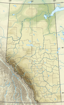
Division No. 11 is a census division in Alberta, Canada. Surrounding the City of Edmonton, the majority of the division comprises Alberta's Capital Region, while the western and southern portions of the division are located within central Alberta. The division also forms the northern segment of the Calgary–Edmonton Corridor.

Millet is a town in central Alberta, Canada. It is approximately 40 kilometres (25 mi) south of Alberta's capital city of Edmonton.

<span class="mw-page-title-main">Alberta Highway 13</span> Highway in Alberta

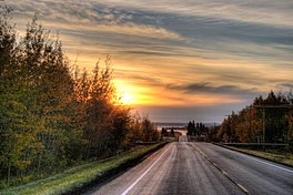
Alberta Provincial Highway No. 13, commonly referred to as Highway 13, is an east–west highway through central Alberta. It runs from Alder Flats, 7 km (4 mi) west of Highway 22, to the Alberta-Saskatchewan border, where it becomes Saskatchewan Highway 14. Highway 13 is about 366 kilometres (227 mi) long. East of the City of Wetaskiwin, it generally parallels a Canadian Pacific rail line.

<span class="mw-page-title-main">Thorsby, Alberta</span> Town in Alberta, Canada

Thorsby is a town in central Alberta, Canada. It is approximately 38 km (24 mi) west of the Leduc on Highway 39. Pigeon Lake and Pigeon Lake Provincial Park are located 20 km (12 mi) south of the community.

<span class="mw-page-title-main">Maskwacis</span> Unincorporated community/Hamlet in Alberta, Canada

Maskwacis, renamed in 2014 from Hobbema, is an unincorporated community in central Alberta, Canada at intersection of Highway 2A and Highway 611, approximately 70 kilometres (43 mi) south of the City of Edmonton. The community consists of two Cree First Nations communities – one on the Ermineskin 138 reserve to the north and the other on the Samson 137 reserve to the south. It also consists of an adjacent hamlet within Ponoka County. The community also serves three more nearby First Nations reserves including Samson 137A to the south, Louis Bull 138B to the northwest, and Montana 139 to the south.

Grandview is a summer village in Alberta, Canada. It is located on the southwest shore of Pigeon Lake, in the County of Wetaskiwin No. 10.

Poplar Bay is a summer village in Alberta, Canada. It is located on the western shore of Pigeon Lake.

Crystal Springs is a summer village in Alberta, Canada. It is located on the southeast shores of Pigeon Lake, 1.2 km (0.75 mi) north of Highway 13. The community borders the Summer Village of Grandview to the northwest and the Village at Pigeon Lake to the south.

Itaska Beach is a summer village in Alberta, Canada. It is located on the northwest shore of Pigeon Lake, west of Wetaskiwin.

Norris Beach is a summer village in Alberta, Canada. It is located on the southern shore of Pigeon Lake, along Highway 13.

Silver Beach is a summer village in Alberta, Canada. It is located on the eastern shore of Pigeon Lake, west from Wetaskiwin.

Sundance Beach is a summer village in Alberta, Canada. It is located on the northern shore of Pigeon Lake. Mission Beach is a locality within the summer village.

Falun is a hamlet in central Alberta, Canada within the County of Wetaskiwin No. 10. It is located on Highway 13, approximately 31 kilometres (19 mi) west of Wetaskiwin.

<span class="mw-page-title-main">Mulhurst Bay</span> Hamlet in Alberta, Canada

Mulhurst Bay, or Mulhurst, is a hamlet in central Alberta, Canada within the County of Wetaskiwin No. 10. It is located 8 kilometres (5.0 mi) northwest of Highway 13A, approximately 38 kilometres (24 mi) southwest of Leduc.

Village at Pigeon Lake is a hamlet in central Alberta, Canada within the County of Wetaskiwin No. 10. It is located 0.3 kilometres (0.19 mi) north of Highway 13, approximately 44 kilometres (27 mi) west of Wetaskiwin.

Westerose is a hamlet in central Alberta, Canada within the County of Wetaskiwin No. 10. It is located on Highway 13, approximately 44 kilometres (27 mi) west of Wetaskiwin.

Grandview Beach is a resort village in the Canadian province of Saskatchewan within Census Division No. 6. It is on the shores of Last Mountain Lake in the Rural Municipality of Sarnia No. 221.

Argentia Beach is a summer village in Alberta, Canada. It is located on the northern shore of Pigeon Lake.

<span class="mw-page-title-main">Maskwacis-Wetaskiwin</span> Provincial electoral district in Alberta, Canada

Maskwacis-Wetaskiwin is a provincial electoral district in Alberta, Canada. The district is one of 87 districts mandated to return a single member (MLA) to the Legislative Assembly of Alberta using the first past the post method of voting. It was contested for the first time in the 2019 Alberta general election and is represented by Rick Wilson of the United Conservative Party of Alberta.

References

  1. "Pigeon Lake". in Atlas of Alberta Lakes. University of Alberta Press. 1990. Retrieved 24 Nov 2019.
  2. "About". Pigeon Lake Watershed Association. Retrieved November 8, 2014.
  3. "Our Member Municipalities and Council Representatives". Alliance of Pigeon Lake Municipalities. November 8, 2014.
  4. 1 2 3 Your Official Road Map of Alberta (Map). Travel Alberta. 2014.