Related Research Articles

Alberta is one of the thirteen provinces and territories of Canada. It is part of Western Canada and is one of the three prairie provinces. Alberta is bordered by British Columbia to the west, Saskatchewan to the east, the Northwest Territories (NWT) to the north, and the U.S. state of Montana to the south. It is one of the only two landlocked provinces in Canada. The eastern part of the province is occupied by the Great Plains, while the western part borders the Rocky Mountains. The province has a predominantly continental climate but experiences quick temperature changes due to air aridity. Seasonal temperature swings are less pronounced in western Alberta due to occasional Chinook winds.
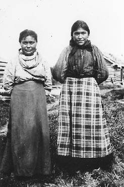
The Slavey are a First Nations indigenous peoples of the Dene group, indigenous to the Great Slave Lake region, in Canada's Northwest Territories, and extending into northeastern British Columbia and northwestern Alberta.

Alberta is one of the thirteen provinces and territories of Canada. Located in Western Canada, the province has an area of 661,190 km2 (255,290 sq mi) and is bounded to the south by the United States state of Montana along 49° north for 298 km (185 mi); to the east at 110° west by the province of Saskatchewan for 1,223 km (760 mi); and at 60° north the Northwest Territories for 644 km (400 mi). The southern half of the province borders British Columbia along the Continental Divide of the Americas on the peaks of the Rocky Mountains, while the northern half borders British Columbia along the 120th meridian west. Along with Saskatchewan it is one of only two landlocked provinces or territories.
The Sunwapta River is a major tributary of the Athabasca River in Jasper National Park in Alberta, Canada.

Lesser Slave Lake —known traditionally as "Beaver Lake" or "Beaver people were over there, living there" —is located in central Alberta, Canada, northwest of Edmonton. It is the second largest lake entirely within Alberta boundaries, covering 1,160 km2 (450 sq mi) and measuring over 100 km (62 mi) long and 15 km (9.3 mi) at its widest point. Lesser Slave Lake averages 11.4 m (37 ft) in depth and is 20.5 m (67 ft) at its deepest. It drains eastwards into the Athabasca River by way of the Lesser Slave River.

Lesser Slave Lake is a provincial electoral district for the Legislative Assembly of Alberta, Canada. It has existed since 1971 and is mandated to return a single member using the first past the post method of voting.
Alberta Provincial Highway No. 2, commonly referred to as Highway 2 or the Queen Elizabeth II Highway, is a major highway in Alberta that stretches from the Canada–United States border through Calgary and Edmonton to Grande Prairie. Running primarily north to south for approximately 1,273 kilometres (791 mi), it is the longest and busiest highway in the province carrying more than 170,000 vehicles per day near Downtown Calgary. The Fort Macleod—Edmonton section forms a portion of the CANAMEX Corridor that links Alaska to Mexico. More than half of Alberta's 4 million residents live in the Calgary–Edmonton Corridor created by Highway 2.
Lesser Slave Lake Provincial Park is a provincial park and birdwatching area located in north-central Alberta, Canada.

The Lesser Slave River is a river in central Alberta, Canada. It is a major tributary of the Athabasca River.

Northern Alberta is a geographic region located in the Canadian province of Alberta.
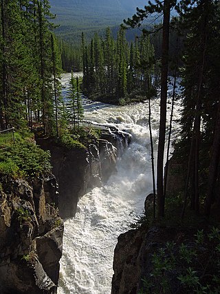
The Maligne River is a medium-sized river in the Canadian Rockies. It runs through parts of Jasper National Park in Alberta, Canada. The Maligne is a major tributary of the Athabasca River. The river takes from the French word for malignant or wicked. It is theorised that a Belgian priest voyageur created this name in reference to the current of the river near its confluence with the Athabasca River.
The Assineau River is a short river forming in central Alberta. The Assineau flows into Lesser Slave Lake, which flows out through the Lesser Slave River, a major tributary of the Athabasca River. The name for the river was in use by 1904. It is suggested that Assineau is a version of the Cree word for nobody.

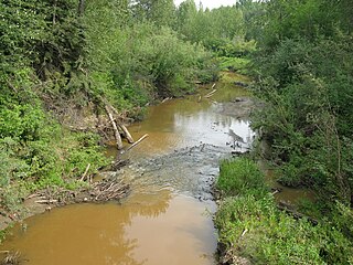
The Driftpile River is a medium-length river forming in central Alberta. The Drifpile flows into Lesser Slave Lake, which flows out through the Lesser Slave River, a major tributary of the Athabasca River. The Geological Survey of Canada was using the name Driftpile by 1892. The river was named because of the large amount of driftwood that collected at the river's mouth.
The Jackpine River is an early tributary of the Smoky River. It forms in the Canadian Rockies, within Willmore Wilderness Park, in the province of Alberta, north of Jasper National Park. The river collects the runoff from Resthaven Mountain, Barricade Mountain, Jackpine Mountain, Mount Holmes, Perseverance Mountain, and Draco Peak.

The Snake Indian River is a large tributary of the Athabasca River, exiting entirely within Jasper National Park. The Snake Indian forms at Snake Indian Pass, south of Monte Christo Mountain and Snake Indian Mountain, north of Calumet Peak. The river travels in a general northwest direction before turning sharply south. The river plummets over the massive Snake Indian Falls before joining the Athabasca River downstream of Jasper Lake, near the east gate of Jasper National Park.

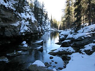
The Snaring River is a medium-sized river in the Canadian Rockies. It runs through parts of Jasper National Park in Alberta, Canada. The Snaring River is a significant tributary of the Athabasca River. The Snaring is named after a former local tribe of first nations people who lived in dugouts and trapped animals with snares.
Grouard, also known as Grouard Mission, is a hamlet in northern Alberta within Big Lakes County. It was previously an incorporated municipality between 1909 and 1944.
Marten Beach is a hamlet in northern Alberta, Canada within the Municipal District of Lesser Slave River No. 124. It is located on the northeast shore of Lesser Slave Lake, 2 kilometres (1.2 mi) west of Highway 88. It is approximately 36 kilometres (22 mi) north of the Town of Slave Lake and 238 kilometres (148 mi) northwest of the City of Edmonton.
The Swan River First Nation is a Woodland Cree First Nations band government in northern Alberta. Located on the south-central shore of Lesser Slave Lake near Kinuso, it controls two Indian reserves, Swan River 150E and Assineau River 150F.
Marten River may refer to:
References
| Rivers |  | |
|---|---|---|
| Waterfalls | ||
| Lakes | ||
| Reservoirs | ||
| Glaciers | ||
| Other | ||