
Alberta is one of the thirteen provinces and territories of Canada. It is a part of Western Canada and is one of the three prairie provinces. Alberta borders British Columbia to the west, Saskatchewan to the east, the Northwest Territories to the north, and the U.S. state of Montana to the south. It is one of the only two landlocked provinces in Canada, with Saskatchewan being the other. The eastern part of the province is occupied by the Great Plains, while the western part borders the Rocky Mountains. The province has a predominantly continental climate but experiences quick temperature changes due to air aridity. Seasonal temperature swings are less pronounced in western Alberta due to occasional Chinook winds.

Lake Louise is a hamlet within Banff National Park in Alberta, Canada. Named after Princess Louise, Duchess of Argyll, it lies in Alberta's Rockies on the Bow River, 3 km (1.9 mi) northeast of the lake that shares its name. Initially settled in 1884 as an outpost for the Canadian Pacific Railway, Lake Louise sits at an elevation of 1,600 m (5,200 ft), making it Canada's highest community. The nearby lake, framed by mountains, is one of the most famous mountain vistas in the world.

Cold Lake is a city in east-central Alberta, Canada and is named after the lake nearby. Canadian Forces Base Cold Lake is situated within the city's outer limits.

Alberta's Métis people are descendants of mixed First Nations/Indigenous peoples and White/European families. The Métis are considered an aboriginal group under Canada's Constitution Act, 1982. They are separate and distinct from First Nations, though they live in the same regions and have cultural similarities, and have different legal rights.

Chestermere, originally named Chestermere Lake is a city in the Canadian province of Alberta, within Rocky View County. It is largely a commuter town of Calgary and is a member municipality of the Calgary Region. The city, which surrounds Chestermere Lake, was known as Chestermere Lake from 1977 to 1993.
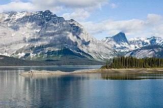
Peter Lougheed Provincial Park is in Kananaskis Country about 90 kilometres (56 mi) west of Calgary, along the Kananaskis Trail in Alberta, Canada.

Slave Lake is a town in northern Alberta, Canada that is surrounded by the Municipal District of Lesser Slave River No. 124. It is approximately 255 km (158 mi) northwest of Edmonton. It is located on the southeast shore of Lesser Slave Lake at the junction of Highway 2 and Highway 88.
Cochrane Lake is a hamlet in southern Alberta under the jurisdiction of Rocky View County. Statistics Canada also recognizes a smaller portion of the hamlet as a designated place under the name of Cochrane Lake Subdivision.

Cold Lake is a large lake in Northern Alberta and Saskatchewan, Canada. The lake straddles the Alberta / Saskatchewan border, and has a water area of 373 km2 (144 sq mi). It is also one of the deepest lakes in Alberta with a maximum depth of 200.1 m (656 ft). It has around 24 known species of fish and is a major ice fishing lake. Cold Lake is also major stop for many migrating birds, and is home to one of the largest warbler populations in Alberta. A surface of 248 km2 (96 sq mi) lies in the province of Alberta.
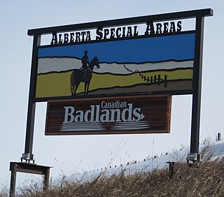
The Special Areas Board is the governing body of Alberta's special areas. Special areas are designated rural municipalities similar to municipal districts; however, the elected advisory councils are overseen by four representatives appointed by the province, under the direct authority of Alberta Municipal Affairs.
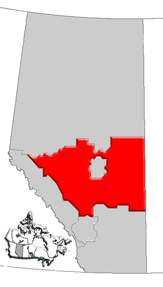
Central Alberta is a region located in the Canadian province of Alberta.
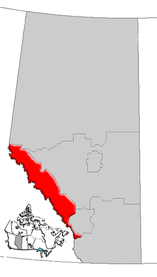
Alberta's Rockies comprise the Canadian Rocky Mountains in Alberta, Canada. On the southwestern part of the province along the British Columbia border, the region covers all but the south of Census Division 15.

Northern Alberta is a geographic region located in the Canadian province of Alberta.
Calling Lake is a hamlet in northern Alberta, Canada within the Municipal District of Opportunity No. 17. It is located on Highway 813 along the eastern shore of Calling Lake, immediately north of Calling Lake Provincial Park. It is approximately 59 km (37 mi) north of Athabasca and 113 km (70 mi) south of Wabasca and has an elevation of 595 m (1,952 ft).
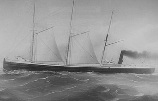
The John M. Osborn was a wooden steam barge that sank in Lake Superior in 1884 with the loss of five lives. The Osborn was just 2 years old when the larger, steel-hulled Alberta, which was called a "steel monster" and "terror of the lakes", rammed her. The wreck of the Osborn was discovered 100 years after her sinking. The wreck was illegally salvaged in the 1980s. Many of Osborn's artifacts became the property of the State of Michigan after they were seized from Great Lakes Shipwreck Museum. The State allows the museum to display the artifacts as a loan. The wreck of the Osborn is now protected by the Whitefish Point Underwater Preserve as part of an underwater museum.
This page is based on this
Wikipedia article Text is available under the
CC BY-SA 4.0 license; additional terms may apply.
Images, videos and audio are available under their respective licenses.


