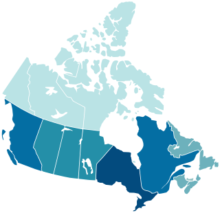
Canada is divided into 10 provinces and three territories. The majority of Canada's population is concentrated in the areas close to the Canada–US border. Its four largest provinces by area are also its most populous; together they account for 86.5% of the country's population. The territories account for over a third of Canada's area but are home to only 0.32% of its population, which skews the national population density value.

The Chipewyan are a Dene Indigenous Canadian people of the Athabaskan language family, whose ancestors are identified with the Taltheilei Shale archaeological tradition. They are part of the Northern Athabascan group of peoples, and come from what is now Western Canada.
Peter Pond was an American explorer, cartographer, merchant and soldier who was a founding member of the North West Company and the Beaver Club. Though he was born and died in Milford, Connecticut, most of his life was spent in northwestern North America, on the upper Mississippi, and in western Canada.

Chipewyan or Denesuline, often simply called Dene, is the language spoken by the Chipewyan people of northwestern Canada. It is categorized as part of the Northern Athabaskan language family. Dënësųłinë́ has nearly 12,000 speakers in Canada, mostly in Saskatchewan, Alberta, Manitoba and the Northwest Territories. It has official status only in the Northwest Territories, alongside 8 other aboriginal languages: Cree, Tlicho, Gwich'in, Inuktitut, Inuinnaqtun, Inuvialuktun, North Slavey and South Slavey.

Kasba Lake is a lake in the northern Canadian wilderness. The majority of the lake lies within the Northwest Territories, but a small section is in Nunavut. The lake is close to Canada's four corners. A seasonal fishing lodge is open to tourists each summer.

Lac de Gras is a lake approximately 300 kilometres (190 mi) north east of Yellowknife, in the Northwest Territories of Canada. Lac de Gras was the centre of the diamond rush of the 1990s. There are two working, and one closed, diamond mines in the area, Diavik Diamond Mine, Ekati Diamond Mine, and the care and maintenance Snap Lake Diamond Mine. It was called Ekati by aboriginal peoples.

The history of post-confederation Canada began on July 1, 1867, when the British North American colonies of Canada, New Brunswick, and Nova Scotia were united to form a single Dominion within the British Empire. Upon Confederation, the United Province of Canada was immediately split into the provinces of Ontario and Quebec. The colonies of Prince Edward Island and British Columbia joined shortly after, and Canada acquired the vast expanse of the continent controlled by the Hudson's Bay Company, which was eventually divided into new territories and provinces. Canada evolved into a fully sovereign state by 1982.

The geography of Saskatchewan is unique among the provinces and territories of Canada in some respects. It is one of only two landlocked regions and it is the only region whose borders are not based on natural features like lakes, rivers, or drainage divides. The borders of Saskatchewan, which make it very nearly a trapezoid, were determined in 1905 when it became a Canadian province. Saskatchewan has a total area of 651,036 square kilometres (251,366 sq mi) of which 591,670 km2 (228,450 sq mi) is land and 59,366 km2 (22,921 sq mi) is water.
Green Lake is a northern village in Saskatchewan, Canada. Its residents are predominantly Métis people. Green Lake is located northeast of Meadow Lake, and northwest of Big River. It lies in the southern boreal forest, and takes its name from nearby Green Lake. Fishing, tourism, and farming, are the major industries.

Lac La Martre, is the third largest lake in the Northwest Territories, Canada. It is located approximately 201 km (125 mi) northwest of the territorial capital of Yellowknife. The Tłı̨chǫ community of Whatì is located on the east shore of Lac La Martre.

Lac la Ronge is a glacial lake in the Canadian province of Saskatchewan. It is the fifth largest lake in the province and is approximately 250 kilometres (160 mi) north of Prince Albert, on the edge of the Canadian Shield. La Ronge, Air Ronge, and the Lac La Ronge First Nation are on the western shore. The lake is a popular vacation spot. Recreational activities include fishing, boating, canoeing, hiking, and camping.

Pinehouse is a northern village located in the boreal forest of Saskatchewan on the western shore of Pinehouse Lake within the Canadian Shield.

MacKay Lake is the fifth largest lake in the Northwest Territories, Canada.

Aylmer Lake is a lake along the Lockhart River in the Northwest Territories of Canada. Of lakes in the Northwest Territories, it is the seventh largest.

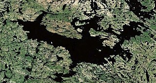
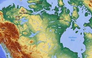
Lac des Bois is a lake in the Northwest Territories, Canada.


