
The Mackenzie River is a river in the Canadian boreal forest. It forms, along with the Slave, Peace, and Finlay, the longest river system in Canada, and includes the second largest drainage basin of any North American river after the Mississippi.

The Liard River of the North American boreal forest flows through Yukon, British Columbia and the Northwest Territories, Canada. Rising in the Saint Cyr Range of the Pelly Mountains in southeastern Yukon, it flows 1,115 km (693 mi) southeast through British Columbia, marking the northern end of the Rocky Mountains and then curving northeast back into Yukon and Northwest Territories, draining into the Mackenzie River at Fort Simpson, Northwest Territories. The river drains approximately 277,100 km2 (107,000 sq mi) of boreal forest and muskeg.
The Fort Nelson River, often shortened to simply the Nelson River, is in north-eastern British Columbia, Canada. It flows 517 kilometres (321 mi) generally north-westward to the Liard River, a tributary of the Mackenzie River, which empties into the Arctic Ocean. The river drains a watershed of 55,900 square kilometres (21,600 sq mi) and is formed by the confluence of the Fontas River flowing from the east, and the Sikanni Chief River flowing from the south. These, along with the Sahtaneh and Muskwa Rivers, constitute the major tributaries. The source of the Sikanni Chief, on the eastern slope of the Rocky Mountains, is ultimately the headwater of the Fort Nelson River.

The Mackenzie Mountains are a Canadian mountain range forming part of the Yukon–Northwest Territories boundary between the Liard and Peel rivers. The range is named in honour of Canada's second prime minister, Alexander Mackenzie. Nahanni National Park Reserve and Nááts'ihch'oh National Park Reserve are in the Mackenzie Mountains.

The Pelly River is a river in Canada, and is a headstream of the Yukon River. The river originates west of the Mackenzie Mountains and flows 530 km (330 mi) through south-central Yukon. The Pelly has two main tributaries, the Ross and Macmillan rivers.

The South Nahanni River is a major tributary of the Liard River, located roughly 500 km (310 mi) west of Yellowknife in the Northwest Territories of Canada. It is the centerpiece of Nahanni National Park Reserve. It flows from the Mackenzie Mountains in the west, through the Selwyn Mountains, growing as it heads east over the majestic Virginia Falls, and finally empties into the Liard River. The Nahanni has a unique geological history. It was formed when the area was a broad flat plain, forming a winding course typical of flatland rivers. As the mountains lifted, the river cut four deep canyons into the rock, maintaining its eccentric course.

Belly River is a river in northwest Montana, United States and southern Alberta, Canada. It is a tributary of the Oldman River, itself a tributary of the South Saskatchewan River.

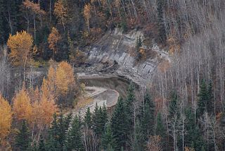
The Horn River is a river in the Northwest Territories of Canada. It is a major tributary of the Mackenzie River.

The Rosebud River is a major tributary of the Red Deer River in Alberta, Canada. The Rosebud River passes through agricultural lands and ranchland for most of its course, and through badlands in its final reaches. It provides water for irrigation canals through a variety of dams built on its course and that of its tributaries.
The Kotaneelee River is a river in the Northwest Territories of Canada. It is a tributary of the Liard River.

Trout River is a river in the Northwest Territories of Canada. It is a major tributary of the Mackenzie River.

The Kakisa River is a major tributary of the Mackenzie River in the Northwest Territories of Canada.
The Redknife River is a river in the Northwest Territories of Canada. It is a major tributary of the Mackenzie River.
The Prophet River is a river in northern British Columbia, Canada. It is a tributary of the Muskwa River.
Besa River is a river in northern British Columbia, Canada. It is a tributary of the Prophet River.
The Notikewin River is a tributary of the Peace River in northern Alberta, Canada. The Notikewin Provincial Park is established at the mouth of the river.
The Redstone River is a large river in the Northwest Territories of Canada. It is about 289 kilometres (180 mi) long. It is a tributary of the Mackenzie River, joining it on the left bank some 100 kilometres (62 mi) north of Wrigley. Draining a rugged and high area of the Mackenzie Mountains, the Redstone watershed is sparsely populated by people but remains an ecological haven for wildlife including moose, caribou, wolves Dall's Sheep and Bears. It is a pristine mountain wilderness.

The Keele River is a tributary of the Mackenzie River, about 410 kilometres (250 mi) long, in the western part of the Canadian Northwest Territories. Flowing in a generally northeast direction, it drains a sparsely populated, rugged area of the Mackenzie Mountains.

The Redwillow River is a tributary of the Wapiti River in northern Alberta and north-eastern British Columbia, Canada. It flows through the Pouce Coupe Prairie, in the south of Peace River Country.
The Heart River is a river in northern Alberta, Canada. It is a major tributary of the Peace River.

