Kotaneelee River

Last updated
Kotaneelee River
Territories Yukon, Northwest Territories
Country Canada
Physical characteristics
Main source La Biche Range
1,600 m (5,200 ft)
60°49′15.13″N124°31′57.47″W / 60.8208694°N 124.5326306°W / 60.8208694; -124.5326306 (Kotaneelee River origin)
River mouth Liard River
230 m (750 ft)
60°10′50.23″N123°42′01.73″W / 60.1806194°N 123.7004806°W / 60.1806194; -123.7004806 (Kotaneelee River mouth) Coordinates: 60°10′50.23″N123°42′01.73″W / 60.1806194°N 123.7004806°W / 60.1806194; -123.7004806 (Kotaneelee River mouth)
Basin features
Tributaries
  • Left:
    Chinkeh Creek

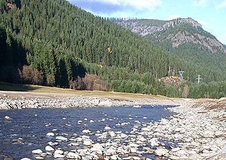
The Kotaneelee River is a river in the Northwest Territories of Canada. It is a tributary of the Liard River.

Northwest Territories Territory of Canada

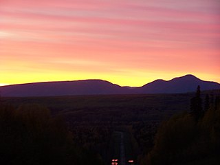
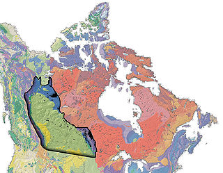
The Northwest Territories is a federal territory of Canada. At a land area of approximately 1,144,000 km2 (442,000 sq mi) and a 2016 census population of 41,786, it is the second-largest and the most populous of the three territories in Northern Canada. Its estimated population as of 2018 is 44,445. Yellowknife became the territorial capital in 1967, following recommendations by the Carrothers Commission.

Canada Country in North America

Canada is a country in the northern part of North America. Its ten provinces and three territories extend from the Atlantic to the Pacific and northward into the Arctic Ocean, covering 9.98 million square kilometres, making it the world's second-largest country by total area. Canada's southern border with the United States is the world's longest bi-national land border. Its capital is Ottawa, and its three largest metropolitan areas are Toronto, Montreal, and Vancouver. As a whole, Canada is sparsely populated, the majority of its land area being dominated by forest and tundra. Consequently, its population is highly urbanized, with over 80 percent of its inhabitants concentrated in large and medium-sized cities, many near the southern border. Canada's climate varies widely across its vast area, ranging from arctic weather in the north, to hot summers in the southern regions, with four distinct seasons.

Liard River river in Canada

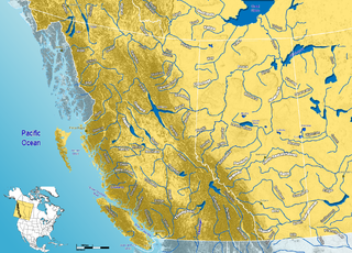
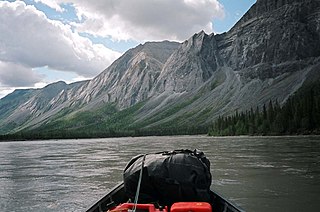
The Liard River flows through Yukon, British Columbia and the Northwest Territories, Canada. Rising in the Saint Cyr Range of the Pelly Mountains in southeastern Yukon, it flows 1,115 kilometres (693 mi) southeast through British Columbia, marking the northern end of the Rocky Mountains and then curving northeast back into Yukon and Northwest Territories, draining into the Mackenzie River at Fort Simpson, Northwest Territories. The river drains approximately 277,100 square kilometres (107,000 sq mi) of boreal forest and muskeg.

Contents

It gives the name to the Kotaneelee Formation, a stratigraphical unit of the Western Canadian Sedimentary Basin.

The Kotaneelee Formation is a stratigraphical unit of Late Cretaceous age in the Western Canadian Sedimentary Basin.

Stratigraphy The study of rock layers and their formation

Stratigraphy is a branch of geology concerned with the study of rock layers (strata) and layering (stratification). It is primarily used in the study of sedimentary and layered volcanic rocks. Stratigraphy has two related subfields: lithostratigraphy and biostratigraphy.

Western Canadian Sedimentary Basin

The Western Canadian Sedimentary Basin (WCSB) is a vast sedimentary basin underlying 1,400,000 square kilometres (540,000 sq mi) of Western Canada including southwestern Manitoba, southern Saskatchewan, Alberta, northeastern British Columbia and the southwest corner of the Northwest Territories. It consists of a massive wedge of sedimentary rock extending from the Rocky Mountains in the west to the Canadian Shield in the east. This wedge is about 6 kilometres (3.7 mi) thick under the Rocky Mountains, but thins to zero at its eastern margins. The WCSB contains one of the world's largest reserves of petroleum and natural gas and supplies much of the North American market, producing more than 16,000,000,000 cubic feet (450,000,000 m3) per day of gas in 2000. It also has huge reserves of coal. Of the provinces and territories within the WCSB, Alberta has most of the oil and gas reserves and almost all of the oil sands.

Course

The Kotaneelee River originates in Yukon, just west of the Northwest Territories border, on the eastern slopes of the La Biche Range, at an elevation of 1,600 m (5,200 ft). It flows west into the Northwest Territories, then south-east between the La Biche Range and the Northern Kotaneelee Range. It turns again eastwards and separates the Northern and Southern Kotaneelee Ranges. After receiving the waters of the Chinkeh Creek, it turns south and flows parallel and to the west of the Liard Range of the Franklin Mountains. It turns around Mount Pointed and heads east, passing north of Mount Martin and south of Fisherman Lake before it flows into the Liard River, 15 km (9.3 mi) upstream from Fort Liard, at an elevation of 230 m (750 ft).

Yukon Territory of Canada

Yukon is the smallest and westernmost of Canada's three federal territories. It has the smallest population of any province or territory in Canada, with 35,874 people, although it has the largest city in any of the three territories. Whitehorse is the territorial capital and Yukon's only city.

The Franklin Mountains of the Northwest Territories are a range of low peaks that stretch along the east bank of the Mackenzie River from 64 to 66 degrees of latitude.

Fort Liard Hamlet in Northwest Territories, Canada

Fort Liard is a hamlet in the Dehcho Region of the Northwest Territories, Canada. It is located 37 km (23 mi) north of the British Columbia border. It became accessible by road in 1984 with the completion of the Liard Highway.

Tributaries

See also

Related Research Articles

Mackenzie River largest river system in Canada

The Mackenzie River is the longest river system in Canada, and has the second largest drainage basin of any North American river after the Mississippi River. The Mackenzie River flows through a vast, thinly populated region of forest and tundra entirely within the Canadian Northwest Territories, although its many tributaries reach into four other Canadian provinces and territories.

Canadian Rockies mountain range in Canada

The Canadian Rockies or Canadian Rocky Mountains comprise the Canadian segment of the North American Rocky Mountains. They are the eastern part of the Canadian Cordillera, which is a system of multiple ranges of mountains which runs from the Canadian Prairies to the Pacific Coast. The Canadian Rockies mountain system comprises the southeastern part of this system, lying between the Interior Plains of Alberta and Northeastern British Columbia on the east to the Rocky Mountain Trench of BC on the west. The southern end borders Idaho and Montana of the United States. In geographic terms the boundary is at the Canada/US border, but in geological terms it might be considered to be at Marias Pass in northern Montana. The northern end is at the Liard River in northern British Columbia.

Breitenbush River river in the United States of America

The Breitenbush River is a tributary of the North Santiam River in western Oregon in the United States. It drains a rugged, forested area of the Cascade Range east of Salem.

The Fort Nelson River is in north-eastern British Columbia, Canada. It flows 517 kilometres (321 mi) generally north-westward to the Liard River, a tributary of the Mackenzie River, which empties into the Arctic Ocean. The river drains a watershed of 55,900 square kilometres (21,600 sq mi) and is formed by the confluence of the Fontas River flowing from the east, and the Sikanni Chief River flowing from the south. These, along with the Sahtaneh and Muskwa Rivers constitute the major tributaries. The source of the Sikanni Chief, on the eastern slope of the Rocky Mountains, is ultimately the headwater of the Fort Nelson River.

The Klinaklini River is one of the major rivers of the Pacific Ranges section of the Coast Mountains in the Canadian province of British Columbia. It originates in the Pantheon Range and empties into the head of Knight Inlet.

Kechika River river in Canada

The Kechika River, also historically known as Black's River, is a tributary of the Liard River, about 230 km (140 mi) long, located in northern British Columbia, Canada.

Petitot River river in Canada

Petitot is a river in northern Alberta and British Columbia, Canada. It is a tributary of the Liard River.

Beaver River (Canada) river in Alberta and Saskatchewan

Beaver River is a large river in east-central Alberta and central Saskatchewan, Canada. It flows east through Alberta and Saskatchewan and then turns sharply north to flow into Lac Île-à-la-Crosse on the Churchill River which flows into Hudson Bay. The Alberta part is in the Cold Lake oil sands.

South Nahanni River river in the Northwest Territories, Canada

The South Nahanni River is a major tributary of the Liard River, located roughly 500 kilometres west of Yellowknife in the Northwest Territories of Canada. It is the centerpiece of Nahanni National Park Reserve. It flows from the Mackenzie Mountains in the west, through the Selwyn Mountains, growing as it heads east over the majestic Virginia Falls, and finally empties into the Liard River. The Nahanni has a unique geological history. It was formed when the area was a broad flat plain, forming a winding course typical of flatland rivers. As the mountains lifted, the river cut four deep canyons into the rock, maintaining its eccentric course.

Kitimat River river in Canada

The Kitimat River is a river in the Canadian province of British Columbia. It originates in the Kitimat Ranges, near the sources of the Dala River, Kemano River, Atna River, and Clore River. It flows in a curve north, then west, then south, emptying into Kitimat Arm at the head of Douglas Channel, at the town of Kitimat.

Smoky Group

The Smoky Group is a stratigraphical unit of Late Cretaceous age in the Western Canadian Sedimentary Basin.

Belly River river in Canada

Belly River is a river in northwest Montana, United States and southern Alberta, Canada. It is a tributary of the Oldman River, itself a tributary of the South Saskatchewan River.

Trout River (Northwest Territories) river in Northwest Territories, Canada

Trout River is a river in the Northwest Territories of Canada. It is a major tributary of the Mackenzie River.

The Kakisa River is a major tributary of the Mackenzie River in the Northwest Territories of Canada.

North Nahanni River river in the Northwest Territories of Canada, tributary of the Mackenzie River

North Nahanni River is a river in the Northwest Territories of Canada. It is a major tributary of the Mackenzie River.

The Prophet River is a river in northern British Columbia, Canada. It is a tributary of the Muskwa River.

Besa River is a river in northern British Columbia, Canada. It is a tributary of the Prophet River.

References