Sand River (Alberta)

Last updated
Sand River
CountryFlag of Canada.svg  Canada
Physical characteristics
Main source 675 m (2,215 ft)
55°11′28″N110°27′06″W / 55.19098°N 110.45159°W / 55.19098; -110.45159 (Sand River headwater)
River mouth Beaver River
526 m (1,726 ft)
54°22′42″N111°02′03″W / 54.37839°N 111.03428°W / 54.37839; -111.03428 (Sand River mouth) Coordinates: 54°22′42″N111°02′03″W / 54.37839°N 111.03428°W / 54.37839; -111.03428 (Sand River mouth)

The Sand River is a major tributary of the Beaver River in Alberta, Canada.

Beaver River (Canada) river in Alberta and Saskatchewan

Beaver River is a large river in east-central Alberta and central Saskatchewan, Canada. It flows east through Alberta and Saskatchewan and then turns sharply north to flow into Lac Île-à-la-Crosse on the Churchill River which flows into Hudson Bay. The Alberta part is in the Cold Lake oil sands.

Alberta Province in Canada

Alberta is a western province of Canada. With an estimated population of 4,067,175 as of 2016 census, it is Canada's fourth most populous province and the most populous of Canada's three prairie provinces. Its area is about 660,000 square kilometres (250,000 sq mi). Alberta and its neighbour Saskatchewan were districts of the Northwest Territories until they were established as provinces on September 1, 1905. The premier has been Rachel Notley since May 2015.

Canada Country in North America

Canada is a country in the northern part of North America. Its ten provinces and three territories extend from the Atlantic to the Pacific and northward into the Arctic Ocean, covering 9.98 million square kilometres, making it the world's second-largest country by total area. Canada's southern border with the United States is the world's longest bi-national land border. Its capital is Ottawa, and its three largest metropolitan areas are Toronto, Montreal, and Vancouver. As a whole, Canada is sparsely populated, the majority of its land area being dominated by forest and tundra. Consequently, its population is highly urbanized, with over 80 percent of its inhabitants concentrated in large and medium-sized cities, many near the southern border. Canada's climate varies widely across its vast area, ranging from arctic weather in the north, to hot summers in the southern regions, with four distinct seasons.
Contents

Course

The Sand River originates in a system of lakes in northern Alberta, between Winefred Lake and Cold Lake and at an elevation of 675 metres (2,215 ft). From there it flows generally towards the south and west. It enters the Caribou Lake, then continues north-west and west until it receives the waters of Ipiatik River, then turns south. It flows between Standish Lake, Spencer Lake and Seibert Lake, east of the Lakeland Provincial Park, then receives the waters of Wolf River, west of Wolf Lake. It receives the Punk Creek from Pinehurst Lake before it is crosses by Highway 55 (part of the Northern Woods and Water Route) at Truman. It then turns eastwards and flows into the Beaver River, at an elevation of 526 metres (1,726 ft).

Northern Alberta geographical object

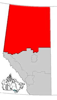
Northern Alberta is a region located in the Canadian province of Alberta.

Winefred Lake is a large lake in east-northern Alberta, Canada. It is located in southern Wood Buffalo, in a remote area between Cold Lake and Fort McMurray, and has a total area of 122.8 km2 (47.4 sq mi). The closest community is the hamlet of Conklin, at 70 km (43 mi).

Pinehurst Lake lake in Canada

Pinehurst Lake is a lake in Northeastern Alberta. Located 245 kilometres (152 mi) northeast of Edmonton, in the Lakeland Provincial Recreation Area just east of the Lakeland Provincial Park, it is a popular destination for anglers and hunters alike.

Tributaries

Wolf River (Alberta)

The Wolf River is a river in the Municipal District of Bonnyville No. 87 and Lac La Biche County in census division No. 12, Alberta, Canada. It is in the Hudson Bay drainage basin and is a left tributary of the Sand River.

See also

Related Research Articles

Geography of Alberta

Alberta is a Canadian province. Located in Western Canada, the province has an area of 661,190 square kilometres (255,290 sq mi) and is bounded to the south by the U.S. state of Montana along 49° north for 298 kilometres (185 mi); to the east at 110° west by the province of Saskatchewan for 1,223 kilometres (760 mi); and at 60° north the Northwest Territories for 644 kilometres (400 mi). The southern half of the province borders British Columbia along the Continental Divide of the Americas on the peaks of the Rocky Mountains, while the northern half borders British Columbia along the 120th meridian west.

Peace River river in Alberta and British Columbia

The Peace River is a 1,923-kilometre-long (1,195 mi) river in Canada that originates in the Rocky Mountains of northern British Columbia and flows to the northeast through northern Alberta. The Peace River joins the Athabasca River in the Peace-Athabasca Delta to form the Slave River, a tributary of the Mackenzie River. The Finlay River, the main headwater of the Peace River, is regarded as the ultimate source of the Mackenzie River. The combined Finlay–Peace–Slave–Mackenzie river system is the 13th longest river system in the world.

Liard River river in Canada

The Liard River flows through Yukon, British Columbia and the Northwest Territories, Canada. Rising in the Saint Cyr Range of the Pelly Mountains in southeastern Yukon, it flows 1,115 kilometres (693 mi) southeast through British Columbia, marking the northern end of the Rocky Mountains and then curving northeast back into Yukon and Northwest Territories, draining into the Mackenzie River at Fort Simpson, Northwest Territories. The river drains approximately 277,100 square kilometres (107,000 sq mi) of boreal forest and muskeg.

Hayes River river in Manitoba, Canada

The Hayes River is a river in Northern Region, Manitoba, Canada that flows from Molson Lake to Hudson Bay at York Factory. It was an historically important river in the development of Canada, and is today a Canadian Heritage River and the longest naturally flowing river in Manitoba.

Elbow River river in Canada

The Elbow River is a river in southern Alberta, Canada. It flows from the Canadian Rockies to the city of Calgary, where it merges into the Bow River.

Pouce Coupe River river in Canada

The Pouce Coupe River is a major tributary of the Peace River in Alberta and British Columbia, Canada. Its name is officially spelled Pouce Coupé River, but it is commonly written without the acute accent.

The Kakwa River is a tributary of the Smoky River in western Alberta, Canada.

Belly River river in Canada

Belly River is a river in northwest Montana, United States and southern Alberta, Canada. It is a tributary of the Oldman River, itself a tributary of the South Saskatchewan River.

Rosebud River river in Canada

The Rosebud River is a major tributary of the Red Deer River in Alberta, Canada.

The Kotaneelee River is a river in the Northwest Territories of Canada. It is a tributary of the Liard River.

The Bad Heart River is a short river in northern Alberta, Canada. It is a tributary of the Smoky River.

The Kakisa River is a major tributary of the Mackenzie River in the Northwest Territories of Canada.

The Prophet River is a river in northern British Columbia, Canada. It is a tributary of the Muskwa River.

The Notikewin River is a tributary of the Peace River in northern Alberta, Canada. The Notikewin Provincial Park is established at the mouth of the river.

Redwillow River river in Canada

The Redwillow River is a tributary of the Wapiti River in northern Alberta and north-eastern British Columbia, Canada. It flows through the Pouce Coupe Prairie, in the south of Peace River Country.

The Puskwaskau River is a short river in Northern Alberta, Canada. It is a tributary of the Smoky River flowing westwards in the Peace River Country. Its waters flow through the Smoky River, Peace River, Slave River, Great Slave Lake and Mackenzie River into the Arctic Ocean.

The Cadotte River is a tributary of the Peace River in Northern Alberta, Canada.

Heart River (Alberta) river in Canada

The Heart River is a river in northern Alberta, Canada. It is a major tributary of the Peace River.

References