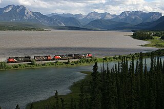
The Continental Divide is the principal, and largely mountainous, hydrological divide of the Americas. The Continental Divide extends from the Bering Strait to the Strait of Magellan, and separates the watersheds that drain into the Pacific Ocean from those river systems that drain into the Atlantic Ocean and, along the northernmost reaches of the Divide, those river systems that drain into the Arctic Ocean.

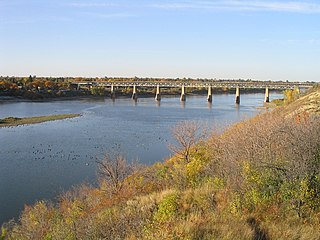
The Saskatchewan River is a major river in Canada, about 550 kilometres (340 mi) long, flowing roughly eastward across Saskatchewan and Manitoba to empty into Lake Winnipeg. Through its tributaries the North Saskatchewan and South Saskatchewan, its watershed encompasses much of the prairie regions of central Canada, stretching westward to the Rocky Mountains in Alberta and northwestern Montana in the United States. It reaches 1,939 kilometres (1,205 mi) to its farthest headwaters on the Bow River, a tributary of the South Saskatchewan in Alberta.

Lake Athabasca is located in the northwest corner of Saskatchewan and the northeast corner of Alberta between 58° and 60° N. The lake is 26% in Alberta and 74% in Saskatchewan.
Fort Edmonton was the name of a series of trading posts of the Hudson's Bay Company from 1795 to 1891, all of which were located in central Alberta, Canada. From 1795 to 1821 it was paired with the North West Company's Fort Augustus. It was the end point of the Carlton Trail, the main overland route for Metis freighters between the Red River Colony and the west and an important stop on the York Factory Express route between London, via Hudson Bay, and Fort Vancouver in the Columbia District.

Fort Assiniboine is a hamlet in northwest Alberta, Canada, within Woodlands County. It is located along the north shore of the Athabasca River at the junction of Highway 33 and Highway 661. It is approximately 39 kilometres (24 mi) northwest of Barrhead, 62 kilometres (39 mi) southeast of Swan Hills and 91 kilometres (57 mi) northeast of Whitecourt.

Métis in Alberta are Métis people, descendants of mixed First Nations/native Indian and white/European families, who live in the Canadian province of Alberta. The Métis are considered an aboriginal group under Canada's Constitution Act 1982 and make up a separate and distinct from the First Nations, and have different legal rights. In Alberta, unlike in the rest of Canada, Métis people have negotiated certain lands to be reserved for them, known today as the Eight Metis Settlements. These Metis Settlements Federated in 1975 to protect existing Metis Settlement lands following the Alberta Governments dissolution, by Order-In-Council of four Metis Settlements from 1950-1960. Following legal challenges by the Federation of Metis Settlements in 1975 for the lose of natural resource against Alberta, the Crown in Right of Alberta settled out of court for a suite of legislation that would see self-government, land, and money transferred to the newly formed government of the Metis Settlements General Council (MSGC), Canada’s only Metis self-govenernment. The Metis Settlements General Council is the legislator of the Federation of Metis Settlements. MSGC is the second largest land owner in the Province of Alberta.

Snow Dome is a mountain located on the Continental Divide in the Columbia Icefield, where the boundary of Banff National Park and Jasper National Park meets the border of Alberta and British Columbia in Canada.

The North Saskatchewan River is a glacier-fed river that flows from the Canadian Rockies continental divide east to central Saskatchewan, where it joins with another major river to make up the Saskatchewan River. Its water flows eventually into the Hudson Bay.

Brûlé Lake is a lake in western Alberta, Canada. It is formed along the Athabasca River, immediately east of Jasper National Park and 30 km west of Hinton. According to one tradition, the lake was named for a burnt tract of woods near the site.

The Fort McKay First Nation (FMFN) is a First Nations government in northeast Alberta comprising five Indian reserves – Fort McKay 174, Fort McKay 174C, Fort McKay 174D, Namur Lake 174B and Namur River 174A. The FMFN, signed to Treaty 8, is affiliated with the Athabasca Tribal Council and its members are of Cree, Metis and Dene heritage. The FMFN's traditional lands include portions of the Athabasca oil sands.
The Sand River is a major tributary of the Beaver River in Alberta, Canada.

Revillon Frères was a French fur and luxury goods company, founded in Paris in 1723. Then called la Maison Givelet, it was purchased by Louis-Victor Revillon in 1839 and soon, as Revillon Frères, became the largest fur company in France. Branches were opened in London in 1869 and in New York in 1878. At the end of the 19th century, Revillon had stores in Paris, London, New York City, and Montreal.

Saskatchewan River fur trade The Saskatchewan River was one of the two main axes of Canadian expansion west of Lake Winnipeg. The other and more important one was northwest to the Athabasca Country. For background see Canadian canoe routes (early). The main trade route followed the North Saskatchewan River and Saskatchewan River, which were just south of the forested beaver country. The South Saskatchewan River was a prairie river with few furs.


