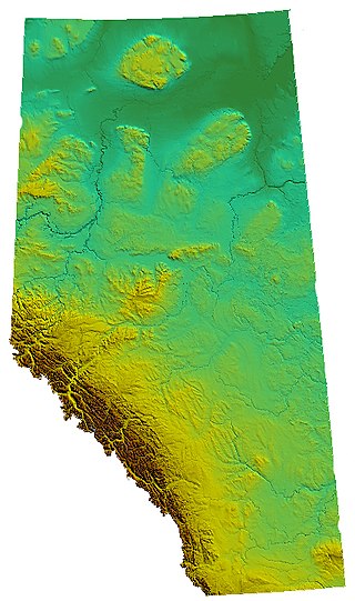
Alberta is one of the thirteen provinces and territories of Canada. Located in Western Canada, the province has an area of 661,190 km2 (255,290 sq mi) and is bounded to the south by the United States state of Montana along 49° north for 298 km (185 mi); to the east at 110° west by the province of Saskatchewan for 1,223 km (760 mi); and at 60° north the Northwest Territories for 644 km (400 mi). The southern half of the province borders British Columbia along the Continental Divide of the Americas on the peaks of the Rocky Mountains, while the northern half borders British Columbia along the 120th meridian west. Along with Saskatchewan it is one of only two landlocked provinces or territories.

The Cypress Hills are a geographical region of hills in southwestern Saskatchewan and southeastern Alberta, Canada. The hills are part of the Missouri Coteau upland.

Seven Persons is a hamlet in Alberta, Canada within Cypress County. It is located approximately 20 kilometres (12 mi) southwest of Medicine Hat on Highway 3 and has an elevation of 755 metres (2,477 ft).
Elkwater is an unincorporated community at the western edge of the Cypress Hills in southeastern Alberta, Canada, 65 kilometres (40 mi) southeast of Medicine Hat. The main access route is via Alberta Highway 41, which leads south from the Trans-Canada Highway.
Eagle Butte is a rural area south of Medicine Hat and west of the Cypress Hills. It is home to Saint Margaret's Church. Formerly there was a NWMP post in the area. The first post office opened in 1900. The locality takes its name from a nearby butte of the same name. It is near the location of a confirmed impact crater 10 km in diameter at 49°42'N110°31'W around 65 million years ago.

Cypress Hills Interprovincial Park is a natural park in Canada straddling the Alberta / Saskatchewan boundary and jointly administered by the two provinces. Located south-east of Medicine Hat in the Cypress Hills, it became Canada's first interprovincial park in 1989.

Smoky Lake is a town in central Alberta, Canada. It is located 116 km (72 mi) northeast of Edmonton at the junction of Highway 28 and Highway 855. It lies between the North Saskatchewan River, Smoky Creek, and White Earth Creek, in a mainly agricultural area. The provincial historic site of Victoria Settlement is nearby. Long Lake Provincial Park is located 60 km (37 mi) north of the town. The Woods Cree, a First Nations people, named "Smoking Lake" for the smoke from ceremonies performed on the shore; the name Smoky Lake may also be based in the mist that rose from the lake in great quantities at sundown. One of its churches, the St. Onuphrius Ukrainian-Catholic, built in 1907, has been moved to the Canadian Museum of History in Gatineau, Quebec. It is in Census Division No. 12 and is the municipal office for the Smoky Lake County.

Endiang is a hamlet in Alberta, Canada within the County of Stettler No. 6. It is located approximately 80 kilometres (50 mi) southeast of Stettler.
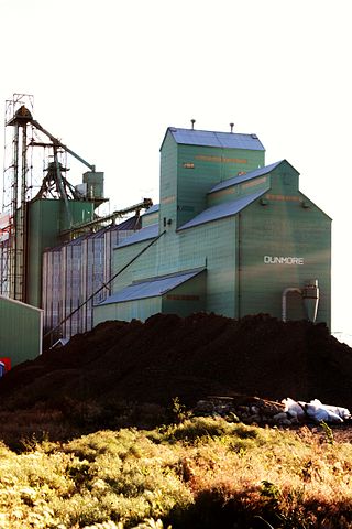
Dunmore is a hamlet in Alberta, Canada, within Cypress County, 2.6 kilometres (1.6 mi) southeast of Medicine Hat's city limits on Highway 1 and the Canadian Pacific Railway mainline. A portion of the hamlet is recognized as a designated place by Statistics Canada.
Schuler is a hamlet in southern Alberta, Canada within Cypress County, located 4 kilometres (2.5 mi) east of Highway 41, approximately 40 kilometres (25 mi) northeast of Medicine Hat.
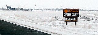
Cypress County is a municipal district in southeastern Alberta, Canada that surrounds the City of Medicine Hat and the Town of Redcliff. The municipality is part of Census Division 1, Alberta. The first farm in the area was settled in 1890.
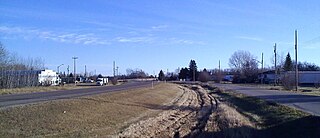
Atmore is a hamlet in Alberta, Canada within Athabasca County. It is located 1 km (0.62 mi) east of the junction of Highway 55 and Highway 63, 43 km (27 mi) west of Lac La Biche, 54 km (34 mi) east of Athabasca and 250 km (160 mi) south of Fort McMurray.
DeBolt is a hamlet in northern Alberta, Canada within the Municipal District of Greenview No. 16. A variant name is Debolt. H. E. Debolt, an early postmaster, gave the community his last name.
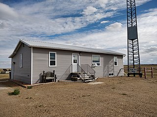
The Rural Municipality of Reno No. 51 is a rural municipality (RM) in the Canadian province of Saskatchewan within Census Division No. 4 and SARM Division No. 3. Located in the southwest corner of the province, it is adjacent to the United States border to the south and the Alberta boundary to the west.
Conklin is a hamlet in northern Alberta, Canada within the Regional Municipality (RM) of Wood Buffalo. It is located on Highway 881 between Fort McMurray and Lac La Biche. It lies near the west end of Christina Lake at an elevation of 575 metres (1,886 ft), and was named for John Conklin, a railroad employee.
Walsh is a hamlet in Alberta, Canada within Cypress County.
Suffield is a hamlet in southern Alberta, Canada within Cypress County. It is located on the Trans-Canada Highway approximately 32 km (20 mi) northwest of Medicine Hat, and just south of CFB Suffield.
Hilda is a hamlet in southern Alberta, Canada within Cypress County, located 4 kilometres (2.5 mi) east of Highway 41, approximately 67 kilometres (42 mi) northeast of Medicine Hat. In 1910, the post master named the post office "Hilda" after his infant daughter.
Veinerville is a hamlet in southern Alberta, Canada within Cypress County. It is located 0.5 kilometres (0.31 mi) northwest of Highway 41A, and less than 150 metres (490 ft) from Medicine Hat's east boundary.
Desert Blume is a hamlet in southern Alberta, Canada within Cypress County, adjacent to the southern boundary of Medicine Hat.


