Cypress County | |
|---|---|
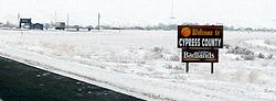 Welcome sign | |
Logo | |
 Location within Alberta | |
| Country | Canada |
| Province | Alberta |
| Region | Southern Alberta |
| Census division | 1 |
| Established | 1985 |
| Incorporated | 1985 |
| Government | |
| • Reeve | Dan Hamilton |
| • Governing body | Cypress County Council |
| • Administrative office | Dunmore |
| Area (2021) [2] | |
| • Land | 12,977.99 km2 (5,010.83 sq mi) |
| Population (2021) [2] | |
• Total | 7,524 |
| • Density | 0.6/km2 (1.6/sq mi) |
| Time zone | UTC−7 (MST) |
| • Summer (DST) | UTC−6 (MDT) |
| Website | cypress.ab.ca |

Cypress County is a municipal district in southeastern Alberta, Canada that surrounds the City of Medicine Hat and the Town of Redcliff. The municipality is part of Census Division 1, Alberta. [3] The first farm in the area was settled in 1890. [4]