Related Research Articles

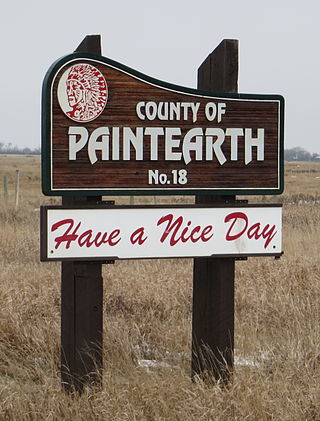
The County of Paintearth No. 18 is a municipal district in east central Alberta, Canada. Located in Census Division No. 7, its municipal office is located southeast of the Town of Castor near the intersection of Highway 12 and Highway 36.
Suffield is a hamlet in southern Alberta, Canada within Cypress County. It is located on the Trans-Canada Highway approximately 32 km (20 mi) northwest of Medicine Hat, and just south of CFB Suffield.
Aden is a locality in the County of Forty Mile No. 8, Alberta. It serves as a port of entry into the U.S. state of Montana for the nearby Canada – United States border crossing. The port of entry is located where Alberta Highway 880 continues as Secondary Highway 409 within Liberty County, Montana.
Atlee is a locality in Special Area No. 2, Alberta, Canada. It is located 1 km (0.62 mi) north of Highway 555 on Range Road 75, approximately 90 km (56 mi) north of the City of Medicine Hat. It has an elevation of 2,559 ft (780 m).
Pollockville is an unincorporated community in southern Alberta in Special Area No. 2, located 20 kilometres (12 mi) east of Highway 36, 62 kilometres (39 mi) northeast of Brooks.

Child Lake 164A is an Indian reserve of the Beaver First Nation in Alberta, located within Mackenzie County. It is 32 kilometers northwest of Fort Vermilion. The reserve takes its name from a nearby lake where a child once drowned.
Sheerness is an unincorporated community in southern Alberta within Special Area No. 2, located 7 kilometres (4.3 mi) east of Highway 36, 102 kilometres (63 mi) north of Brooks.
Agatha is an unincorporated area in southeastern Alberta, Canada.
Cecil is a locality in Cypress County, Alberta, Canada.
Connemara is a locality in Alberta, Canada within Foothills County. The locality takes its name from Connemara, in Ireland.
Behan is a locality in Alberta, Canada.
Bantry is a locality in Alberta, Canada.
Bartstow is a locality in Alberta, Canada.
Cavendish is a locality in Alberta, Canada.
Howie is a locality in Alberta, Canada.
Ispas is a locality in Alberta, Canada.
Crowfoot is a locality in Alberta, Canada.
Waterways is a locality within the Regional Municipality of Wood Buffalo in northern Alberta, Canada. It is now a neighbourhood within the Fort McMurray urban service area along the west bank of the Clearwater River, south of the river's confluence with the Athabasca River.
Haddock is a locality in Yellowhead County Alberta, Canada.
References
- ↑ "Illingworth". Geographical Names Data Base . Natural Resources Canada.
- ↑ Place-names of Alberta. Ottawa: Geographic Board of Canada. 1928. p. 67.
Coordinates: 50°07′00″N111°27′06″W / 50.11679°N 111.45174°W