Beaver County, Alberta

Last updated

Beaver County
Shonts - Killean Farms Ltd Grain Elevator 2.JPG
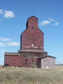
Killean Farms Ltd. grain elevator in Shonts
Beaver County.png
AB locator BEAVER COUNTY.svg
Location within Alberta
Coordinates: 53°15′N112°14′W / 53.250°N 112.233°W / 53.250; -112.233
CountryCanada
Province Alberta
Region Central Alberta
Census division 10
Established1943
Incorporated1958
Government
[1]
   Reeve Kevin Smook
  Governing body
Beaver County Council
  • Barry Bruce
  • Eugene Hrabec
  • Lionel Williams
  • Dale Pederson
  • Kevin Smook
  CAOKayleena Spiess
   Administrative office Ryley
Area
 (2021) [2]
  Land3,219.74 km2 (1,243.15 sq mi)
Population
 (2021) [2]
  Total5,868
  Density1.8/km2 (5/sq mi)
Time zone UTC-7 (MST)
  Summer (DST) UTC-6 (MDT)
Postal code span
T0B
Website beaver.ab.ca

Beaver County is a municipal district in central-east Alberta, Canada. It is centred on Holden in the western part of Census Division No. 10. Its municipal office is located in Ryley.

Contents

Beaver County was incorporated as a municipal district on July 31, 1999, and the name was changed from "County of Beaver No. 9" to "Beaver County". [3]

Geography

Communities and localities

The following localities are located within Beaver County. [5]

Localities

Demographics

In the 2021 Census of Population conducted by Statistics Canada, Beaver County had a population of 5,868 living in 2,180 of its 2,434 total private dwellings, a change of

In the 2016 Census of Population conducted by Statistics Canada, Beaver County had a population of 5,905 living in 2,177 of its 2,381 total private dwellings, a

Attractions

Two parks with campgrounds are located in the county's limits, Black Nugget Lake (located between Tofield and Ryley, south of Highway 14) and Camp Lake (located east of Viking, between Kinsella and Innisfree).

See also

Related Research Articles

<span class="mw-page-title-main">County of Grande Prairie No. 1</span> Municipal district in Alberta, Canada

The County of Grande Prairie No. 1 is a municipal district in northwestern Alberta, Canada in Census Division No. 19.

<span class="mw-page-title-main">Athabasca County</span> Municipal district in Alberta, Canada

Athabasca County is a municipal district in north central Alberta, Canada. It is located northeast of Edmonton and is in Census Division No. 13. Prior to an official renaming on December 1, 2009, Athabasca County was officially known as the County of Athabasca No. 12.

<span class="mw-page-title-main">Division No. 10, Alberta</span> Census division in Alberta, Canada

Division No. 10 is a census division in Alberta, Canada. It is located in the east-central portion of central Alberta and includes Alberta's portion of the City of Lloydminster.

<span class="mw-page-title-main">Ryley</span> Village in Alberta, Canada

Ryley is a village in central Alberta, Canada. It is surrounded by Beaver County, along Highway 14 between the City of Edmonton and the Town of Viking. The City of Camrose is approximately 58 km (36 mi) south of Ryley. The village was named in 1908 after George Urquhart Ryley, Grand Trunk Pacific Railway Land Commissioner at the time.

<span class="mw-page-title-main">Starland County</span> Municipal district in Alberta, Canada

Starland County is a municipal district located in southern Alberta, Canada.

<span class="mw-page-title-main">County of Barrhead No. 11</span> Municipal district in Alberta, Canada

The County of Barrhead No. 11 is a municipal district in north central Alberta, Canada. It is located northwest of Edmonton and is in Census Division No. 13.

<span class="mw-page-title-main">Yellowhead County</span> Municipal district in Alberta, Canada

Yellowhead County is a municipal district in west central Alberta, Canada. It is the only municipal district within Alberta census division No. 14.

<span class="mw-page-title-main">Kneehill County</span> Municipal district in Alberta, Canada

Kneehill County is a municipal district in central Alberta, Canada within Census Division No. 5.

<span class="mw-page-title-main">Big Lakes County</span> Municipal district in Alberta, Canada

Big Lakes County, formerly the Municipal District of Big Lakes, is a municipal district in north-central Alberta, Canada.

<span class="mw-page-title-main">Camrose County</span> Municipal district in Alberta, Canada

Camrose County is a municipal district in central Alberta, Canada. It is located in Census Division 10, around the City of Camrose.

<span class="mw-page-title-main">Cardston County</span> Municipal district in Alberta, Canada

Cardston County is a municipal district in southern Alberta, Canada. It is located in Census Division 3 around the Town of Cardston.

<span class="mw-page-title-main">County of Forty Mile No. 8</span> Municipal district in Alberta, Canada

The County of Forty Mile No. 8 is a municipal district in south eastern Alberta, Canada. It is located in Census Division 1, southwest of Medicine Hat. Its municipal office is located in the Village of Foremost.

<span class="mw-page-title-main">Lacombe County</span> Municipal district in Alberta, Canada

Lacombe County is a municipal district in central Alberta, Canada. It is within Census Division No. 8 north of the City of Red Deer. Its municipal office is 4 km (2.5 mi) west of Highway 2 and the City of Lacombe, and 6 km (3.7 mi) east of the Summer Village of Gull Lake, at the intersection of Highway 12 and Spruceville Road.

<span class="mw-page-title-main">Woodlands County</span> Municipal district in Alberta, Canada

Woodlands County is a municipal district in north-central Alberta, Canada. Located in Census Division No. 13, its municipal office is located outside but adjacent to the Town of Whitecourt. A second municipal office is located in the Hamlet of Fort Assiniboine.

<span class="mw-page-title-main">Mackenzie County</span> Specialized municipality in Alberta, Canada

Mackenzie County is a specialized municipality in northern Alberta, Canada. It is located in Census Division 17, along the Mackenzie Highway. The municipal office is located in the hamlet of Fort Vermilion.

<span class="mw-page-title-main">County of Northern Lights</span> Municipal district in Alberta, Canada

The County of Northern Lights is a municipal district in northwest Alberta, Canada. Located in Census Division 17, its municipal office is located in the Town of Manning.

<span class="mw-page-title-main">County of Wetaskiwin No. 10</span> Municipal district in Alberta, Canada

The County of Wetaskiwin No. 10 is a municipal district in central Alberta, Canada that is south of Edmonton. Located in Census Division No. 11, its municipal office is in located in the City of Wetaskiwin.

<span class="mw-page-title-main">Vulcan County</span> Municipal district in Alberta, Canada

Vulcan County is a municipal district in Alberta, Canada. Located in Census Division No. 5, its municipal office is located in the Town of Vulcan.

<span class="mw-page-title-main">County of St. Paul No. 19</span> Municipal district in Alberta, Canada

The County of St. Paul No. 19 is a municipal district in eastern central Alberta, Canada. Located in Census Division No. 12, its municipal office is located in the Town of St. Paul.

<span class="mw-page-title-main">Smoky Lake County</span> Municipal district in Alberta, Canada

Smoky Lake County is a municipal district in north-eastern Alberta, Canada. Located in Census Division No. 12, its municipal office is located in the Town of Smoky Lake.

References

  1. "Municipal Officials Search". Alberta Municipal Affairs. May 9, 2019. Retrieved October 1, 2021.
  2. 1 2 3 "Population and dwelling counts: Canada, provinces and territories, and census subdivisions (municipalities)". Statistics Canada. February 9, 2022. Retrieved February 9, 2022.
  3. Beaver County municipal profile Archived 2018-09-02 at the Wayback Machine - Alberta Municipal Affairs
  4. 1 2 "Specialized and Rural Municipalities and Their Communities" (PDF). Alberta Municipal Affairs. January 12, 2022. Retrieved January 21, 2022.
  5. "Standard Geographical Classification (SGC) 2006, Economic Regions: 4810016 - Beaver County, geographical codes and localities, 2006". Statistics Canada. March 5, 2010. Archived from the original on May 25, 2013. Retrieved August 11, 2012.
  6. "Population and dwelling counts, for Canada, provinces and territories, and census subdivisions (municipalities), 2016 and 2011 censuses – 100% data (Alberta)". Statistics Canada. February 8, 2017. Retrieved February 8, 2017.